Map of Silverton, Oregon
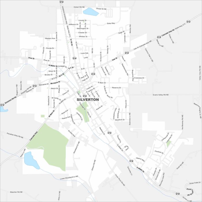
Our map of Silverton, Oregon shows this scenic town near waterfalls. The Oregon Garden and Silver Falls State Park are top attractions nearby.
Our map of Silverton, Oregon shows this scenic town near waterfalls. The Oregon Garden and Silver Falls State Park are top attractions nearby.
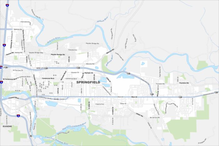
Get around Springfield with our map. It’s a friendly community next to Eugene, with easy access to rivers, trails, and mountain scenery.
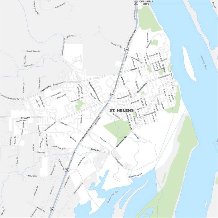
Our map of St. Helens highlights its setting along the Columbia River. The town has historic charm and mountain views on clear days.
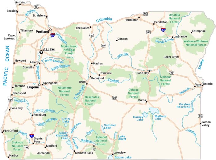
Oregon’s the kind of place where mountains, forests, and coastline meet on one map. Our road map of Oregon captures it all.
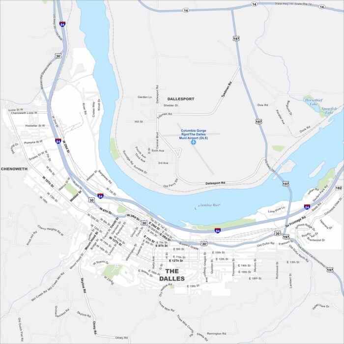
Our road map of The Dalles highlights its Columbia River location. With a scenic gorge setting, it’s a gateway to Oregon wine country.
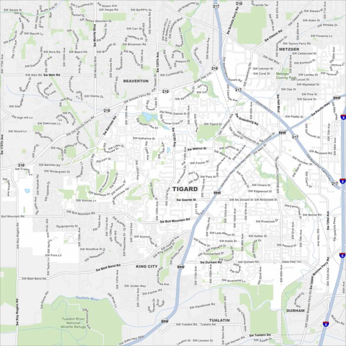
Our map of Tigard helps you explore this Portland metro suburb. It features shopping centers and Tualatin River access.
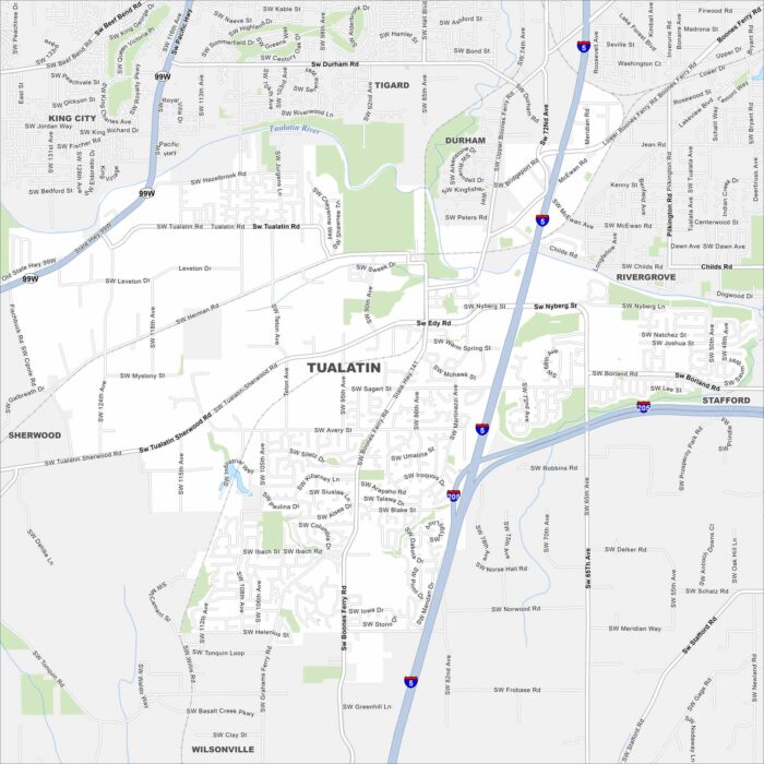
Find your bearings using our Tualatin map. This suburb is south of Portland, Oregon. Our map highlights its riverfront, parks, and streets.
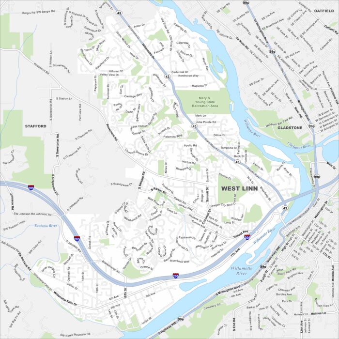
Check out West Linn on this road map. The Willamette River and forested hills frame this scenic suburban city.
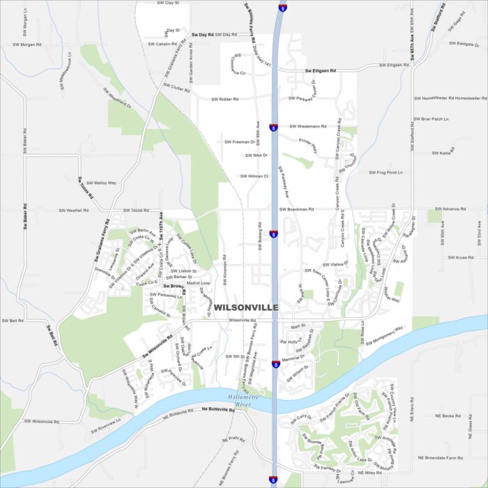
Our road map of Wilsonville shows this city south of Portland. Parks, neighborhoods, and industry spread along the Willamette River.
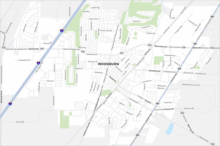
This Woodburn map shows its farming roots and growing neighborhoods. The city is also known for its close proximity to I-5.