Map of Huber Heights, Ohio
Check out our map of Huber Heights northeast of Dayton. The city spreads along I-70 with neighborhoods branching off.
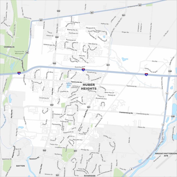
Check out our map of Huber Heights northeast of Dayton. The city spreads along I-70 with neighborhoods branching off.
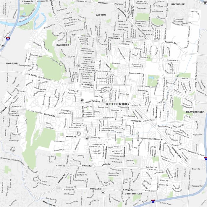
Our map of Kettering shows it blending into greater Dayton. Parks and residential areas cover much of the area.
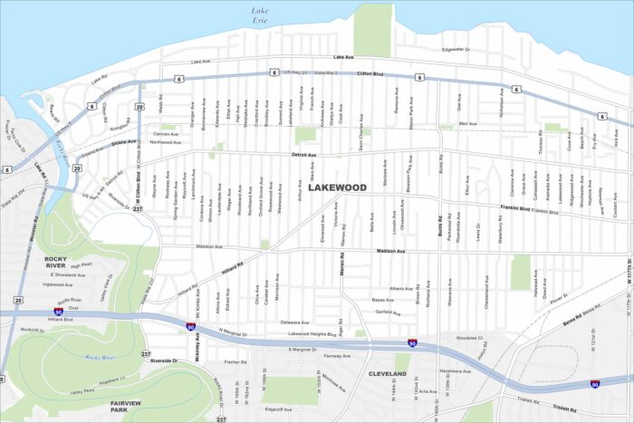
Tucked along Lake Erie, Lakewood stretches in a narrow band. The map shows streets running right to the shoreline.
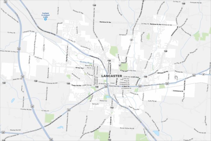
Lancaster rests in the Hocking River Valley. This map shows hills surrounding the city on three sides. Downtown anchors the center.
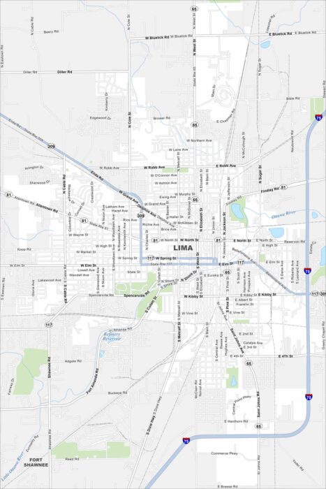
Our map of Lima places the city amid flat farmland in northwest Ohio. Highways and rail lines slice through the center.
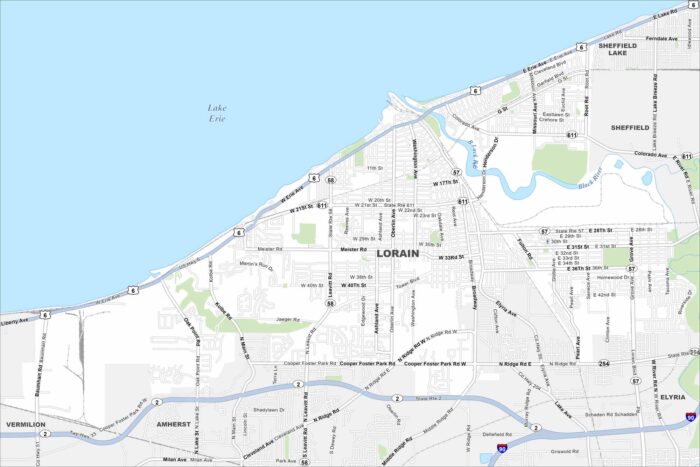
Lorain sits on Lake Erie west of Cleveland. Our map shows the Black River flowing into the harbor. Highways connect the city inland.
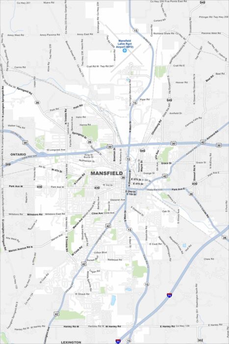
Mansfield sits between Cleveland and Columbus. Our map shows its highway network and the rail lines cutting through.
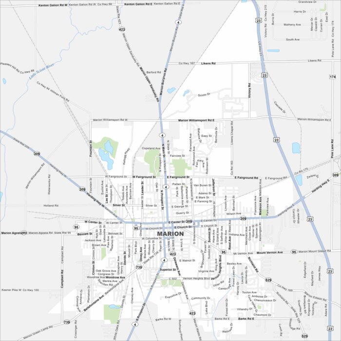
Marion lies north of Columbus in central Ohio. Our map highlights its highway connections, rail lines, and downtown area.
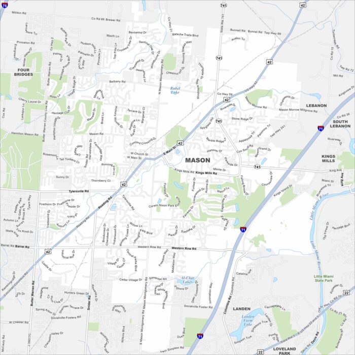
Our map of Mason, Ohio outlines its roads and green spaces north of Cincinnati. Mason is also recognized as the resort area of southwest Ohio
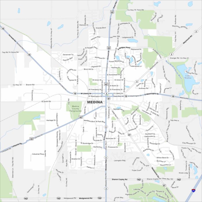
Discover Medina, located in northeast Ohio. Our map shows highways, roads, waterways and parks that spread outward.
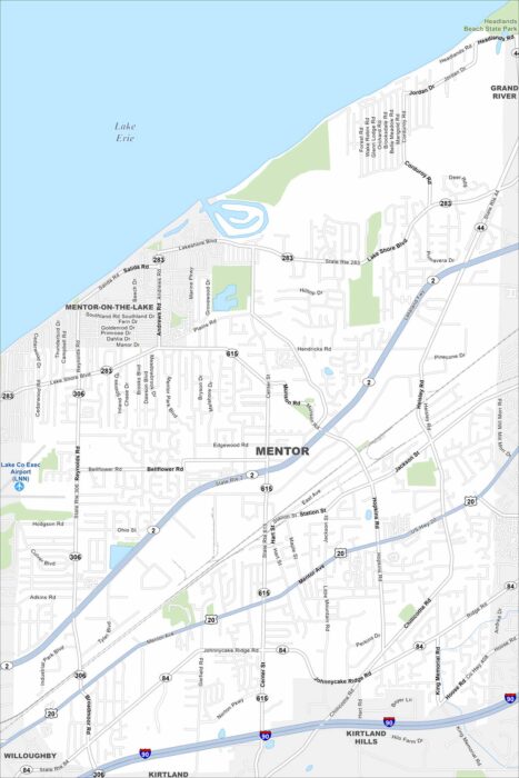
Discover Mentor, Ohio along Lake Erie. Our map shows the shoreline, parks, highways, roads and neighborhoods.
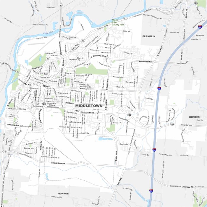
Middletown, Ohio lies between Cincinnati and Dayton. Our map shows the Great Miami River flowing through town.
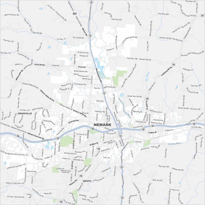
Newark lies east of Columbus along the Licking River. The map shows a historic downtown square and highways/roads.
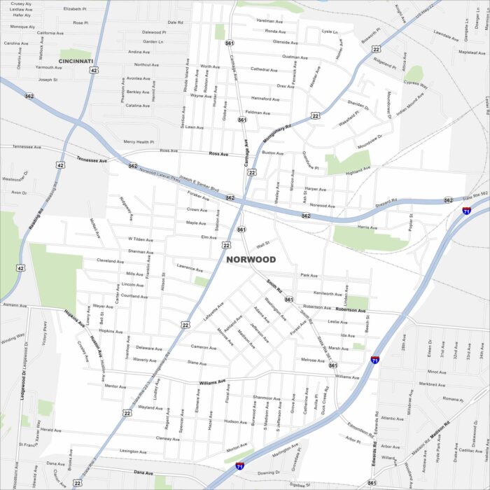
Norwood lies just northeast of Cincinnati. This map highlights a dense street grid with highways cutting across.
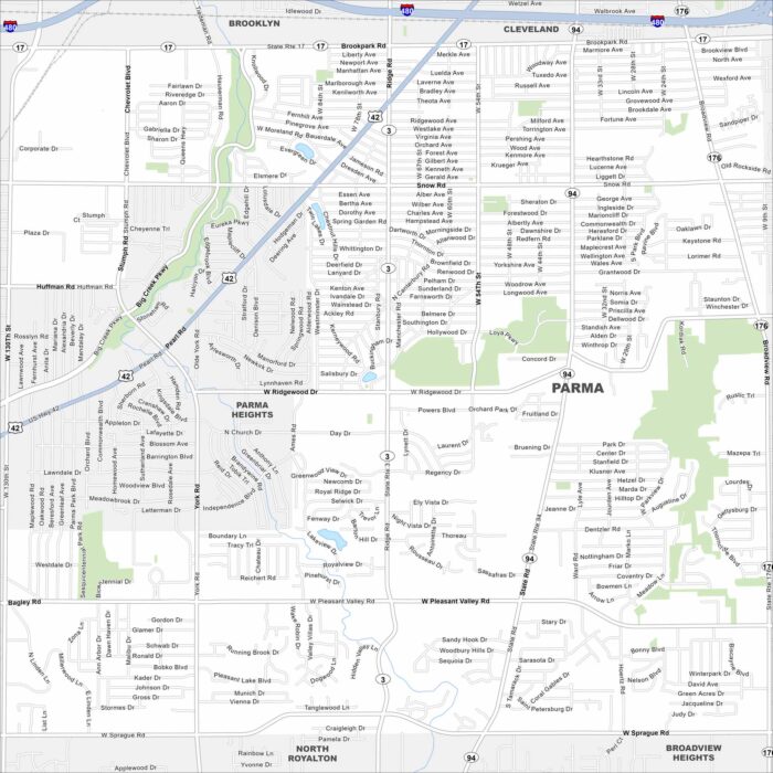
Our map of Parma highlights this city southwest of Cleveland. Suburban streets spread outward with tons of parks.