Map of Syracuse, New York
Our Syracuse map highlights this upstate city. Syracuse University, a historic downtown, and snow-filled winters define the area.
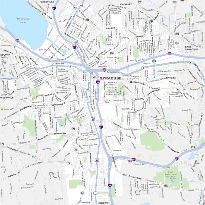
Our Syracuse map highlights this upstate city. Syracuse University, a historic downtown, and snow-filled winters define the area.
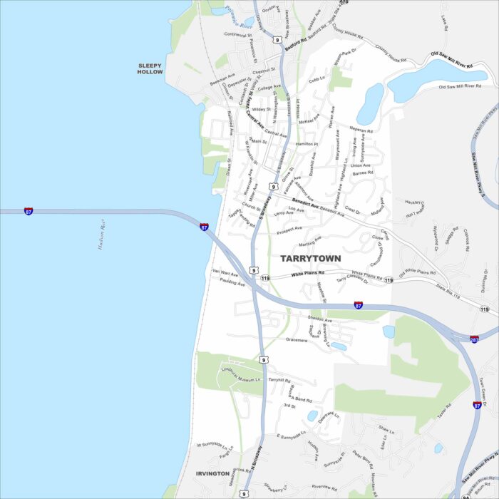
Our map of Tarrytown shows its prime location along the Hudson River. This historic village is known for its river views and more.
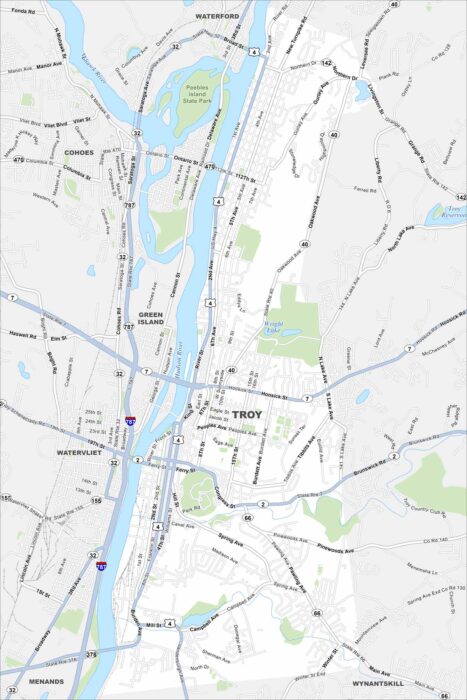
Troy is a Hudson River city with deep industrial history. Our map of Troy shows you around its historic downtown and its many parks.
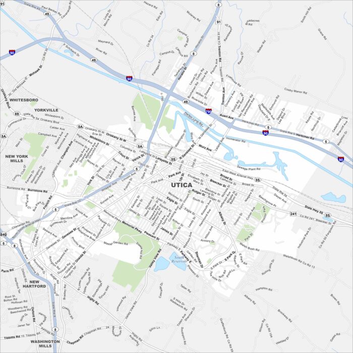
Utica is a Mohawk Valley city with rich immigrant history. Our map shows its highways, downtown streets, and of course, Mohawk River.
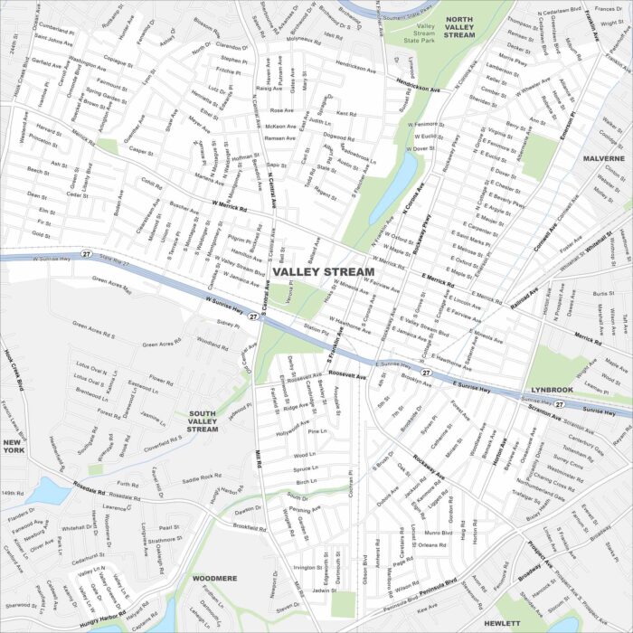
Our road map of Valley Stream shows its Long Island setting. The village is filled with parks, shops, and close city connections.
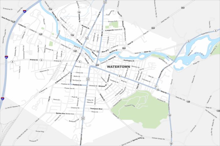
Here’s how to get around Watertown near the Thousand Islands region. Our map highlights the Black River and the city’s historic downtown.
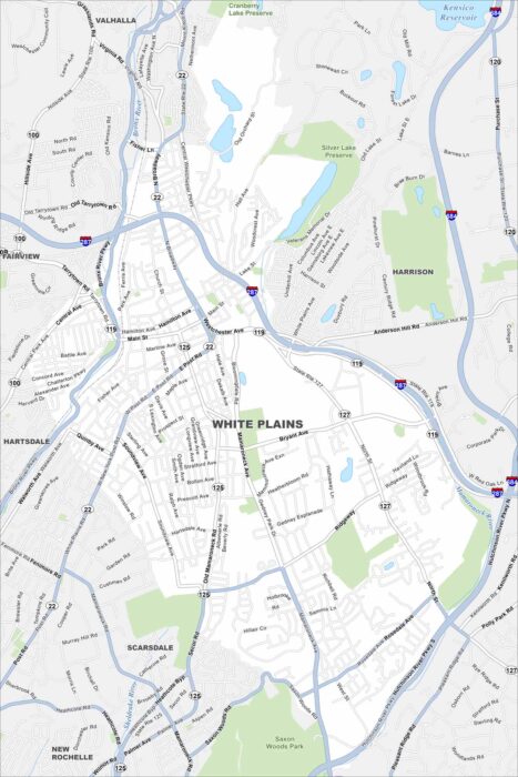
Get to know White Plains, a busy hub in Westchester County. The city blends shopping, business, and suburban neighborhoods.
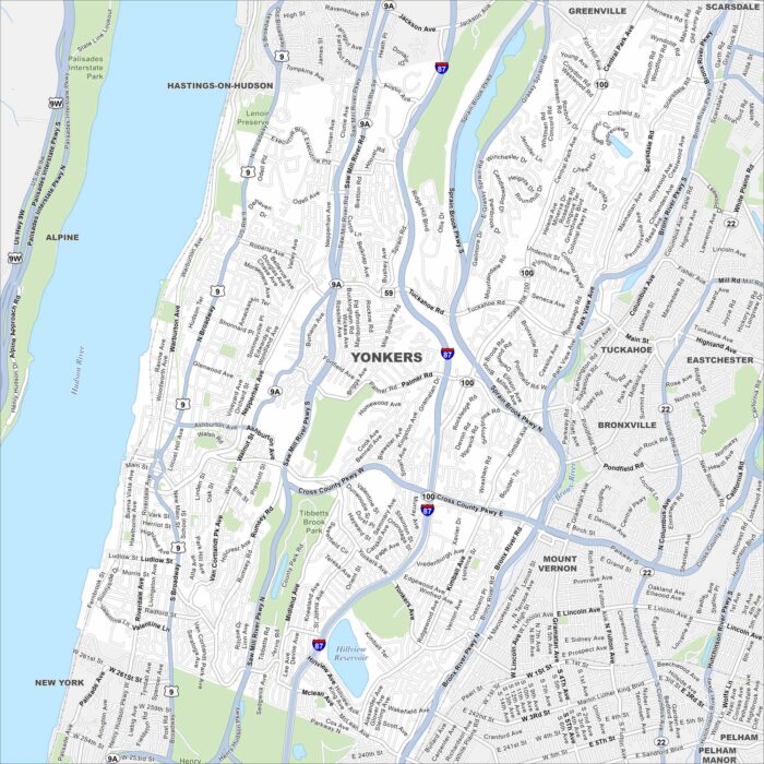
See the streets of Yonkers along the Hudson River. From riverfront parks to historic neighborhoods, our map lays it all out.