Map of Coon Rapids, Minnesota
Coon Rapids hugs the Mississippi River and is north of Minneapolis. The area mixes neighborhoods with riverfront trails.
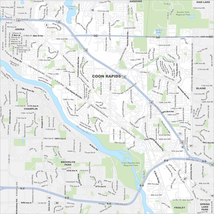
Coon Rapids hugs the Mississippi River and is north of Minneapolis. The area mixes neighborhoods with riverfront trails.
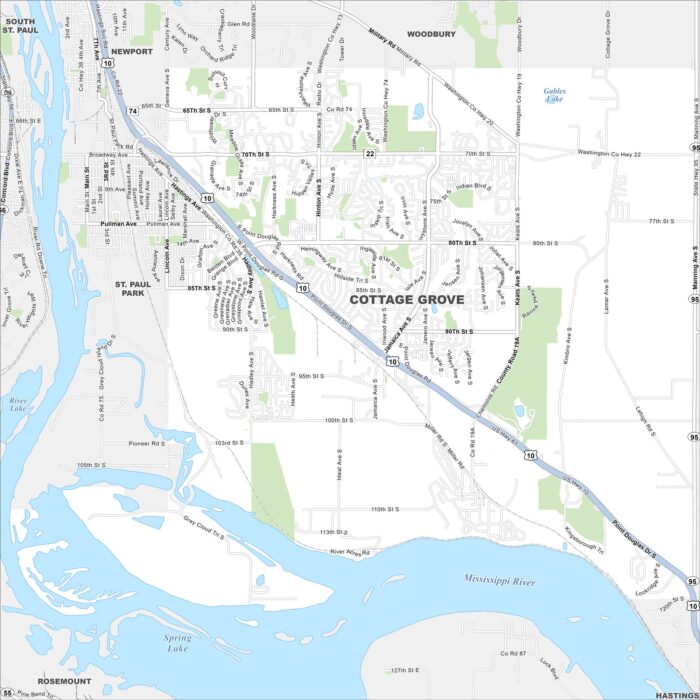
Cottage Grove shows up here with roads, highways, and rivers. You can find it along the Mississippi. It’s also situated south of St. Paul.
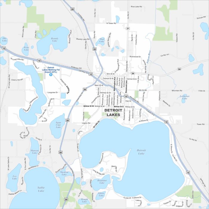
Our map of Detroit Lakes brings out a cluster of lakes scattered around the town. Roads extend between the shorelines and wooded areas.
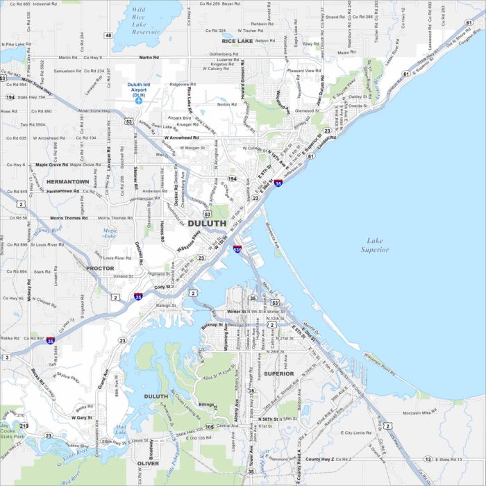
Duluth sits on the western tip of Lake Superior. Our map of the city shows the harbor, lift bridge, and hillside streets.
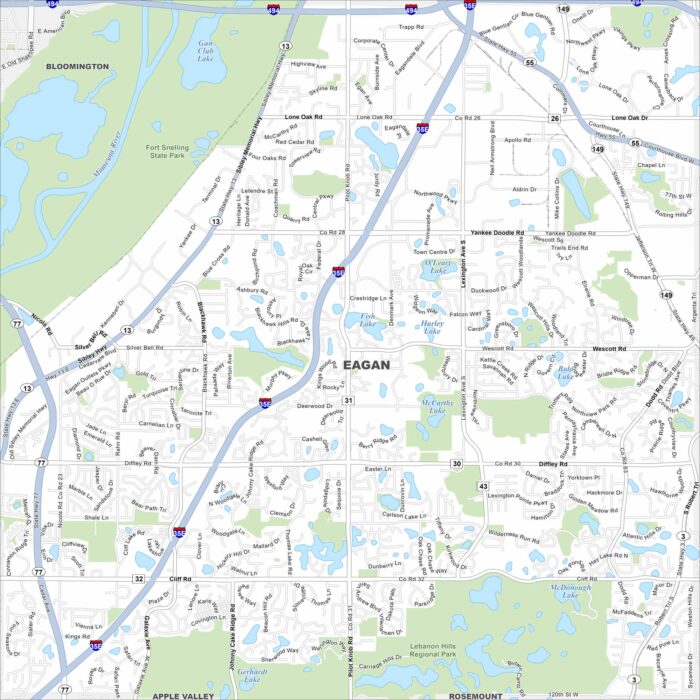
Eagan stretches along the Minnesota River, just south of St. Paul. This map shows its lakes, parks and major freeways.
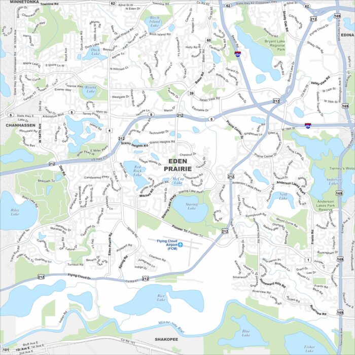
Our map of Eden Prairie, Minnesota shows lakes scattered throughout the city, including Staring and Red Rock Lake.
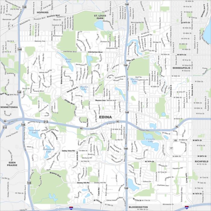
Edina is located southwest of Minneapolis. Our map highlights several lakes, including Arrowhead and Lake Cornelia.
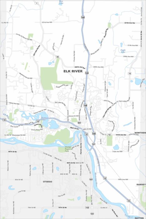
Explore our map of Elk River to see the junction of Highways 10 and 169. The Mississippi River runs along the city’s edge.
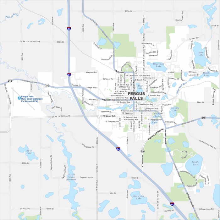
Fergus Falls sits in the heart of Minnesota lake country. The Otter Tail River cuts through town, connecting several small lakes.
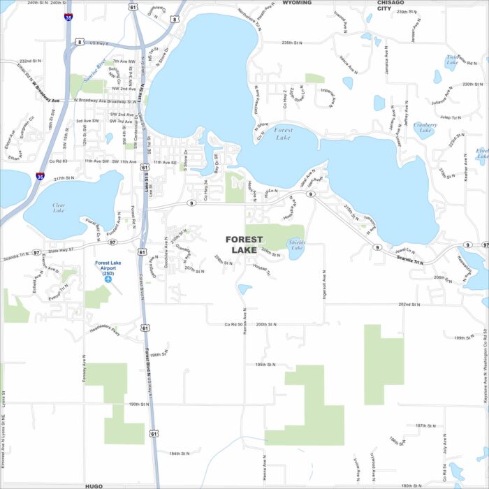
Forest Lake is shaped like a square and sits north of St. Paul. Its namesake lake is front and center but other smaller lakes are here too.
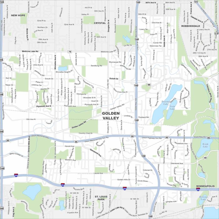
Take a look at our map of Golden Valley, Minnesota. Here’s where ponds and parks break up neighborhoods and highways.
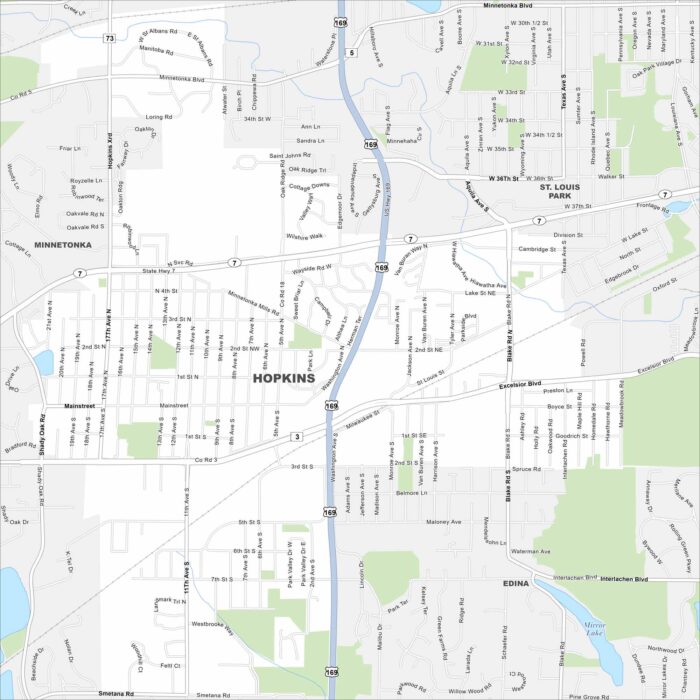
Explore our map of Hopkins just west of Minneapolis. Its downtown hugs the rail line. Residential neighborhoods fill in around the city core.
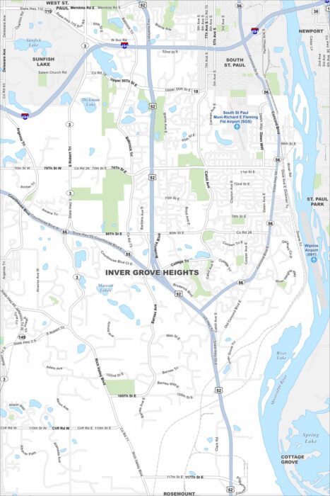
Our map of Inver Grove Heights shows its location along the Mississippi River. Highways curve around lakes and parks.
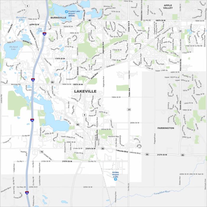
Lake Marion and Orchard Lake stand out on our map of Lakeville, Minnesota. Subdivisions fill the space between farmland and water.
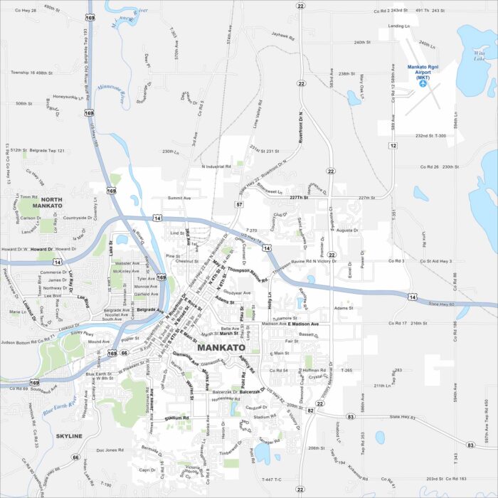
Our map of Mankato shows the Minnesota and Blue Earth Rivers meeting. Highways cross through the downtown and connect to nearby towns.