Central Illinois Map
Here’s our county map highlighting the Central Illinois region in teal. You’ll find this region across the middle portion of the state.
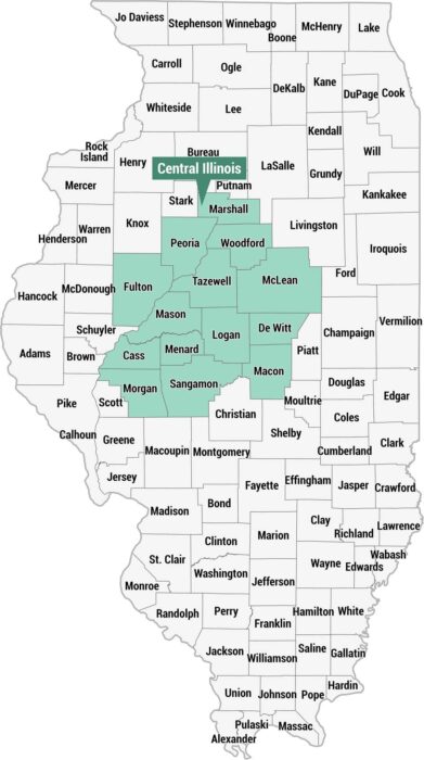
Here’s our county map highlighting the Central Illinois region in teal. You’ll find this region across the middle portion of the state.
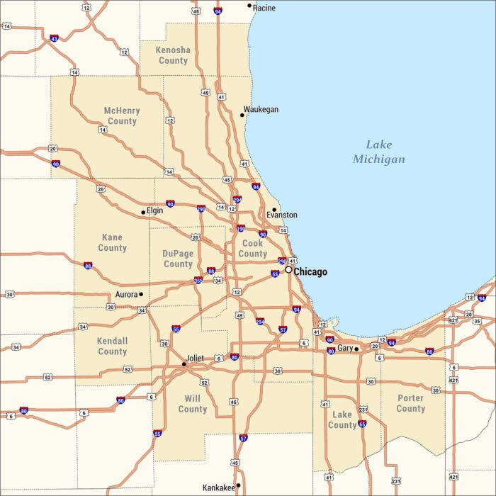
This is a detailed highway and county map of the Chicagoland region. Our map is centered on Chicago along southwestern Lake Michigan.
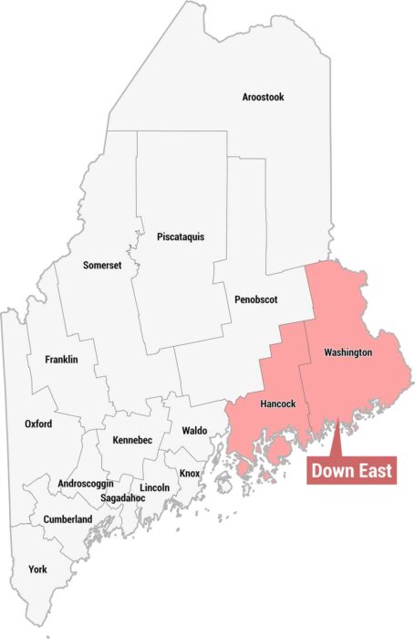
Check out our county map of Maine showing the Down East region in pink. This region is across the eastern portion of the state.
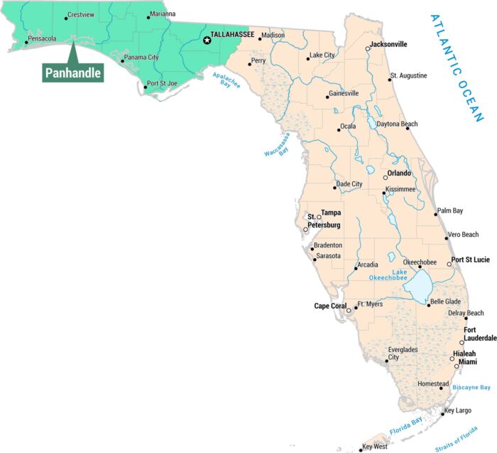
As you can see, our map displays the Panhandle region in the northwestern portion of Florida. We’ve included cities, waterways, and bays.
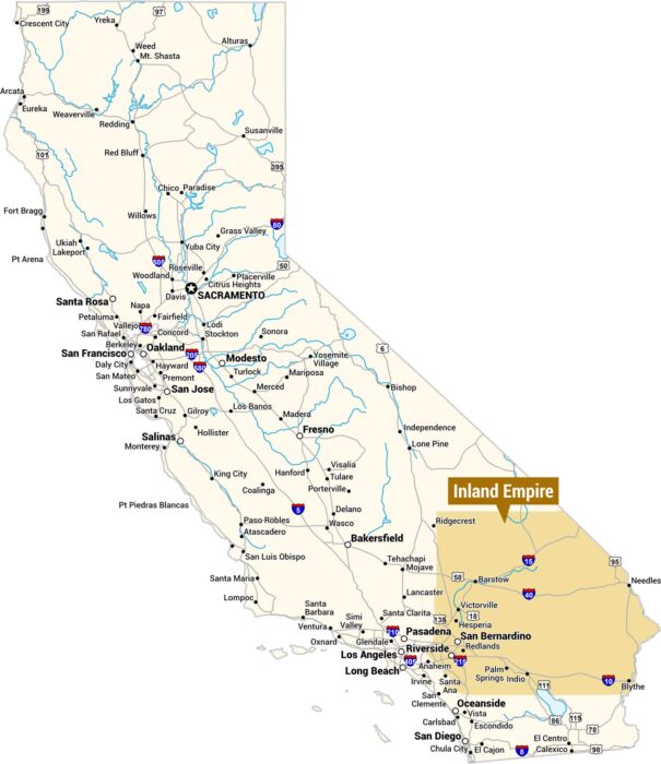
This is a map of California highlighting the Inland Empire in orange, located in the southwestern corner of the state east of Los Angeles.
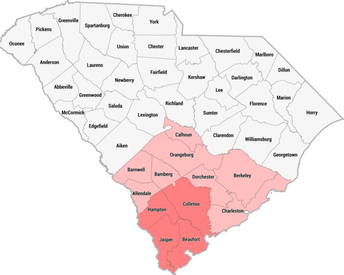
This county map of South Carolina highlights the Lowcountry region in pink and red across the southern and coastal portions of the state.
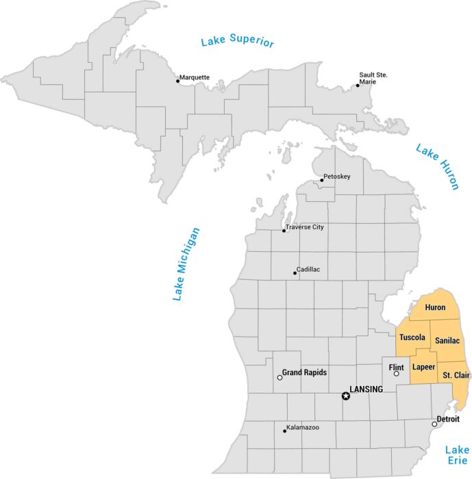
This is a county map of Michigan highlighting the Thumb region. The remaining counties are shown in gray, with major cities labeled.
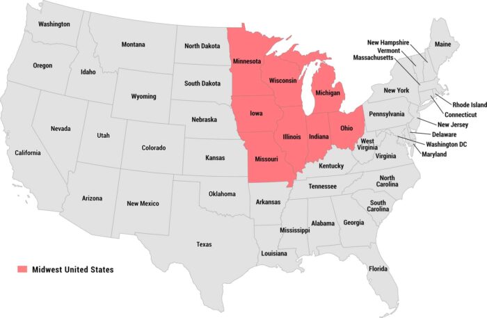
Our map highlights the Midwest United States in red/pink, clearly distinguishing the region from the remaining states shown in gray.
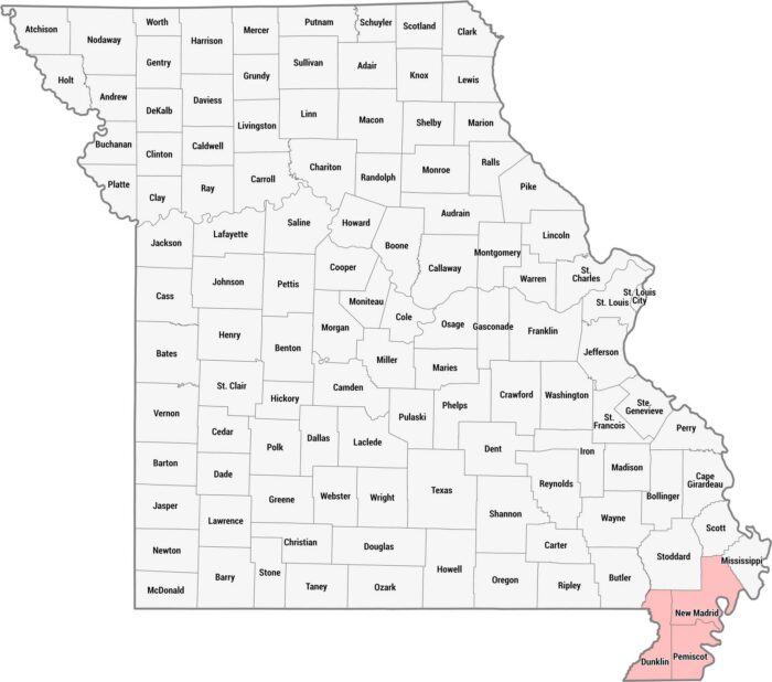
We created this county map of Missouri to highlight the Bootheel region in pink. This distinctive geographic appendage sits juts southward.
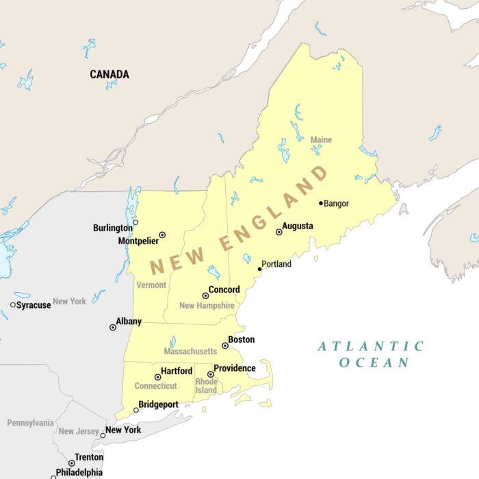
Our regional map highlights New England states in yellow, set against surrounding states and Canada in tan/gray and the Atlantic Ocean.
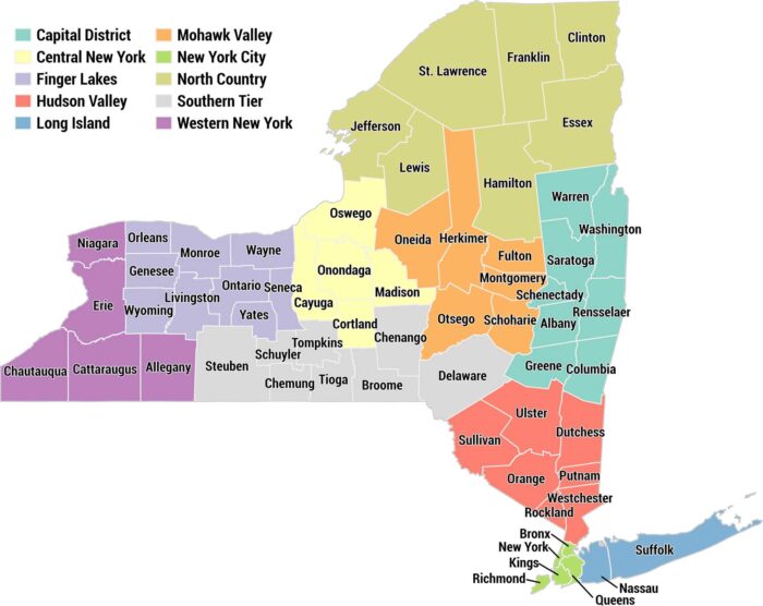
This is a color-coded county map of New York State divided into its 10 official regions. Each region has a distinct color with a legend.
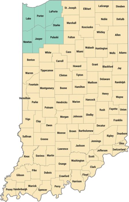
This is a county map with the Northwest Indiana region highlighted in teal in the upper-left corner. The remaining counties are shown in tan.
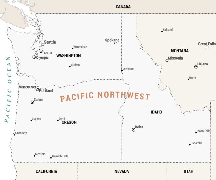
Our Pacific Northwest map covers the northwestern corner of the United States, encompassing Washington, Oregon, Idaho, and Montana.
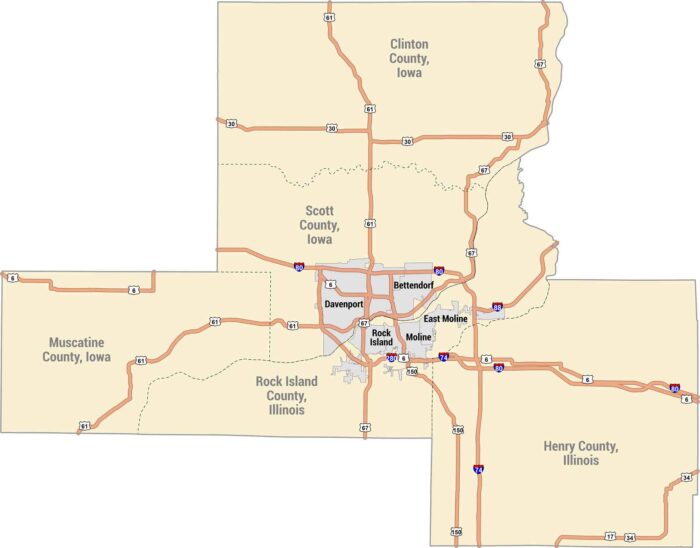
The Quad Cities sit along the Mississippi River along the Iowa-Illinois border. Our map shows Davenport, Bettendorf, Rock Island and Moline.
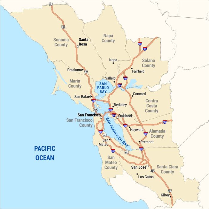
The Bay Area wraps around the water, from San Francisco to San Jose and across to Oakland. Our map shows the cities, bridges, and highways.