Kansas Zip Code Map
See how zip codes stretch across Kansas. Our Kansas zip code map shows large postal areas shaped by open land and small towns.
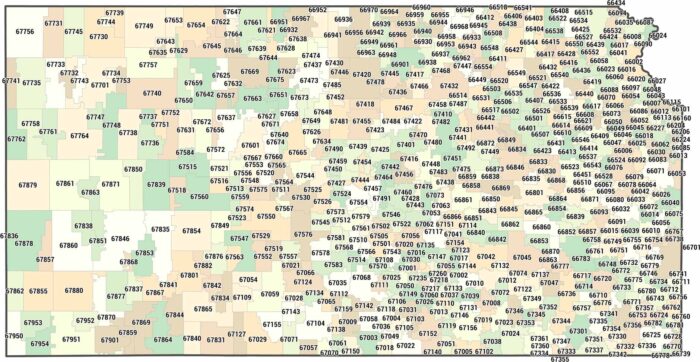
See how zip codes stretch across Kansas. Our Kansas zip code map shows large postal areas shaped by open land and small towns.
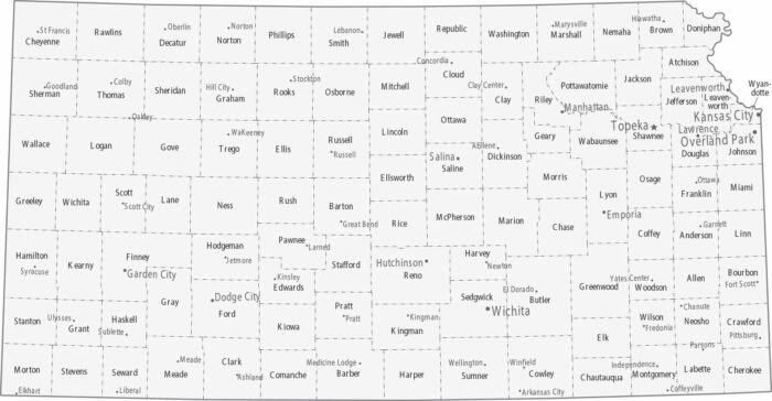
Counties in Kansas form a clean grid statewide. Topeka holds down the capital in the northeast with Kansas City not too far away.
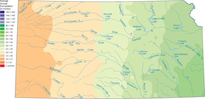
Eastern Kansas appears wetter on the map than the High Plains. Our precipitation map of Kansas shows this steady transition.

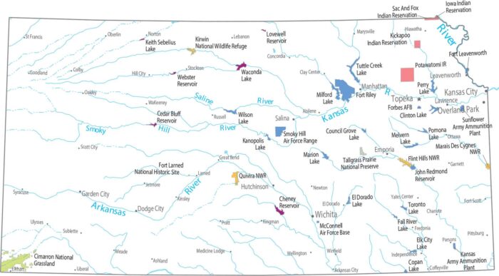
Looking for a map of Kansas lakes and rivers? Our map shows the Arkansas River, Kansas River, and major reservoirs like Milford Lake.
Open space here isn’t protected, it’s working land. Our map shows almost nothing for federal land. Plains dominate everything here.
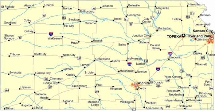
Check out our population density map of Kansas to see population thin across the plains. Eastern Kansas shows higher density than the west.
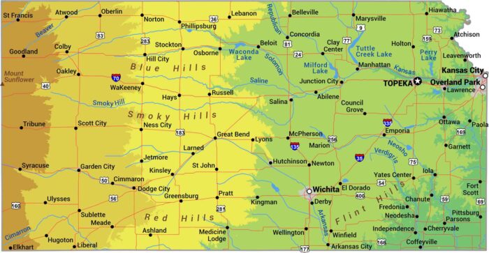
No matter what you’ve heard, Kansas isn’t completely flat. It really just slopes. The land rises gradually from east to west.
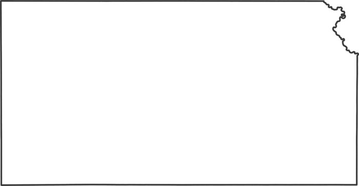
Check out our Kansas outline map. You can see how every single border is a perfect rectangle, except for the Missouri River in the northeast.
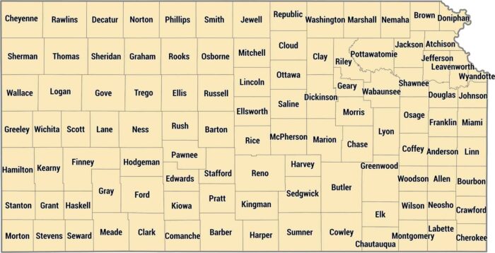
Kansas keeps it organized with 105 counties in tidy rectangles across the plains. This grid is from land surveying across the Great Plains.
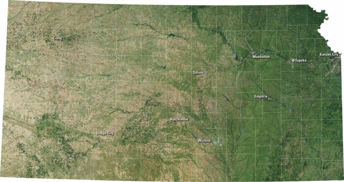
Kansas has a rectangular shape with quiet beauty. From Wichita to Topeka, you’ll spot towns framed by golden fields and long, straight roads.
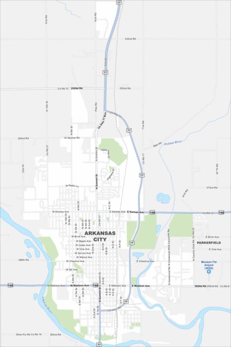
Not to be confused with the state of Arkansas. But Arkansas City sits at the meeting of the Arkansas and Walnut Rivers in Kansas.
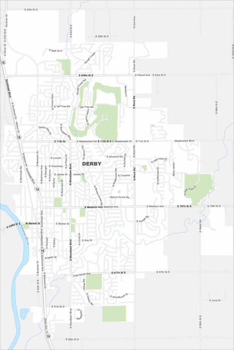
Our map of Derby shows a suburban community south of Wichita. You’ll see the Arkansas River cutting through the area.
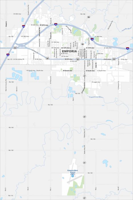
Emporia sits between Topeka and Wichita on the Kansas prairie. Both U.S. 50 and I-35 cross right by the city.
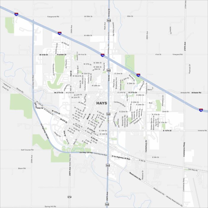
Hays is in western Kansas along Interstate 70. It’s surrounded by open prairie land. Our map of Hays shows its rivers, lakes and roads.
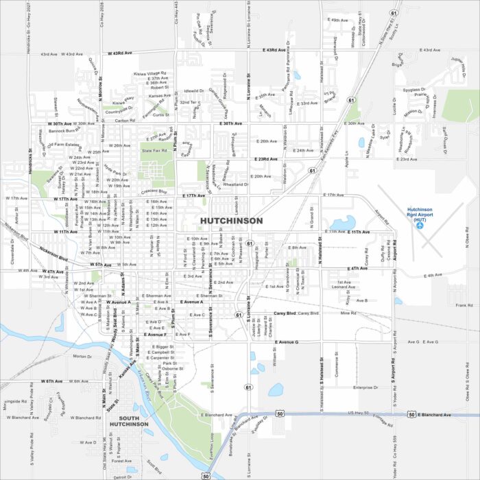
Our map of Hutchinson shows it along the Arkansas River Valley. Highways connect farmland directly to the city grid.