Map of Kankakee, Illinois
Kankakee is built on the Kankakee River. Our map shows the river winding straight through the city. Parks and bridges line its banks.
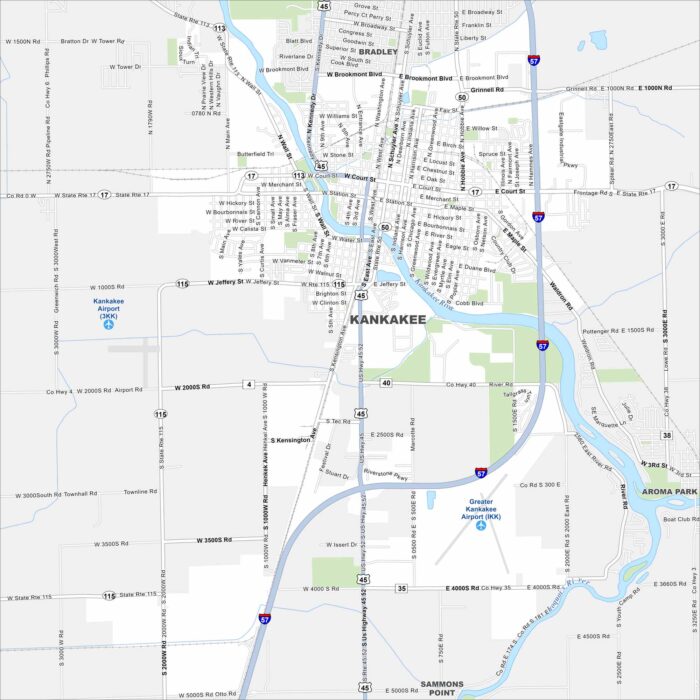
Kankakee is built on the Kankakee River. Our map shows the river winding straight through the city. Parks and bridges line its banks.
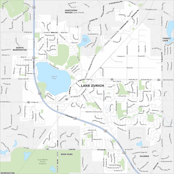
Lake Zurich fills the middle of the map with water. Suburban streets travel outward from the shoreline. Highways link it back to Chicago.
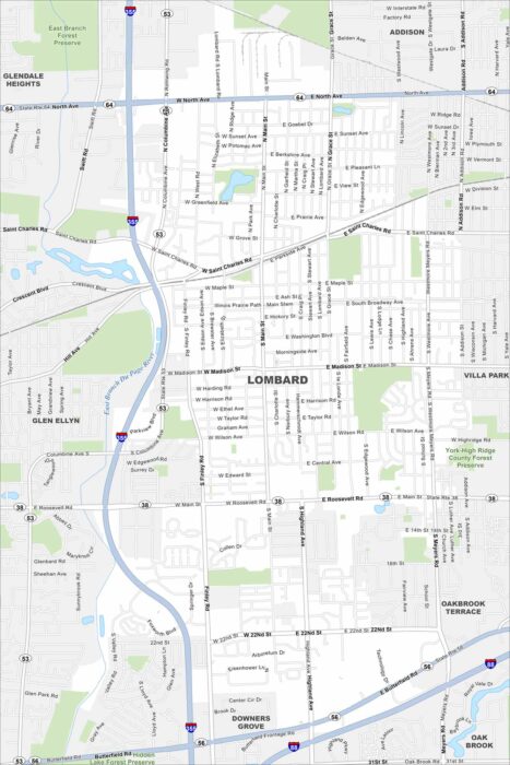
Check out Lombard in suburban DuPage County. Our road map shows its grid of neighborhoods west of Chicago.
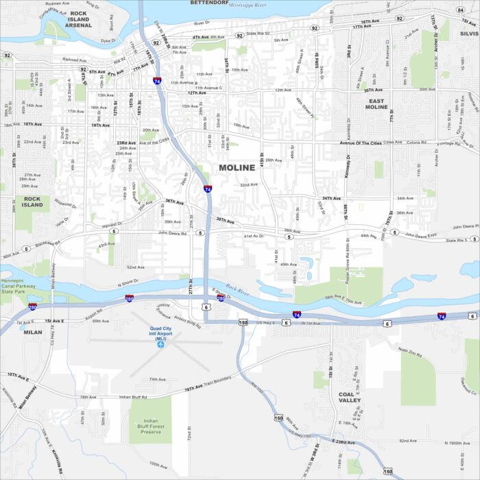
Check out our map of Moline, part of the Quad Cities. The Mississippi River defines its edge, while bridges connect it across state lines.
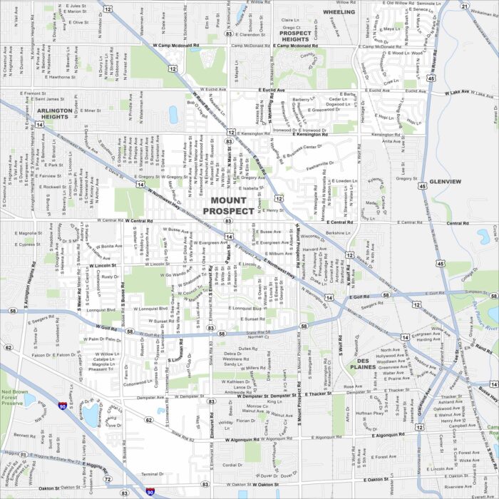
Explore Mount Prospect with our map. It’s one of the larger Chicago suburbs. You’ll notice its access to major highways.
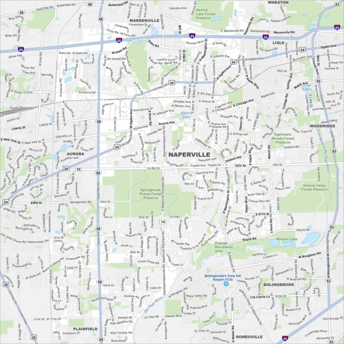
Our map of Naperville highlights a large suburb west of Chicago. The Riverwalk threads through downtown and subdivisions stretch far outward.
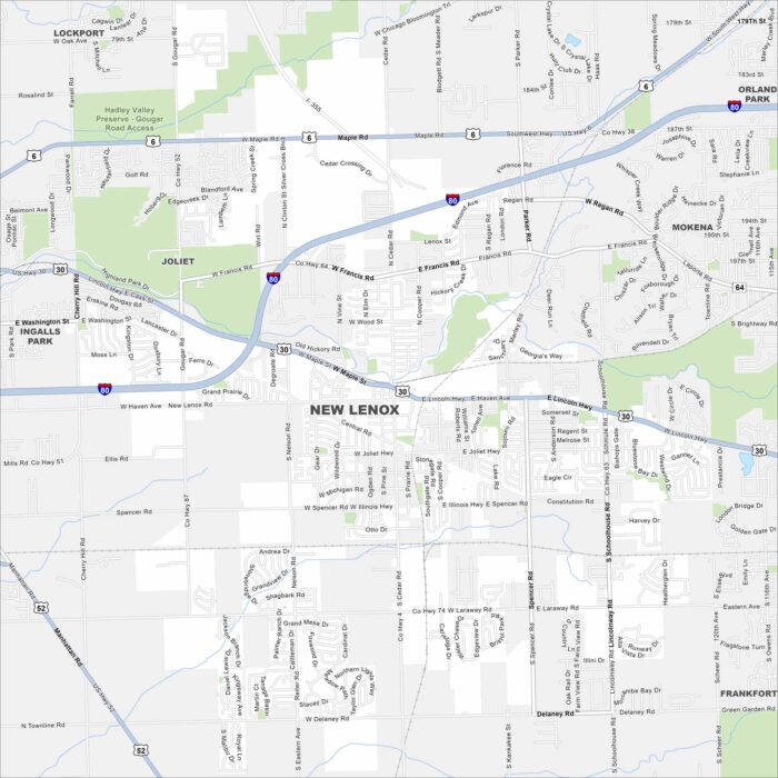
New Lenox lies southwest of Chicago in Will County. Our map shows parks, roads and highway connections. It’s a fast-growing area.
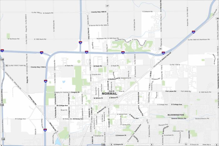
Normal lies next to Bloomington in central Illinois. Our map displays the city’s layout with a blend of college town and suburban growth.
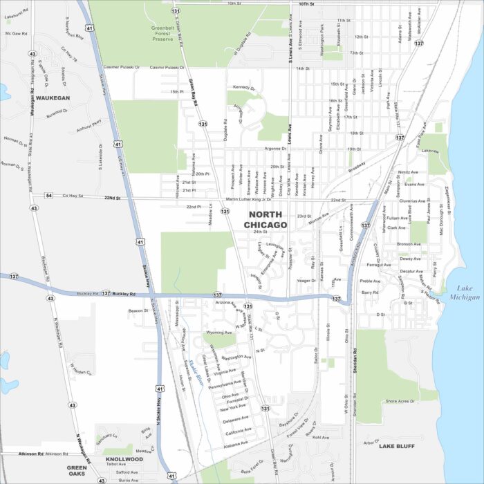
North Chicago sits on Lake Michigan between Waukegan and Lake Bluff. Our map highlights a compact street grid and highway system.
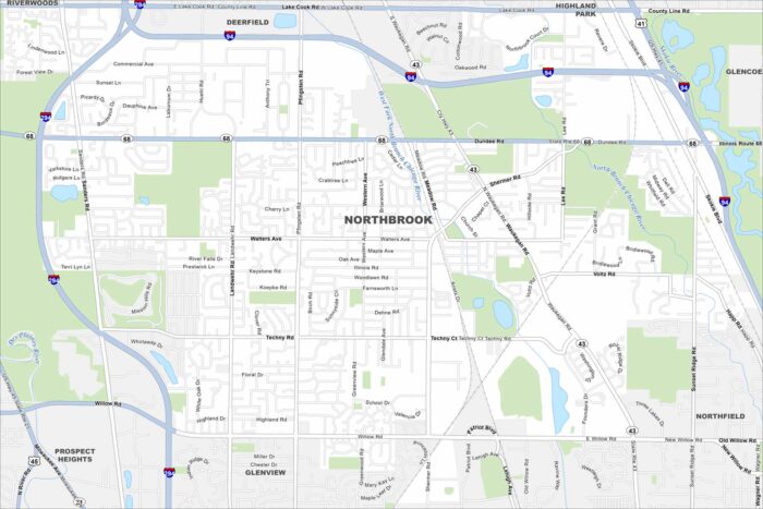
Our map of Northbrook highlights a northern suburb of Chicago. Highways, ponds, and residential areas shape the city’s layout.
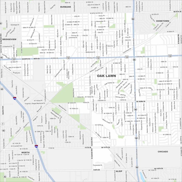
Oak Lawn sits southwest of Chicago. Take a look at this map to see its suburban grid, railways, and highway connections.
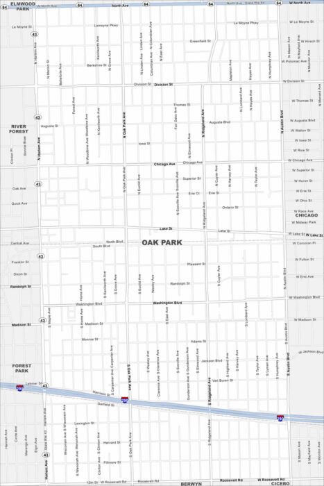
Our map of Oak Park outlines this suburb directly west of Chicago. The street grid is dense, with historic homes and cultural landmarks.
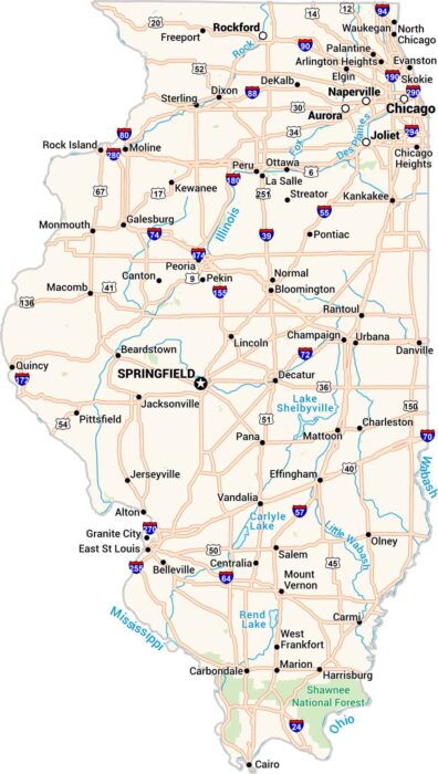
This map of Illinois keeps things clear. Cities, towns, rivers, and lakes are easy to see. Our map makes sense of the Land of Lincoln.
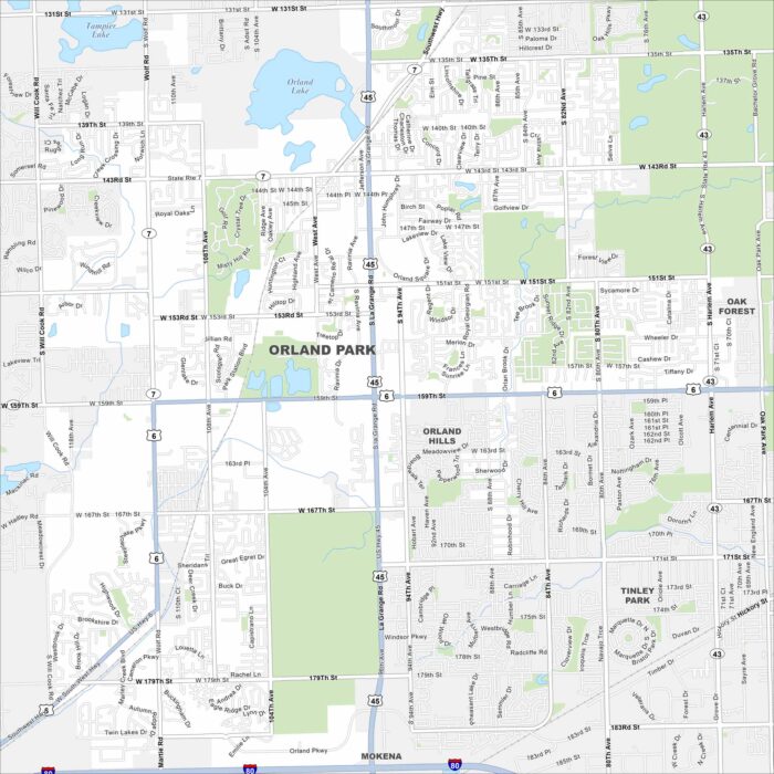
Here’s our map of Orland Park in southwest of Chicago. This map shows suburban lakes, rivers, highways, and parks.
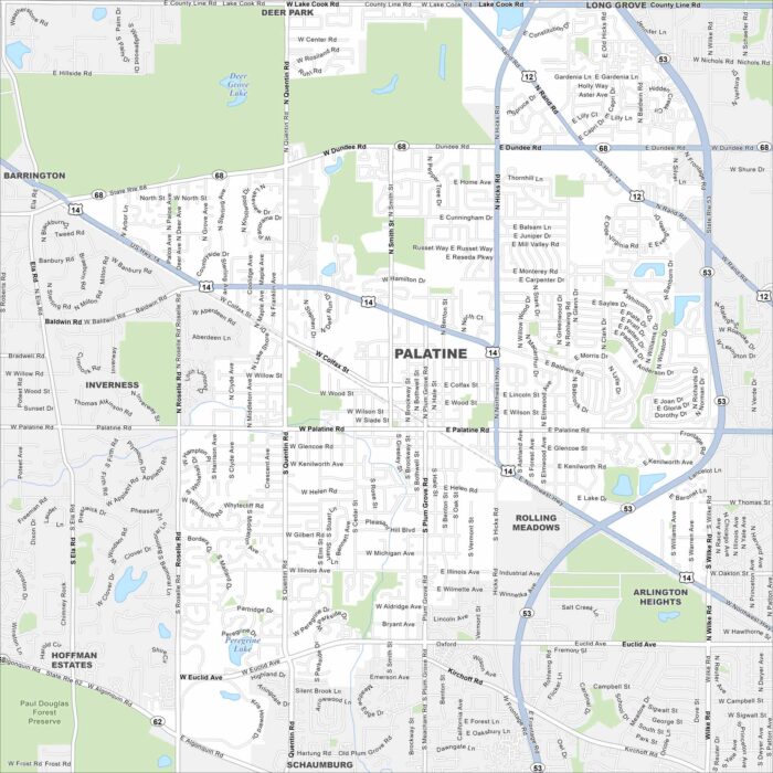
Get to know Palatine, northwest of Chicago. This map highlights its suburban grid, parks, lakes and waterways.