Wicker Park Map, Chicago
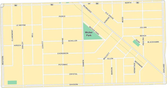
Wicker Park has lots of life to it. Our map lays out every corner, from the busy six-corner intersection to quiet side streets.
Wicker Park has lots of life to it. Our map lays out every corner, from the busy six-corner intersection to quiet side streets.
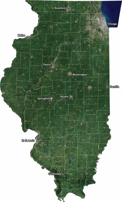
Our Illinois satellite map shows farmland, forests, and wide prairies. You’ll see Lake Michigan to the northeast with Chicago.
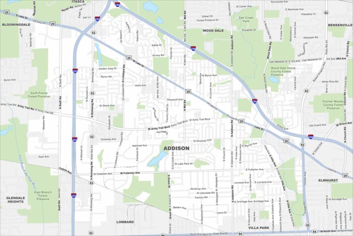
Our map of Addison shows a dense suburban community just west of Chicago. It has busy roads, industrial parks, and is near the metro area.
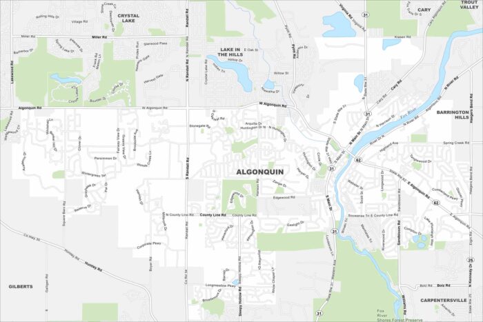
Set along the Fox River, Algonquin has tons of winding roads and open green spaces. Our map shows waterways, highways and local parks.
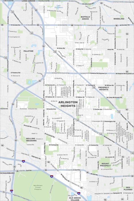
Our map of Arlington Heights lays out the roadways, waterways, and local parks. Roads tie into Chicago, which is located to the southeast.
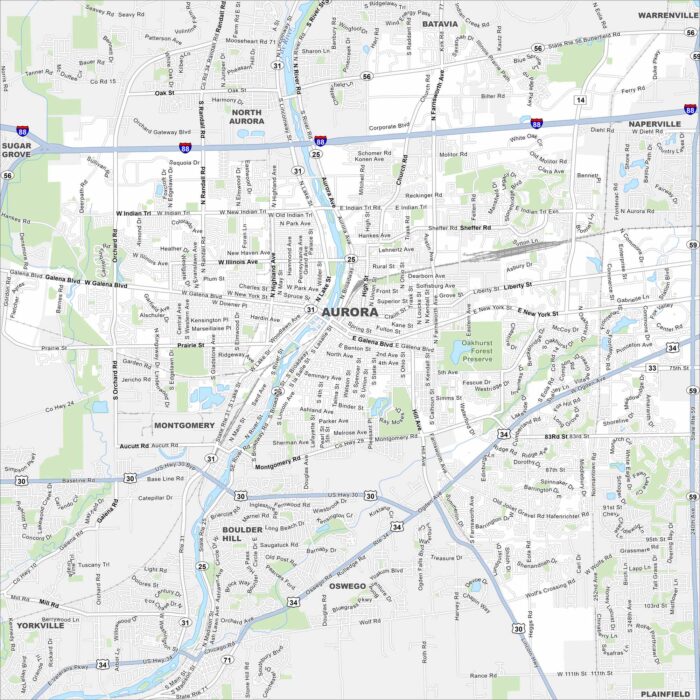
Our map of Aurora shows the highways, streets, and river crossings. Roads follow the Fox River because the city grew along its banks.
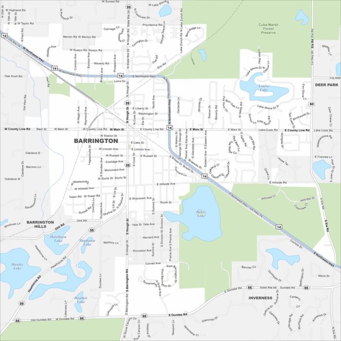
Barrington is mapped with its streets, highways, and surrounding green areas. The roads connect toward Chicago.
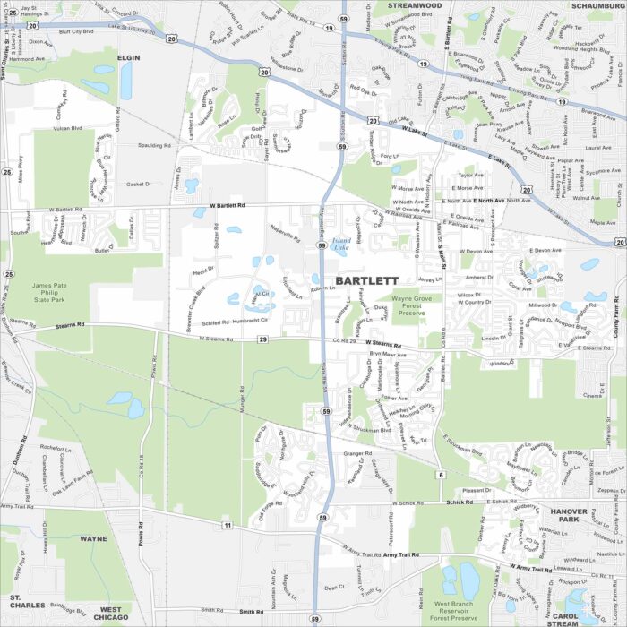
Check out Bartlett, home to forest preserves and open spaces. Enjoy both suburban living and nature. Find it all on our Bartlett map.
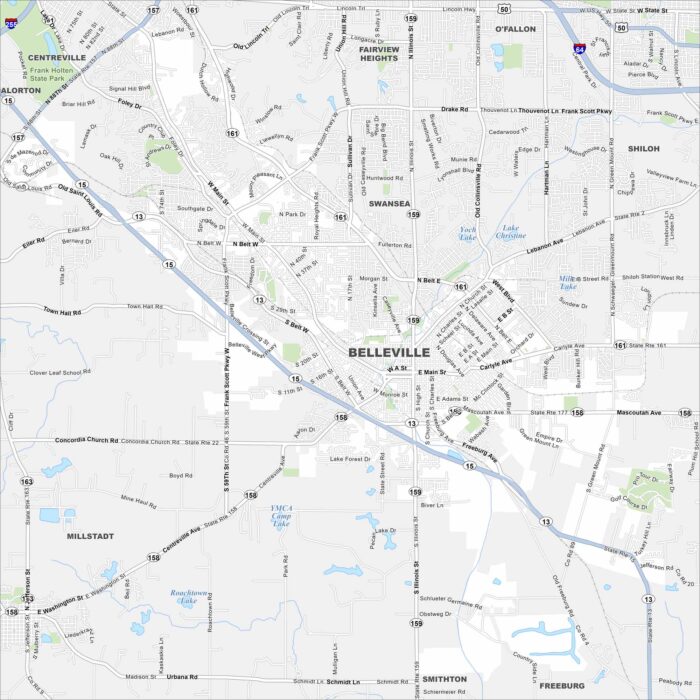
Our map of Belleville highlights the highways, streets, and park spaces. Roads link into the St. Louis area but the city stands on its own.
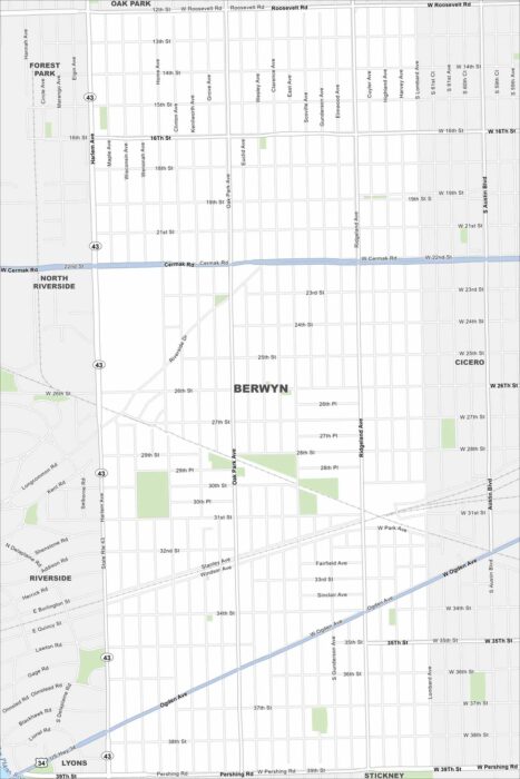
Berwyn is a near-west suburb of Chicago. Our map outlines grid-style streets, rail lines, and neighborhood parks.
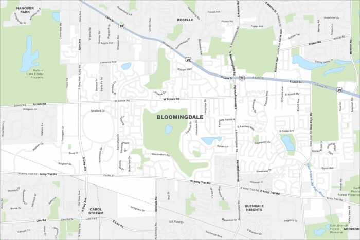
Our map of Bloomingdale highlights its highways, streets, and open park spaces. Roads link into the Chicago area.
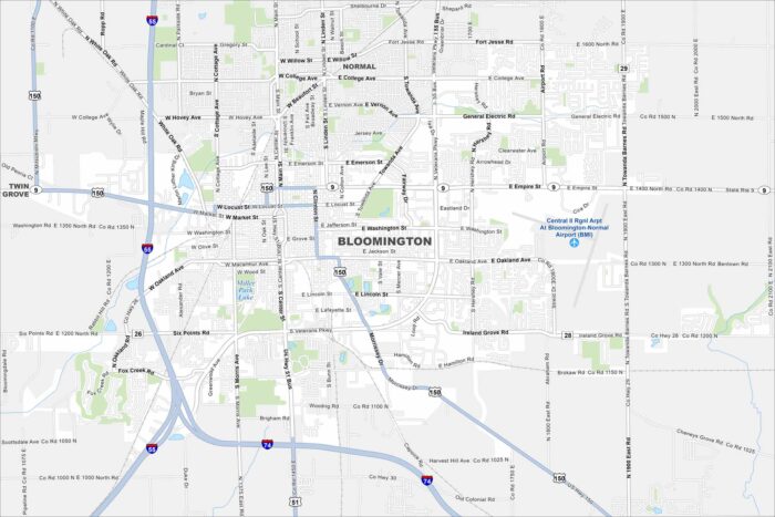
Bloomington is a central Illinois hub. Our map highlights roads, neighborhoods, and nearby parks. The city is tied to agriculture.
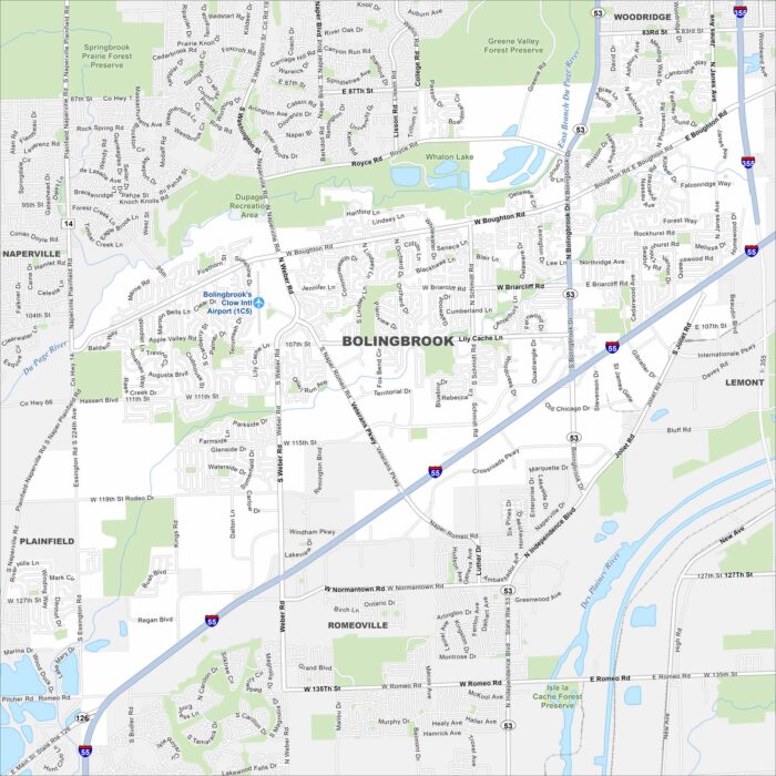
Bolingbrook is a large suburb southwest of Chicago. Our map shows its neighborhoods, parks, and waterways.
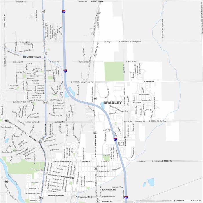
Bradley is a town near Kankakee. Check it out on our map to see its mix of roads and highways. It’s steady because of its local economy.
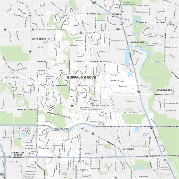
Explore Buffalo Grove with our map, containing roads, parks and lakes. It lies northwest of Chicago. The Des Plaines River is nearby.