Map of Dalton, Georgia
Nestled in the foothills of the Appalachians, Dalton sits next to the Chattahoochee-Oconee National Forest.
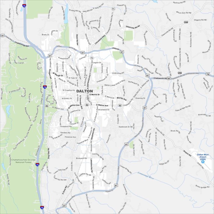
Nestled in the foothills of the Appalachians, Dalton sits next to the Chattahoochee-Oconee National Forest.
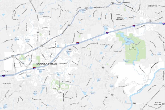
Our map of Douglasville shows a city west of Atlanta along I-20. Our map includes waterways, roadways and state parks.
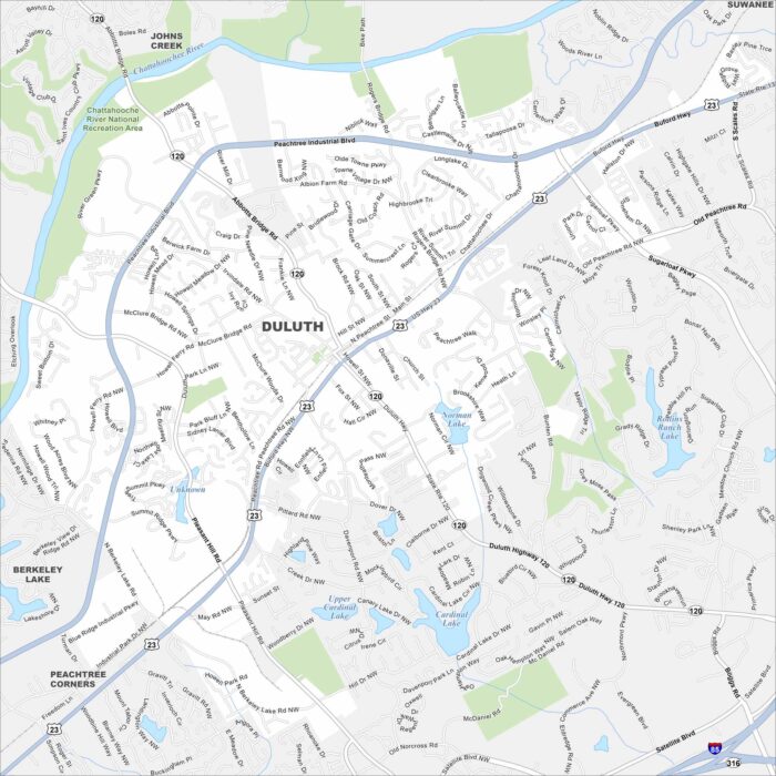
Duluth is in Gwinnett County, northeast of Atlanta. Our map shows neighborhoods, parks, and key roadways tying it to the metro area.
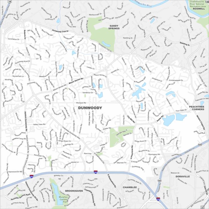
Dunwoody is just north of Atlanta. On the map you’ll notice major highways cutting across neighborhoods and wooded greenbelts.
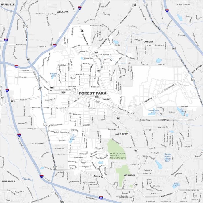
Our map of Forest Park shows it just south of Atlanta. Residential blocks mix with industrial space nearby.
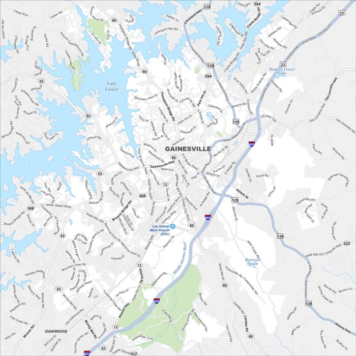
Our map of Gainesville highlights its spot on Lake Lanier. The shoreline with coves and marinas is a major feature.
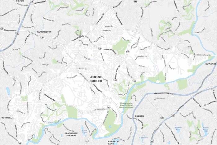
Johns Creek lies northeast of Atlanta with lots of parks and golf courses. Our map shows the Chattahoochee River, parks, highways and more.
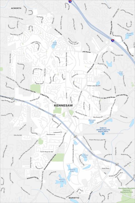
Kennesaw sits northwest of Atlanta. Our map shows Kennesaw Mountain National Battlefield Park on with highways connecting it.
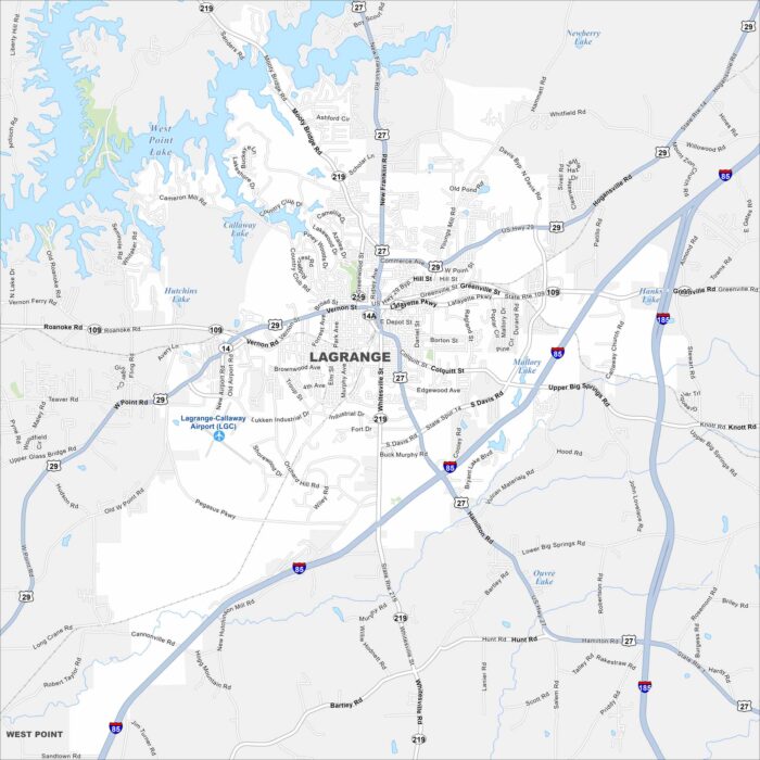
LaGrange is west of Atlanta, Georgia. West Point Lake spreads along the city’s western edge. The downtown square stands out at the center.
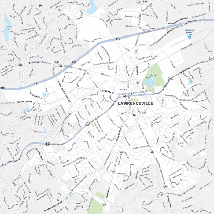
Explore Lawrenceville northeast of Atlanta, Georgia. The courthouse square anchors its center. New subdivisions fill the surrounding map.
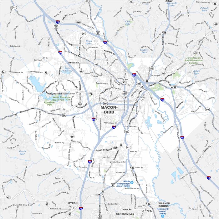
See Macon in central Georgia on our map. A key feature is the Ocmulgee River, which runs past downtown. I-16 and I-75 cross through the city.
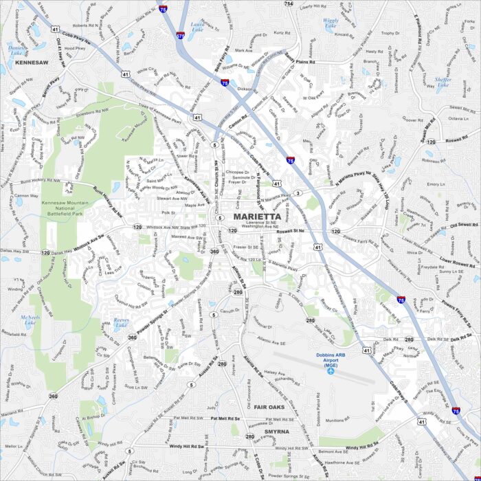
See Marietta on our road map. Interstate 75 runs beside the city, linking it with downtown. The Chattahoochee River flows to the east.
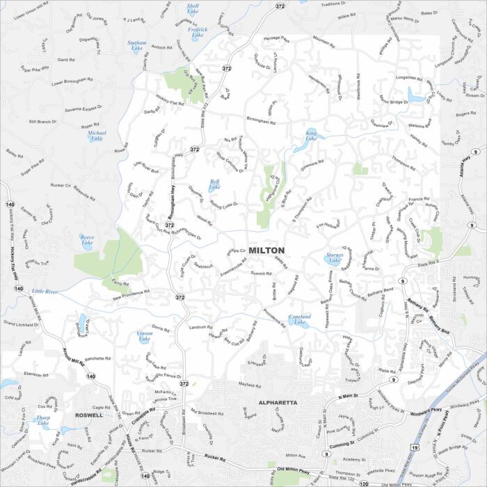
Learn about Milton, Georgia with our road map. But it still feels like one of metro Atlanta’s more rural-feeling suburbs.
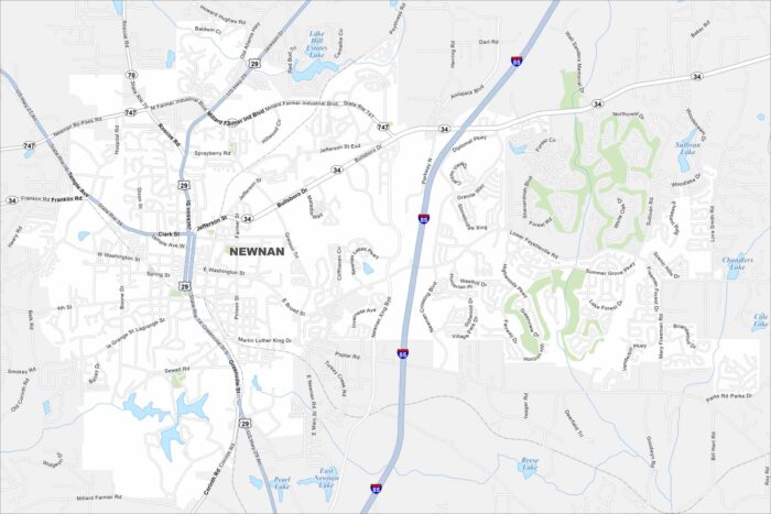
Newnan sits south of Atlanta in Coweta County. Our map highlights its major highways and surrounding wooded areas.
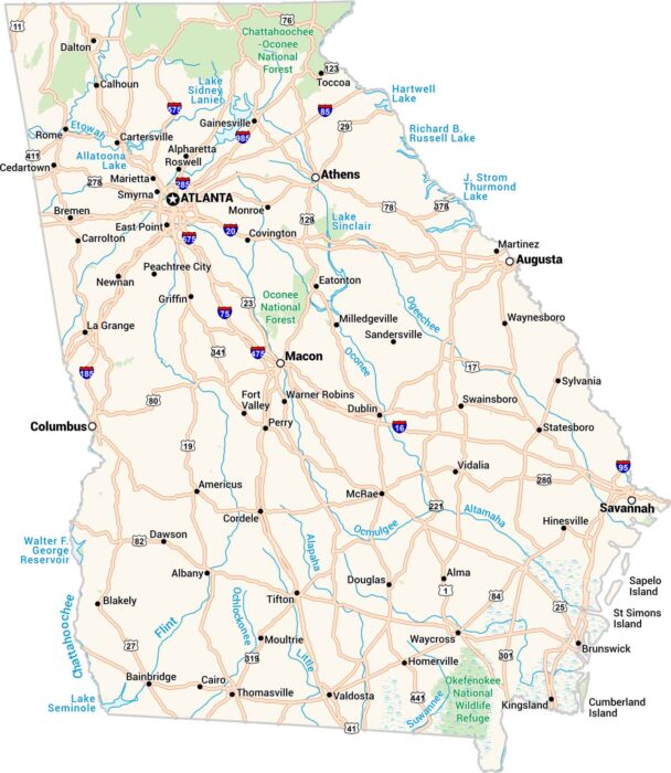
Here’s our map of Georgia. It shows the cities, small towns, rivers, and wide lakes. From Atlanta to Savannah, the whole state is here.