Georgia Physical Map
Georgia climbs from coast to mountains. The Appalachians rise in the north. The middle is Piedmont and the southern third is Coastal Plain.
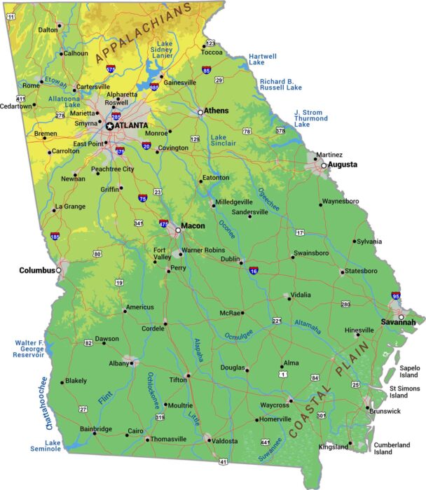
Georgia climbs from coast to mountains. The Appalachians rise in the north. The middle is Piedmont and the southern third is Coastal Plain.
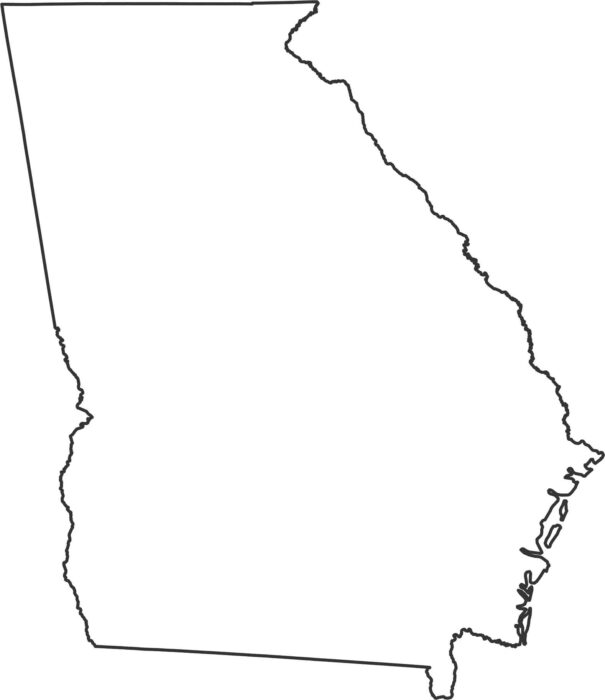
Our Georgia outline map shows the eastern border following the Savannah River. Down south with Florida, it’s a straight line cutting across.
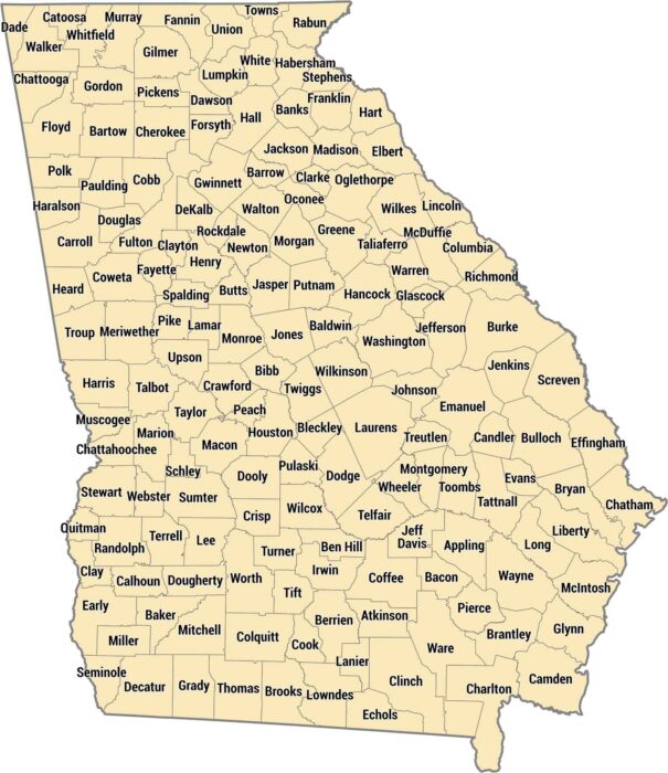
Georgia has 159 counties. That’s more than any state except Texas. Fulton County holds most of Atlanta and millions of people.
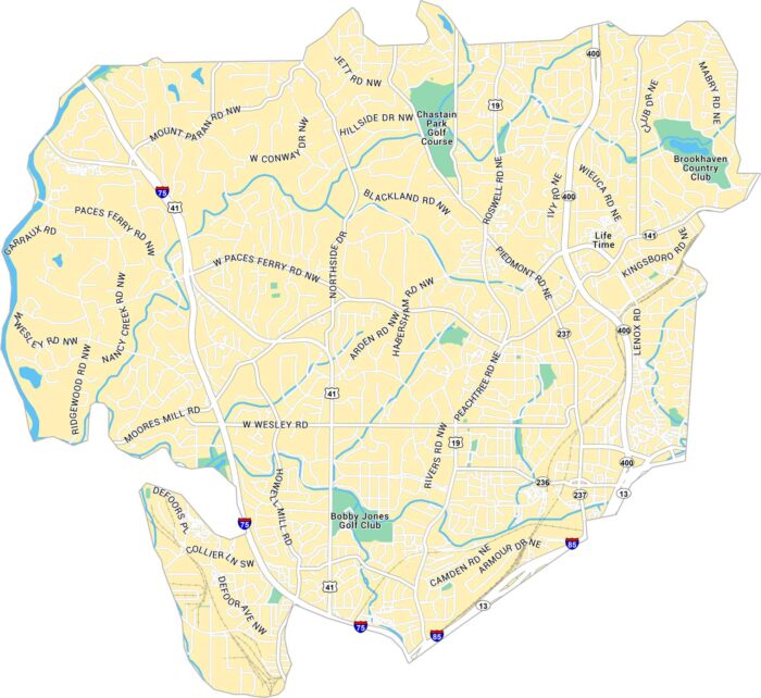
This map of Buckhead highlights Atlanta’s upscale core neighborhood. It shows Peachtree Road, Interstate 75 and its plethora of golf courses.
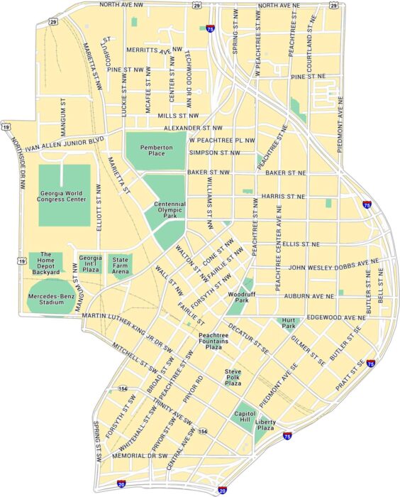
Here’s our map of Downtown Atlanta showing the State Capitol and Centennial Park. You’ll find interstates, streets, and green spaces.
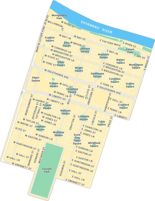
In the heart of Savannah, the Historic District spreads out under oak trees and old brick buildings. This map shows all there is to know.
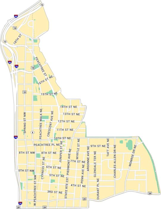
Our map of Midtown Atlanta centers on the stretch between Downtown and Buckhead. It lays out Peachtree Street and other streets.
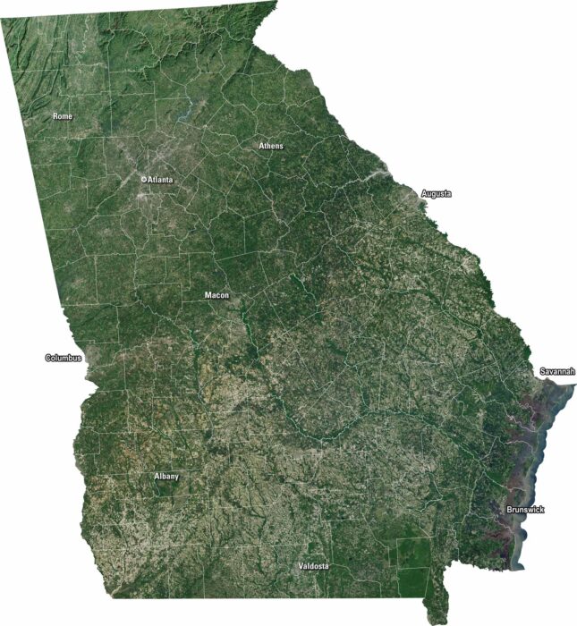
Georgia is a bunch of green and gold in our satellite map. Cities like Atlanta and Savannah stand out in endless countryside.
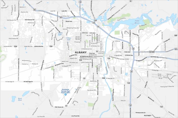
Roadways cross through Albany along the Flint River. Green spaces are also scattered around. Our map shows this South Georgia city.
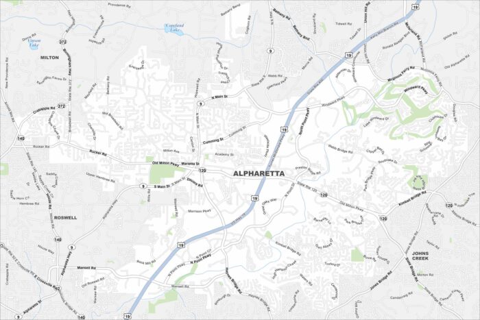
Our map of Alpharetta shows this fast-growing suburb north of Atlanta. Alpharetta has winding neighborhoods with major highways.
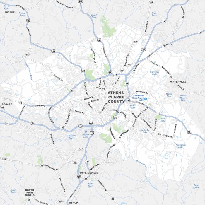
Get to know Athens, Georgia with our road map. It highlights the streets, highways, and parks. Roads wrap around the University of Georgia.
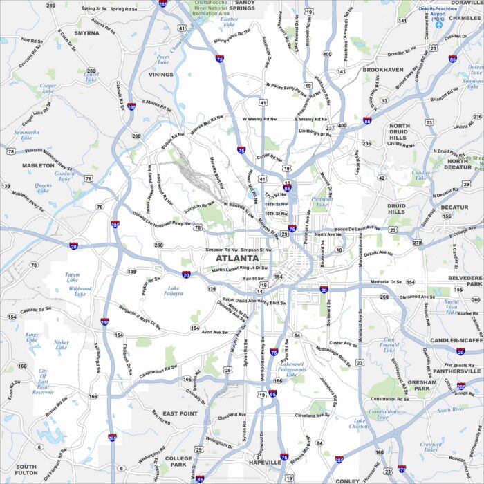
Atlanta is mapped with its highways, streets, and tree-filled spaces. You can see how the interstates connect with the downtown area.
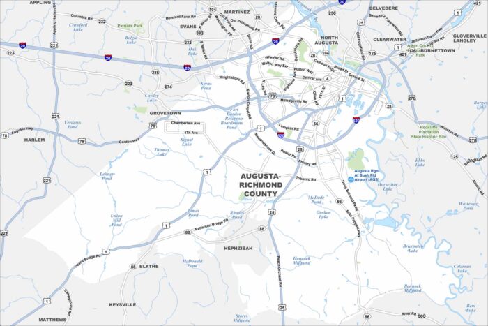
Augusta is mapped with its highways, streets, and rivers. It’s world-famous for hosting the Masters golf tournament.
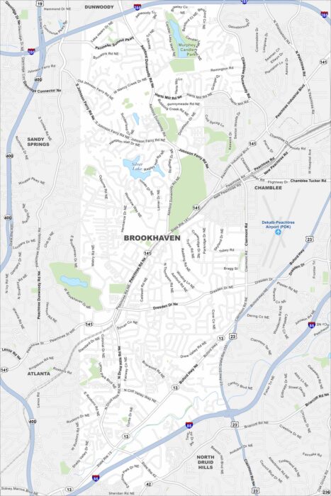
Explore our map of Brookhaven, which includes parks, waterways and highways. Major roads cut through making their way to Atlanta.
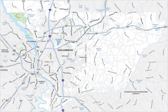
Columbus is on the Chattahoochee River, bordering Alabama. Our map of Columbus highlights the city’s streets, highways and riverfront.