Map of Middletown, Connecticut
Our map of Middletown shows the city’s stretch along the Connecticut River. Wesleyan University anchors its center.
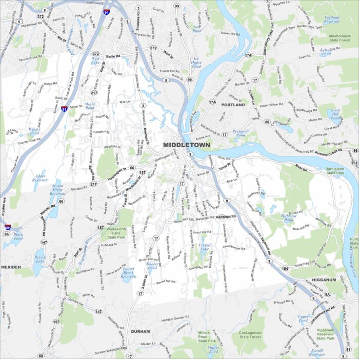
Our map of Middletown shows the city’s stretch along the Connecticut River. Wesleyan University anchors its center.
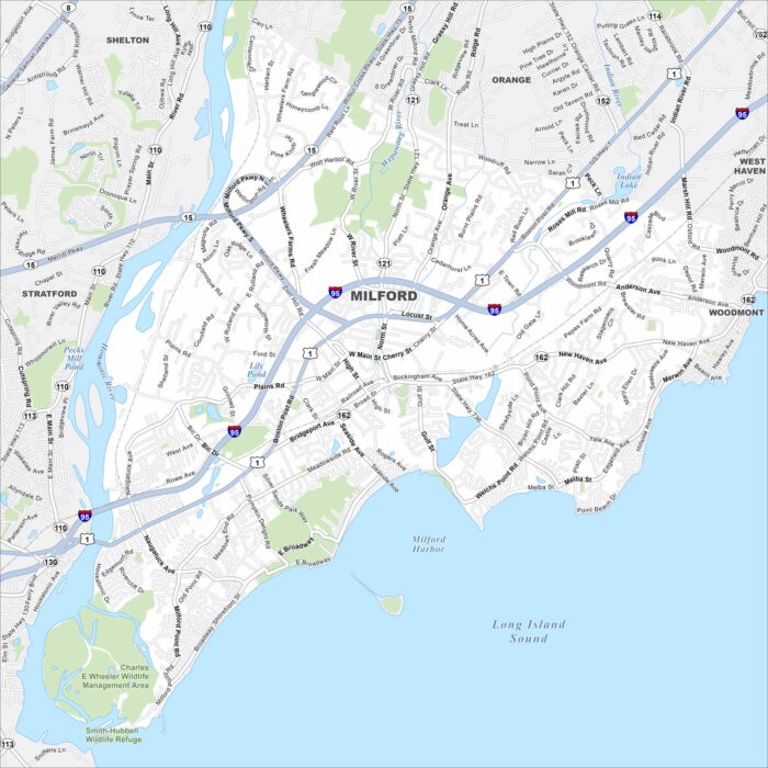
Explore Milford with our road map. The city stretches along Long Island Sound, occupying a good chunk of the Connecticut shoreline.
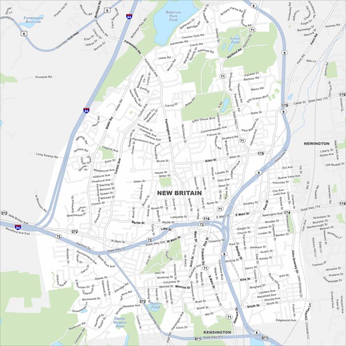
New Britain sits in central Connecticut near Hartford. This map highlights its downtown, residential neighborhoods, and nearby parks.
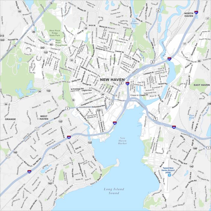
New Haven stretches along Long Island Sound with Yale University at its core. The map highlights highways, roads and the busy harbor.
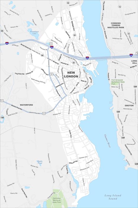
New London rests on the Thames River near Long Island Sound. Our map highlights the parks, highways, roads and a compact downtown.
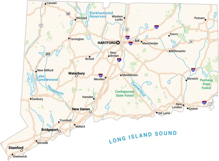
Connecticut’s got a little of everything. It has coasts, forests, and cities packed in one state. Our map of Connecticut shows it all.
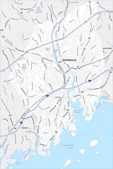
Norwalk stretches along Long Island Sound. Take a look at our map to see marinas, islands, and a busy downtown.
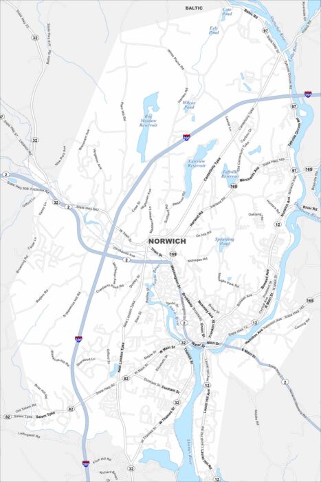
Our map of Norwich shows a city where the Thames, Shetucket, and Yantic Rivers meet. Downtown sits at the rivers’ confluence.
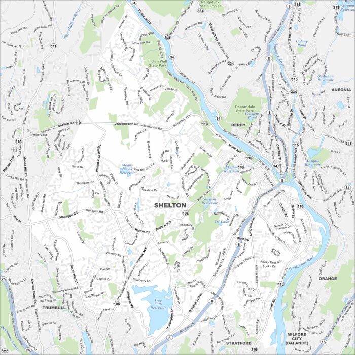
Our map of Shelton highlights this Naugatuck Valley town. With rivers, parks, and a mix of old and new neighborhoods, it’s easy to explore.
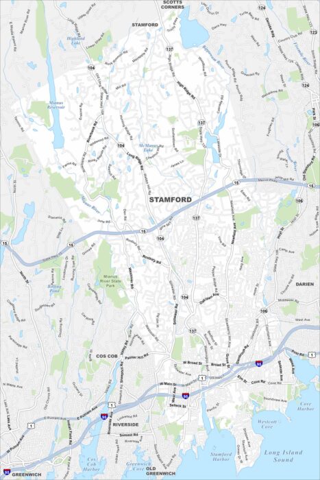
Our map of Stamford highlights the waterfront and busy downtown. The city blends corporate towers with harborside parks and neighborhoods.
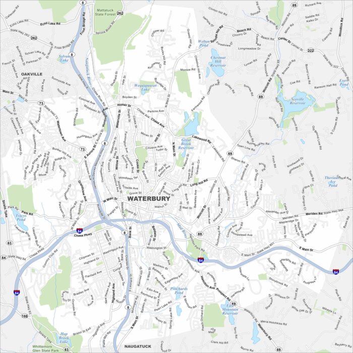
See how Waterbury is connected with our street map. Known as the “Brass City”, it has historic architecture and strong New England character.
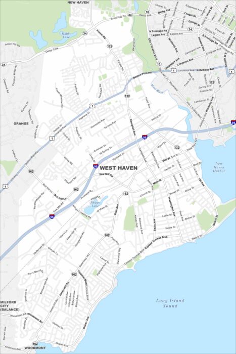
Start with this map of West Haven along the Long Island Sound. Beaches, a long shoreline, and historic neighborhoods stand out.