Map of West Sacramento, California
Here’s a simple map of West Sacramento across the river from downtown Sacramento. It’s a growing city with riverfront development.
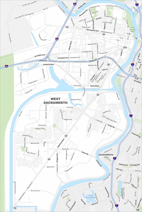
Here’s a simple map of West Sacramento across the river from downtown Sacramento. It’s a growing city with riverfront development.
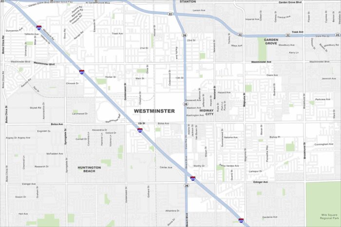
We’ve mapped out every major road in Westminster, California. Known for Little Saigon in the east, it’s a cultural hub in Orange County.
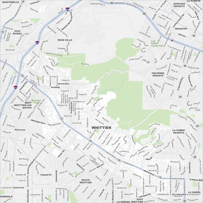
Our Whittier map shows its historic Uptown district and highways. The city sits southeast of Los Angeles and is part of the Gateway Cities.
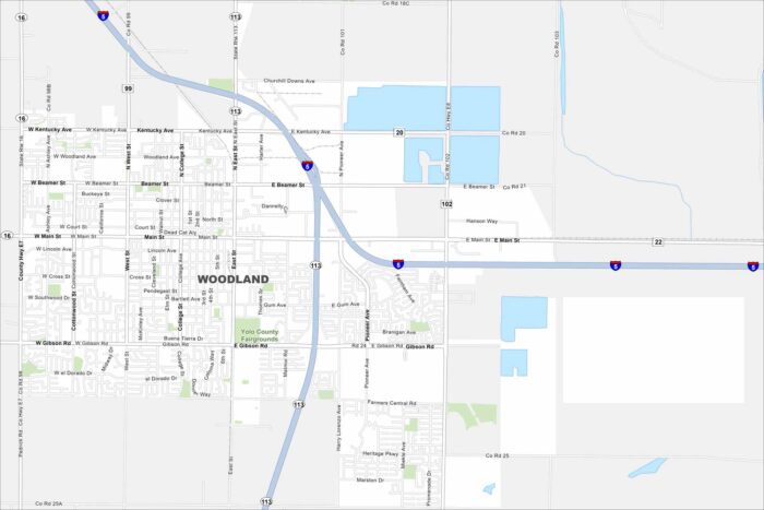
See the streets of Woodland, the seat of Yolo County. Historic downtown blocks meet farmland on the city’s edge.
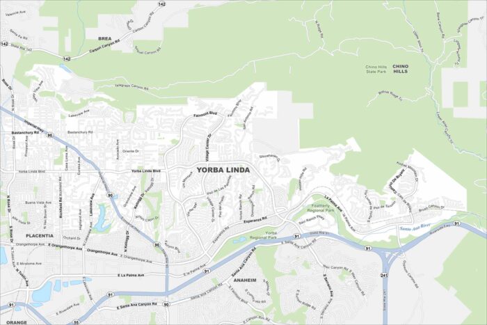
Step into Yorba Linda in Orange County. It’s known as the birthplace of President Richard Nixon. Chino Hills State Park is to the northeast.
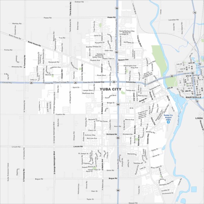
This Yuba City map shows its prime location in the Sacramento Valley. Surrounded by orchards and farmland, it’s a hub for the region.
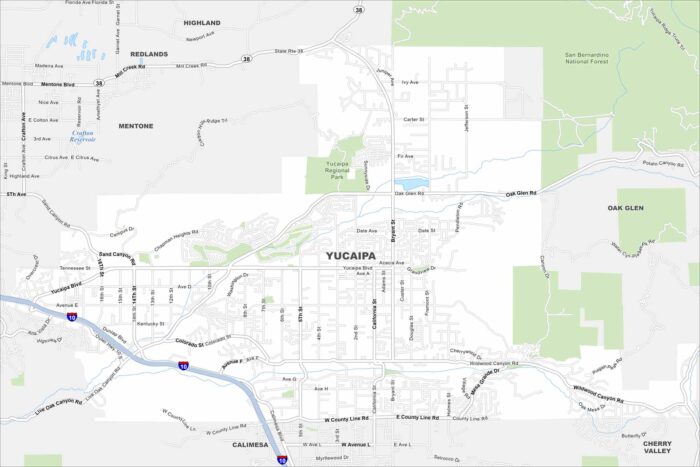
Here’s our map of Yucaipa, California, tucked against the San Bernardino Mountains. Parks and trails give this city a scenic edge.
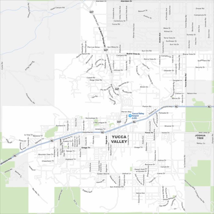
Get a snapshot of Yucca Valley, the gateway to Joshua Tree National Park. Desert views and wide-open skies define the area.