Map of Sumner, Washington
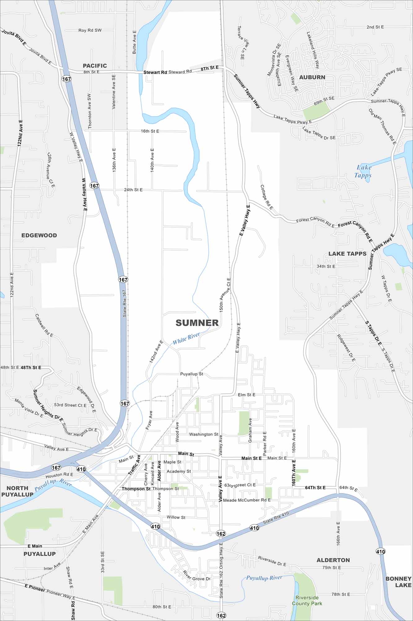
Our map of Sumner guides you through a small city with a historic downtown. It’s also the perfect starting point for trips toward Mount Rainier.
Map Information
On the Map
Interstates/Highways: State Rte 167, State Rte 410, State Rte 162, State Rte 522 Major Roads: Main St, Valley Ave, Traffic Ave, Thompson St, Wood Ave, Fryar Ave, Parker Rd, Graham Ave, Elm St, Puyallup St, Stewart Rd, 24th St, 8th St, 64th St, 160th Ave, 166th Ave, 150th Ave, 142nd Ave, 140th Ave, 136th Ave Lakes and Reservoirs: Lake Tapps Major Rivers: White River, Puyallup River Parks and Preserves: Riverside County Park Nearby Communities: Pacific, Auburn, Lake Tapps, Bonney Lake, Alderton, Puyallup, North Puyallup, EdgewoodWashington State Maps
Move through the Evergreen State with our map collection.


City Maps of Washington
Check out our city maps of Washington


