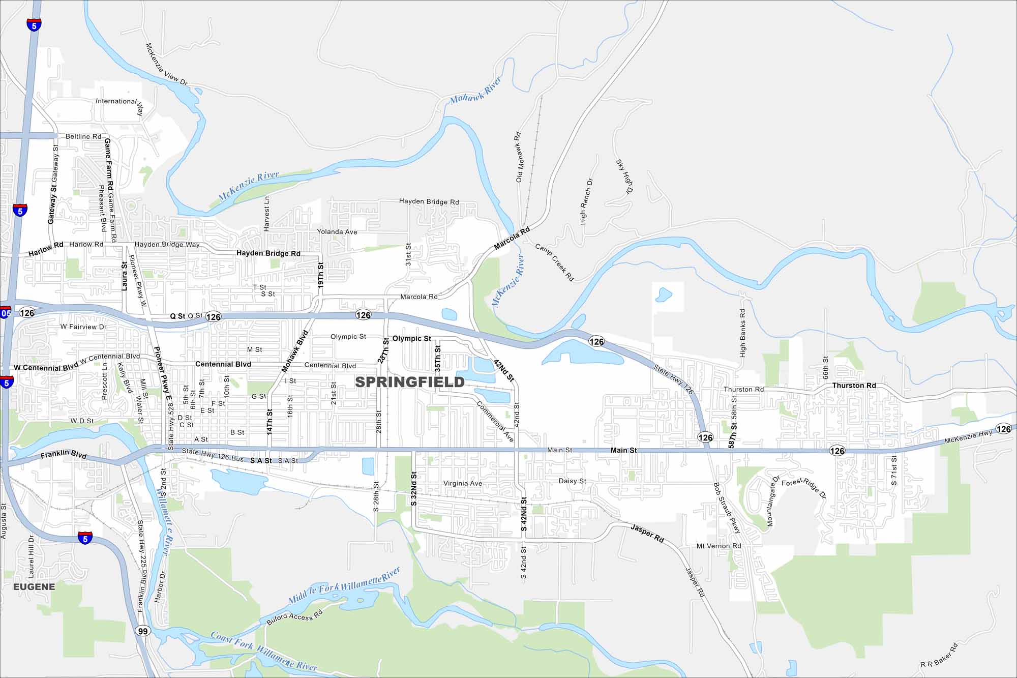
Map of Springfield, Oregon
Get around Springfield with our map. It’s a friendly community next to Eugene, with easy access to rivers, trails, and mountain scenery.
Map Information
On the Map
Interstates/Highways: I-5, State Rte 126, State Rte 528, State Rte 225 Major Roads: Beltline Rd, Gateway St, Game Farm Rd, Pioneer Pkwy, Marcola Rd, Q St, Centennial Blvd, Main St, Bob Straub Pkwy, Thurston Rd, Jasper Rd, Mohawk Blvd, Hayden Bridge Rd, Hayden Bridge Way, Olympic St, 28th St, 42nd St, 58th St, Mackenzie Hwy Airports: McKenzie River, Mohawk River, Willamette River, Middle Fork Willamette River, Coast Fork Willamette River Nearby Communities: EugeneOregon State Maps
Here is our state map collection of Oregon.


City Maps of Oregon
Get to know Portland and Oregon’s urban areas.


