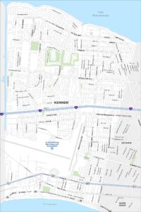
Map of Shreveport, Louisiana
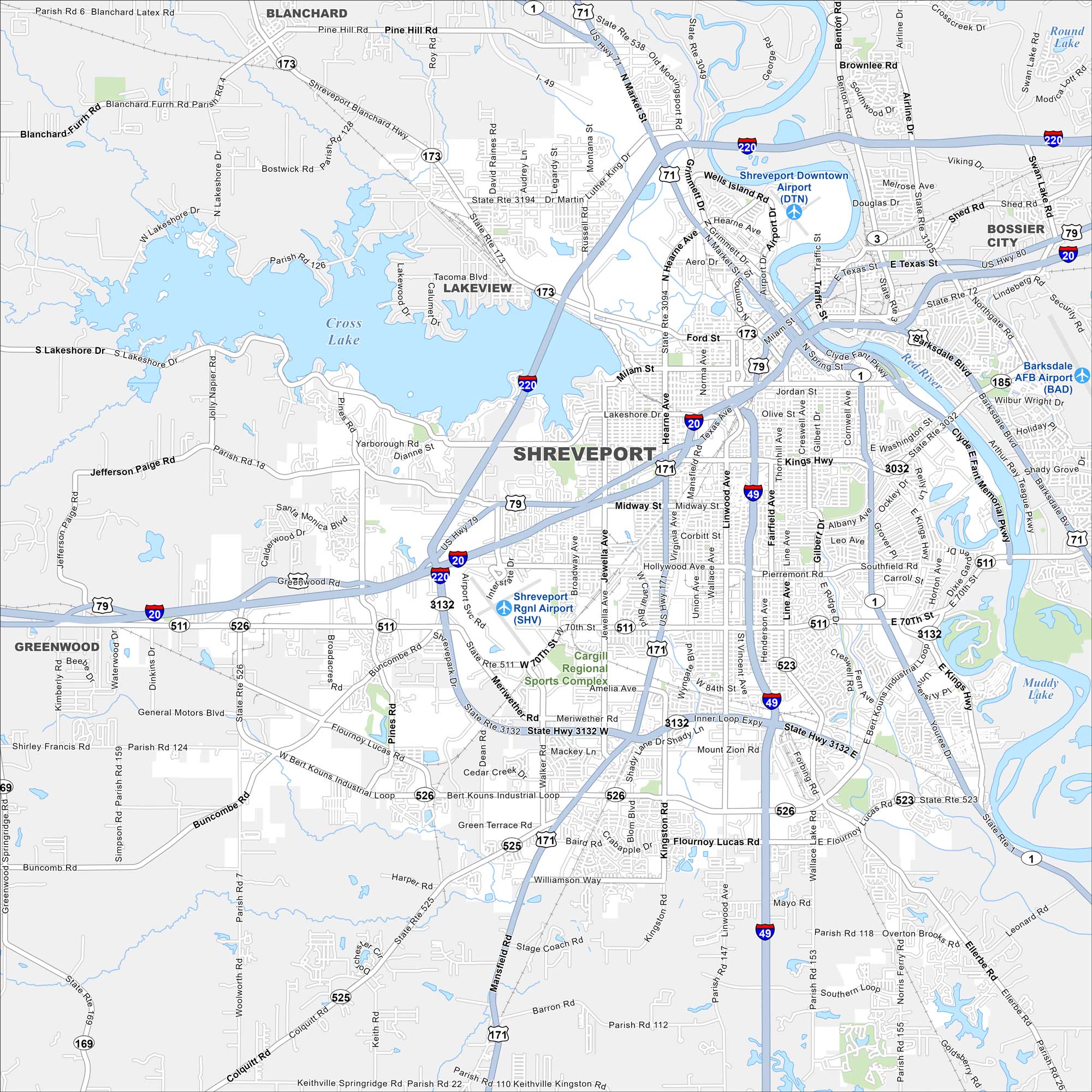
Here’s a map of Shreveport, a major city in northwest Louisiana. It’s known for its riverfront casinos, music scene, and culture. Cross Lake is also a prominent feature in the northwest corner of the city.
Louisiana State Maps
Here are maps showcasing the state of Louisiana


Map Information
On the Map
Interstates/Highways: I-20, I-49, I-220, US Hwy 71, US Hwy 79, US Hwy 80, State Rte 1, State Rte 3, State Rte 169, State Rte 171, State Rte 173, State Rte 3032, State Rte 3132, Inner Loop Expy Major Roads: Mansfield Rd, North Market St, Hearne Ave, Bert Kouns Industrial Loop, Pines Rd, Youree Dr, Line Ave, Fairfield Ave, Barksdale Blvd, Kings Hwy, Midway St, Hollywood Ave, Jewella Ave, Greenwood Rd, 70th St, Flournoy Lucas Rd, Clyde Fant Memorial Pkwy, Shreveport Barksdale Hwy, Southern Ave Airports: Shreveport Rgnl Airport (SHV), Shreveport Downtown Airport (DTN), Barksdale AFB Airport (BAD) Lakes and Reservoirs: Cross Lake, Muddy Lake, Round Lake, Swan Lake Major Rivers: Red River Parks and Preserves: Cargill Regional Sports Complex Nearby Communities: Blanchard, Lakeview, Bossier City, GreenwoodCity Maps of Louisiana
Explore New Orleans and Louisiana’s urban centers with our city maps