Map of SeaTac, Washington
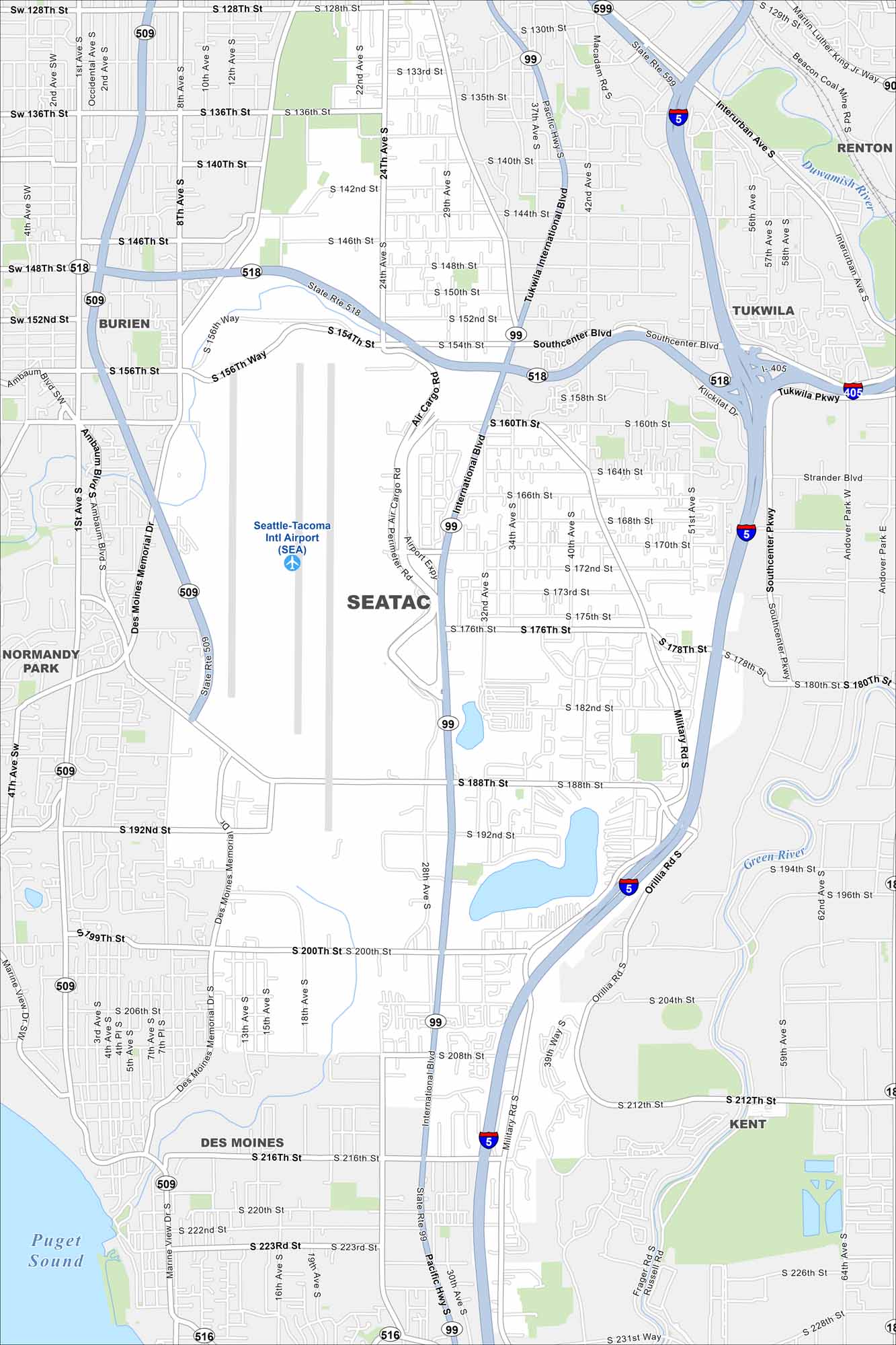
Here’s our map of SeaTac, Washington. Known for its international airport, the city also has lakes, parks, and neighborhoods worth a closer look.
Map Information
On the Map
Interstates/Highways: I-5, I-405, State Rte 518, State Rte 99, State Rte 509, State Rte 516 Major Roads: International Blvd, Pacific Hwy, Des Moines Memorial Dr, Military Rd, Orillia Rd, 188th St, 200th St, 176th St, 154th St, 128th St, Southcenter Blvd, Tukwila Pkwy, Klickitat Dr, Air Cargo Rd, Airport Expy, Marine View Dr, 216th St, 208th St, 160th St, 140th St Airports: Seattle-Tacoma Intl Airport (SEA) Lakes and Reservoirs: Puget Sound Major Rivers: Duwamish River, Green River Nearby Communities: Burien, Tukwila, Renton, Kent, Des Moines, Normandy ParkWashington State Maps
Move through the Evergreen State with our map collection.


City Maps of Washington
Check out our city maps of Washington


