Map of Portland, Oregon
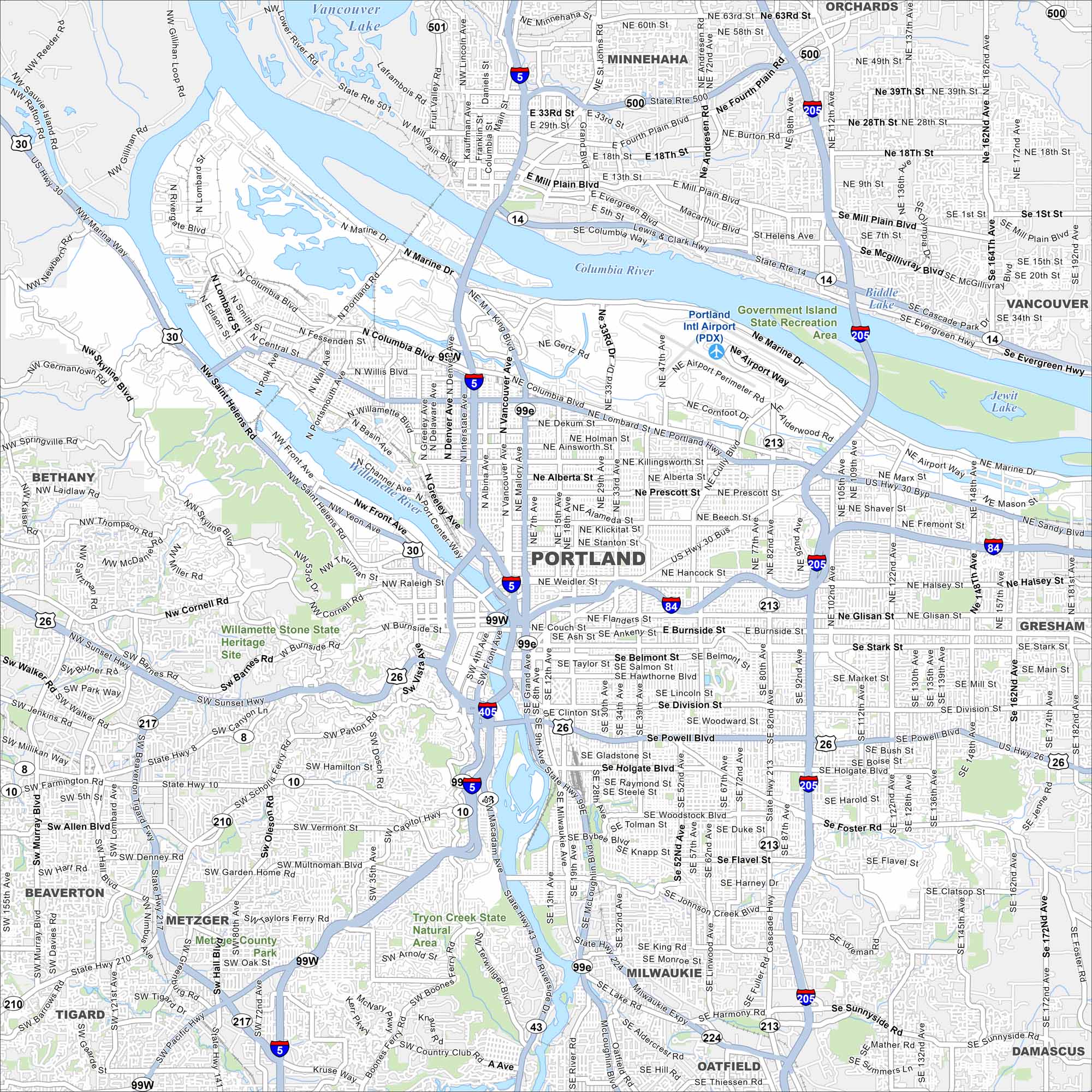
Portland stretches along the Willamette River with bridges connecting across. Hills rise to the west, including forested areas. The city is known for parks, bike paths, and the nearby Columbia River Gorge.
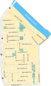
Portland Neighborhood Maps
See our neighborhood maps for a closer look of the city.
Map Information
On the Map
Interstates/Highways: I-5, I-84, I-205, I-405, US Hwy 26, US Hwy 30, US Hwy 99W, US Hwy 99E, State Hwy 8, State Hwy 10, State Hwy 14, State Hwy 43, State Hwy 210, State Hwy 213, State Hwy 217, State Hwy 224, State Hwy 500, State Hwy 501, State Hwy 503 Major Roads: Burnside St, Lombard St, Powell Blvd, 82nd Ave, Sandy Blvd, Foster Rd, Division St, Marine Dr, Columbia Blvd, McLoughlin Blvd, Canyon Rd, Barbur Blvd, Beaverton Hillsdale Hwy, Skyline Blvd, Cornell Rd, Glisan St, Stark St, Holgate Blvd, Woodstock Blvd, Johnson Creek Blvd Airports: Portland Intl Airport (PDX) Lakes and Reservoirs: Vancouver Lake, Jewitt Lake, Biddle Lake Major Rivers: Columbia River, Willamette River Parks and Preserves: Government Island State Recreation Area, Tryon Creek State Natural Area, Willamette Stone State Heritage Site Nearby Communities: Vancouver, Gresham, Beaverton, Tigard, Milwaukie, Lake Oswego, Gladstone, Oregon City, Minnehaha, Orchards, Bethany, Metzger, Oak Grove, Oatfield, West Linn, DamascusOregon State Maps
Here is our state map collection of Oregon.


City Maps of Oregon
Get to know Portland and Oregon’s urban areas.


