Map of Portage, Indiana
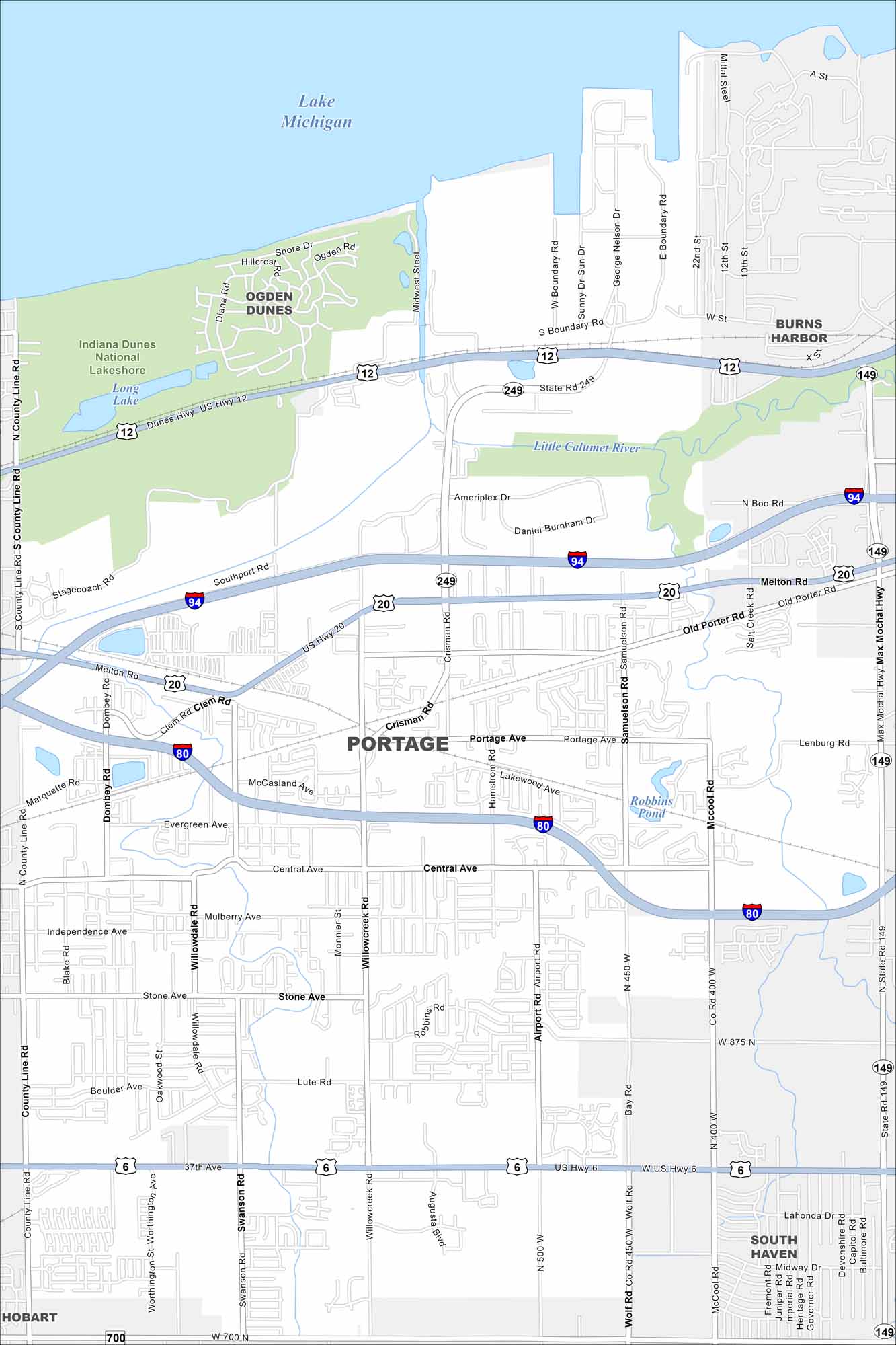
Portage lies along the southern edge of Lake Michigan. Check out our map to see how highways, rail lines, and the lakefront connect. Also notice how Indiana Dunes National Park borders the city to the north.
Indiana State Maps
Study about Indiana with our map collection


Map Information
On the Map
Interstates/Highways: I-80, I-94, US Hwy 6, US Hwy 12, US Hwy 20, State Rte 149, State Rte 249 Major Roads: Central Ave, Portage Ave, Lute Rd, 37th Ave, Willowcreek Rd, Airport Rd, Crisman Rd, Samuelson Rd, Robbins Rd, Old Porter Rd, Melton Rd, Stagecoach Rd, Stone Ave, Independence Ave, Mulberry Ave, McCool Rd, Bay Rd, County Line Rd, Swanson Rd, Ameriplex Dr Lakes and Reservoirs: Lake Michigan, Long Lake, Robbins Pond Major Rivers: Little Calumet River Parks and Preserves: Indiana Dunes National Lakeshore Nearby Communities: Ogden Dunes, Burns Harbor, South Haven, HobartIndiana City Maps
Here are our maps of Indianapolis and Indiana cities


