Map of Phenix City, Alabama
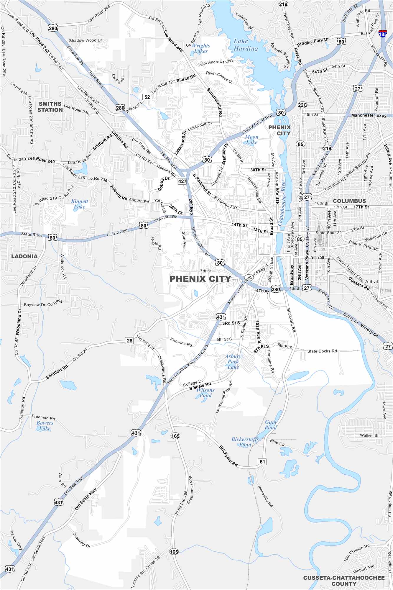
Check out Phenix City along the Chattahoochee River. Our map shows how it connects directly with Columbus, Georgia across the water. Whitewater rafting and riverfront trails stand out on this stretch.


Map Information
On the Map
Interstates/Highways: US 280, US 431, US 80, US 27, AL 165, AL 52, AL 85, AL 219, AL 22C, AL 28, AL 61 Major Roads: Broadway, Dillingham St, 14th St, 13th St, 30th St, 45th St, 54th St, Crawford Rd, Summerville Rd, Seale Rd, Stadium Dr, 5th Ave, 13th Ave, Broad St, Martin Luther King Jr Pkwy Lakes and Reservoirs: Lake Harding, Moon Lake, Kinnett Lake, Asbury Park Lake, Wilsons Pond, Bickerstaffs Pond, Gunn Pond, Bowers Lake Rivers and Creeks: Chattahoochee River Nearby Communities: Columbus, Smiths Station, Ladonia, Cusseta-Chattahoochee CountyAlabama City Maps
Here are our city maps of Alabama


