Map of Northport, Alabama
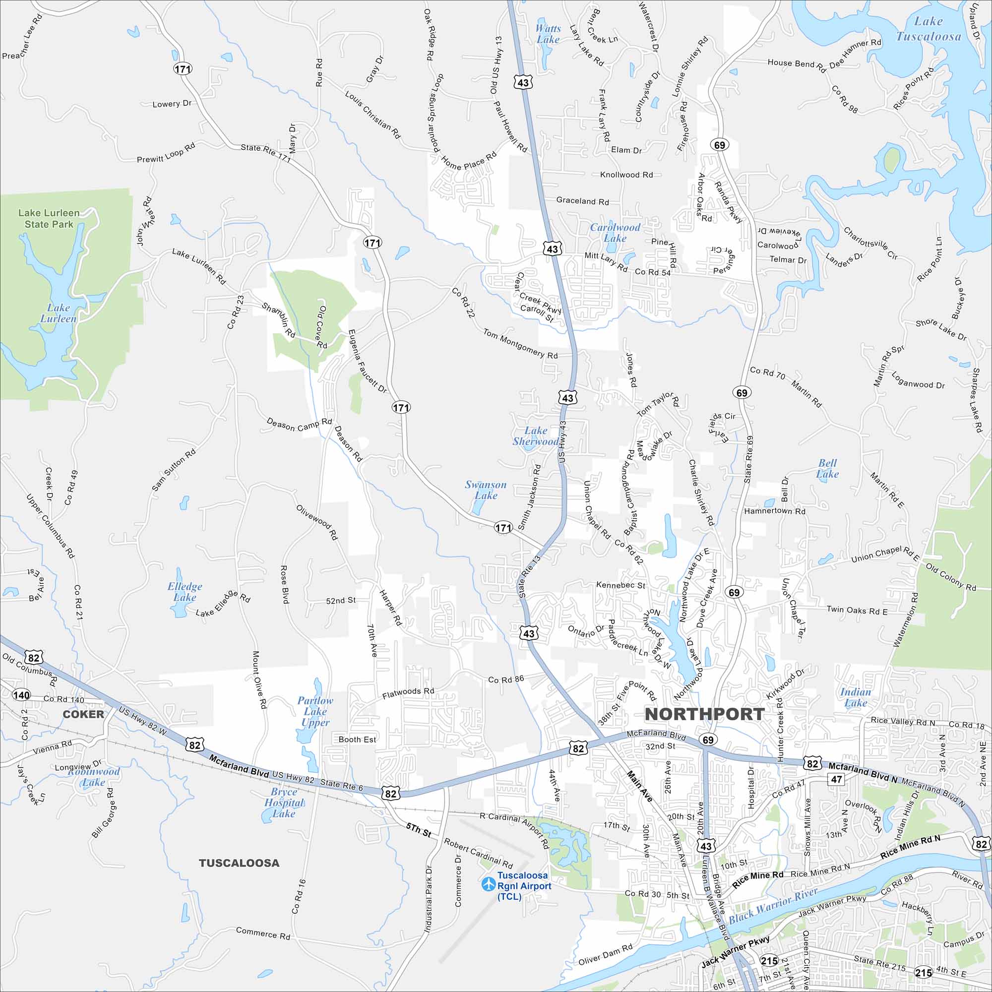
Northport lies just across the Black Warrior River from Tuscaloosa. Check out our map to see highways, streets and river crossings. It’s closely tied to the University of Alabama community.


Map Information
On the Map
Interstates/Highways: US 82, US 43, AL 69, AL 171, AL 140, AL 182 Major Roads: McFarland Blvd, Co Rd 140, Co Rd 86, Co Rd 30, Co Rd 16, Lurleen B Wallace Blvd, Main Ave, 5th St, 17th St, 32nd St, Rice Mine Rd, Flatwoods Rd, Booth East, Kennebec St, Hammertown Rd, Twin Oaks Rd, Union Chapel Rd, Telmar Dr, Knollwood Rd, Tom Montgomery Rd Airports: Tuscaloosa Regional Airport (TCL) Lakes and Reservoirs: Lake Tuscaloosa, Lake Lurleen, Partlow Lake, Elledge Lake, Swanson Lake, Lake Sherwood, Caralwood Lake, Winn Lake, Bell Lake, Indian Lake Rivers and Creeks: Black Warrior River Parks/Preserves/Forests: Lake Lurleen State Park Nearby Communities: Tuscaloosa, CokerAlabama City Maps
Here are our city maps of Alabama


