New York Population Density Map
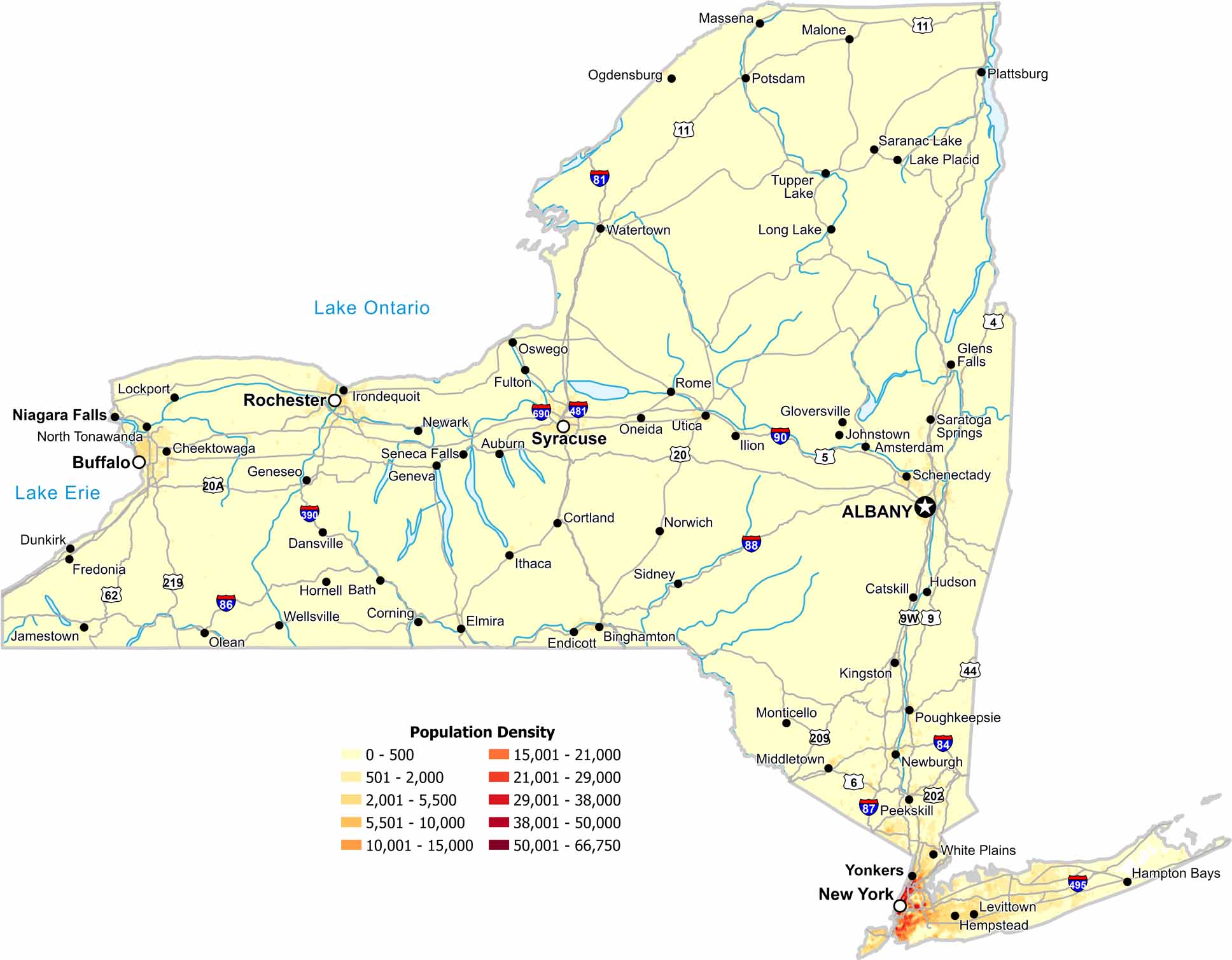
Our population density map of New York shows how geography divides the state. Density peaks around major cities, especially in the New York City area. Otherwise, most of the state is sparsely populated.
Map Information
New York State Maps
Find state maps of the Empire State.


City Maps of New York
Here are the city maps that define New York


