Map of New Iberia, Louisiana
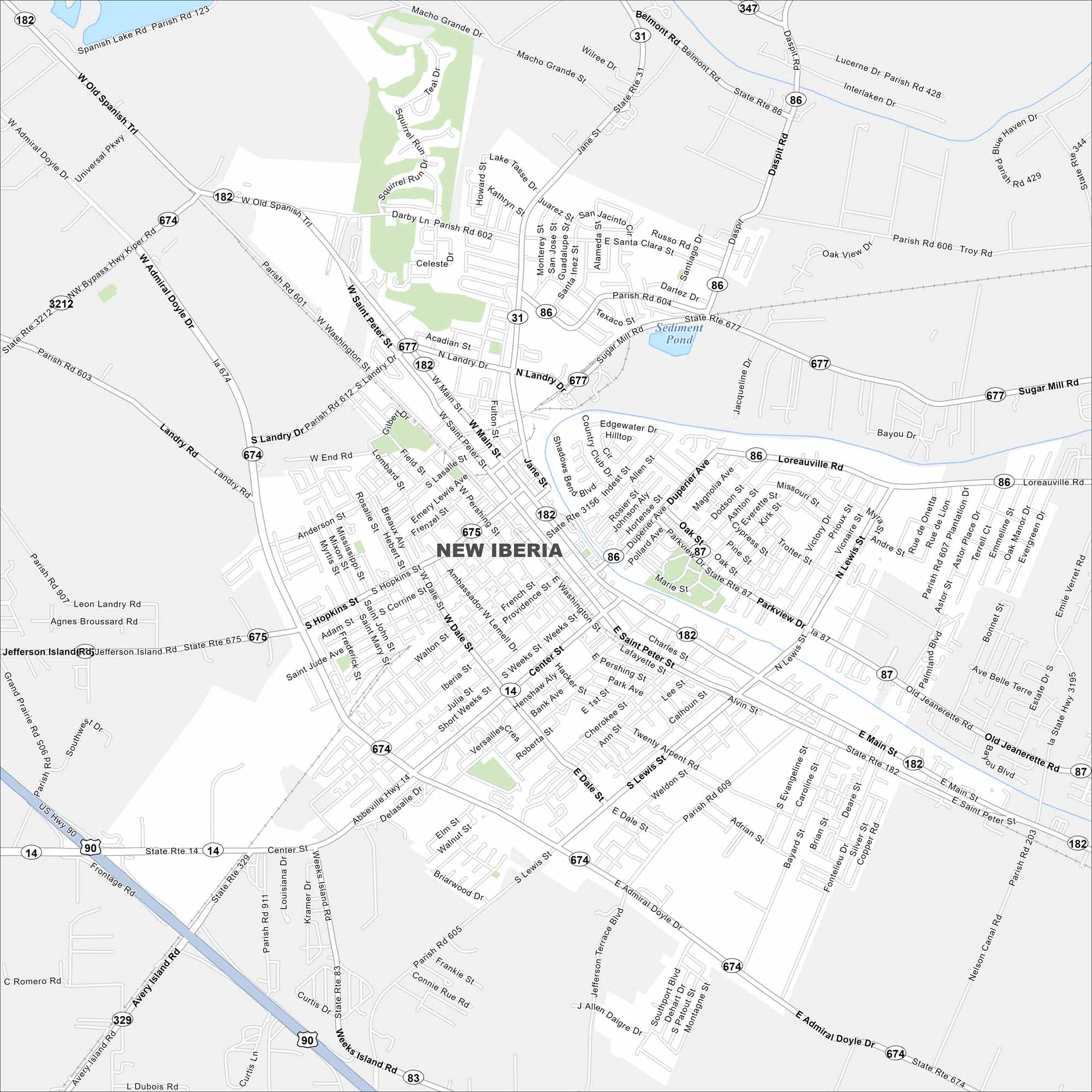
New Iberia sits along Bayou Teche in southern Louisiana. Check out this map to see its historic downtown, waterways, and surrounding sugarcane fields.
Louisiana State Maps
Here are maps showcasing the state of Louisiana


Map Information
On the Map
Interstates/Highways: US Hwy 90, State Rte 14, State Rte 31, State Rte 83, State Rte 86, State Rte 87, State Rte 182, State Rte 329, State Rte 344, State Rte 347, State Rte 674, State Rte 675, State Rte 677, State Rte 3156, State Rte 3212 Major Roads: Admiral Doyle Dr, Main St, Center St, Lewis St, Hopkins St, Saint Peter St, Parkview Dr, Dale St, Weeks Island Rd, Avery Island Rd, Jefferson Island Rd, Loreauville Rd, North Landry Dr, South Landry Dr, Pershing St, Washington St, Dale St, Bank Ave, Burke St, Jane St Lakes and Reservoirs: Sediment PondCity Maps of Louisiana
Explore New Orleans and Louisiana’s urban centers with our city maps