Nevada National Parks and Forests Map
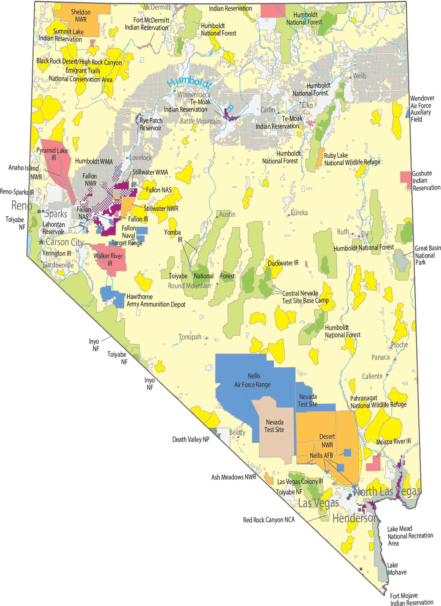
Check out our Nevada map of national parks and forests. Great Basin National Park sits in the eastern part near Utah. Whereas Death Valley National Park crosses the California border in the southwest. Humboldt-Toiyabe National Forest is scattered across multiple mountain ranges.
Map Information
On the Map
Parks, Forests and Federal Lands
National Parks (NP): Death Valley National Park, Great Basin National Park National Forests (NF): Inyo NF, Humboldt NF, Toiyabe NF National Wildlife Refuges (NWR): Anaho Island NWR, Ash Meadows NWR, Fallon NWR, Lake Mohave NWR, Pahranagat NWR, Ruby Lake NWR, Sheldon NWR, Stillwater NWR National Conservation Areas (NCA): Emigrant Trails National Conservation Area, Red Rock Canyon National Conservation Area Other Federal Lands: Black Rock Desert/High Rock Canyon, Mohave Desert, Stillwater Wildlife Management Area Indian Reserves (IR): Duck Valley IR, Duckwater IR, Fallon IR, Fort McDermitt IR, Fort Mojave IR, Goshute IR, Las Vegas Colony IR, Moapa River IR, Pyramid Lake IR, Reno-Sparks IR, Summit Lake IR, Te-Moak IR, Walker River IR, Yerington IR, Yomba IR Army, Naval and Military: Central Nevada Test Site Base Camp, Fallon Naval Air Station, Fallon Naval Target Range, Hawthorne Army Ammunition Depot, Nellis Air Force Base, Nellis Air Force Range, Nevada Test Site, Wendover Air Force Auxiliary FieldLand Information
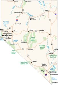
State Capital: Carson City Major Cities: Henderson, Las Vegas, Reno Cities and Towns: Austin, Battle Mountain, Beatty, Caliente, Carlin, Elko, Ely, Eureka, Gardnerville, Lovelock, McDermitt, Panaca, Pioche, Round Mountain, Ruth, Sparks, Tonopah, Wells, Winnemucca Lakes and Reservoirs: Lake Mead, Lake Mohave, Lake Tahoe, Pyramid Lake, Walker Lake Rivers and Streams: Bruneau River, Humboldt River, Muddy River, Owyhee River, Quinn River, Reese River, White RiverNevada State Maps
Click on one of our maps of the Silver State.