Map of Munster, Indiana
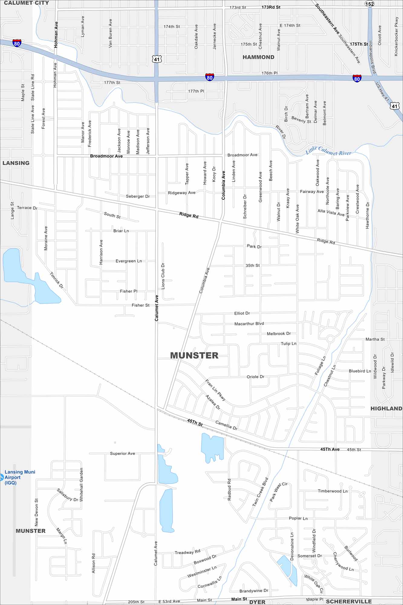
Our map of Munster shows this suburb situated in northwest Indiana. Residential areas and greenways weave through, with Chicago’s influence just to the west. It’s part of the Calumet Region.
Indiana State Maps
Study about Indiana with our map collection


Map Information
On the Map
Interstates/Highways: I-80, US Hwy 41 Major Roads: Calumet Ave, Ridge Rd, 45th St, Broadmoor Ave, Main St, Columbia Ave, Hohman Ave, 173rd St, 175th St, Fisher St, Seberger Dr, Fran Lin Pkwy, Treadway Rd, Westminster Ln, Whitehall Garden, Allison Rd, Margo Ln, 53rd Ave, Wentworth Ave, Manor Ave Airports: Lansing Muni Airport (IGQ) Major Rivers: Little Calumet River Nearby Communities: Hammond, Highland, Dyer, Schererville, Lansing, Calumet CityIndiana City Maps
Here are our maps of Indianapolis and Indiana cities


