Map of Morgan City, Louisiana
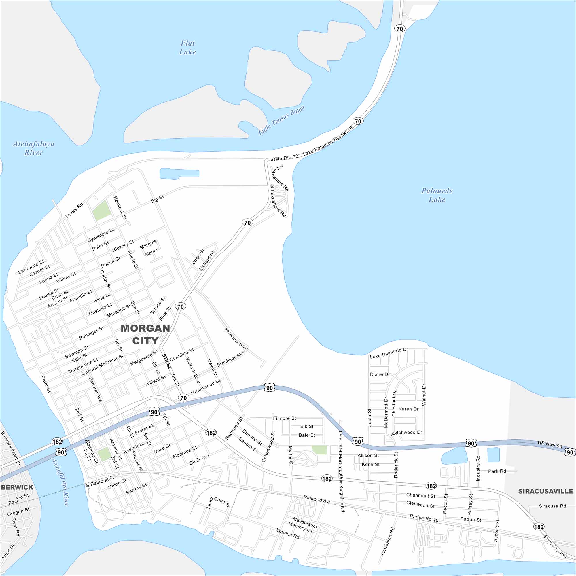
Morgan City sits on the Atchafalaya River and Intracoastal Waterway. Our map highlights its waterways, bridges, and downtown core. Seafood and oil industries anchor the community.
Louisiana State Maps
Here are maps showcasing the state of Louisiana


Map Information
On the Map
Interstates/Highways: US Hwy 90, State Rte 70, State Rte 182 Major Roads: Martin Luther King Jr Blvd, Brashear Ave, Railroad Ave, Federal Ave, Victor II Blvd, Greenwood St, Marguerite St, Onstead St, Marshall St, 8th St, 9th St, Front St, Lake Palourde Dr, Youngs Rd, Parish Rd 10, Allison St, Duke St, Second St, Alabama St, Grizzaffi St Lakes and Reservoirs: Palourde Lake, Flat Lake Major Rivers: Atchafalaya River Nearby Communities: Berwick, SiracusavilleCity Maps of Louisiana
Explore New Orleans and Louisiana’s urban centers with our city maps