Map of Monroe, Louisiana
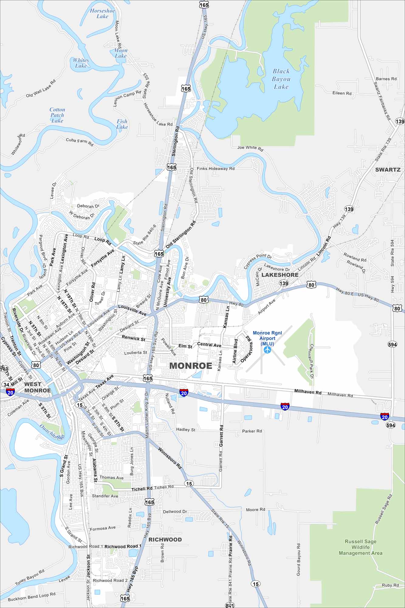
Explore our map of Monroe, located in northern Louisiana. The Ouachita River runs through town, with neighborhoods, parks, and industry along its banks. It’s known for both southern culture and commerce.
Louisiana State Maps
Here are maps showcasing the state of Louisiana


Map Information
On the Map
Interstates/Highways: I-20, US Hwy 80, US Hwy 165, State Rte 15, State Rte 139, State Rte 553, State Rte 594, State Rte 840-6, State Rte 841 Major Roads: Winnsboro Rd, Sterlington Rd, Desiard St, Martin Luther King Jr Dr, Louisville Ave, Forsythe Ave, 18th St, 19th St, Lamy Ln, Kansas Ln, Airport Ave, Millhaven Rd, Texas Ave, Jackson St, Richwood Road 1, Garrett Rd, Thomas Ave, 165 Byp, Riverside Dr, Park Ave Airports: Monroe Rgnl Airport (MLU) Lakes and Reservoirs: Horseshoe Lake, Moon Lake, Whites Lake, Black Bayou Lake, Cotton Patch Lake, Fish Lake Major Rivers: Ouachita River, Little River Parks and Preserves: Russell Sage Wildlife Management Area Nearby Communities: West Monroe, Lakeshore, Swartz, RichwoodCity Maps of Louisiana
Explore New Orleans and Louisiana’s urban centers with our city maps