Map of Calexico, California
See Calexico on our map, right at the US and Mexico border. The city spreads out across the desert with a straightforward street network.
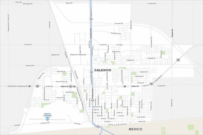
See Calexico on our map, right at the US and Mexico border. The city spreads out across the desert with a straightforward street network.
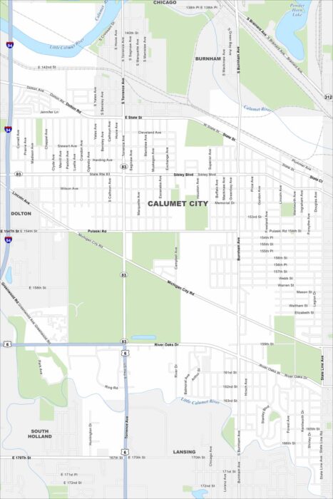
Calumet City is part of Chicago’s south suburbs. Our map shows the Little Calumet River running through and industrial zones nearby.
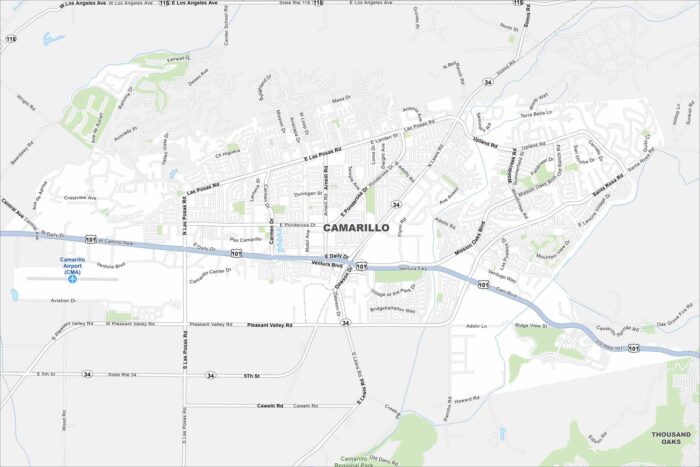
Check out Camarillo with our road map. The city sits between the Santa Monica Mountains and the Pacific Ocean.
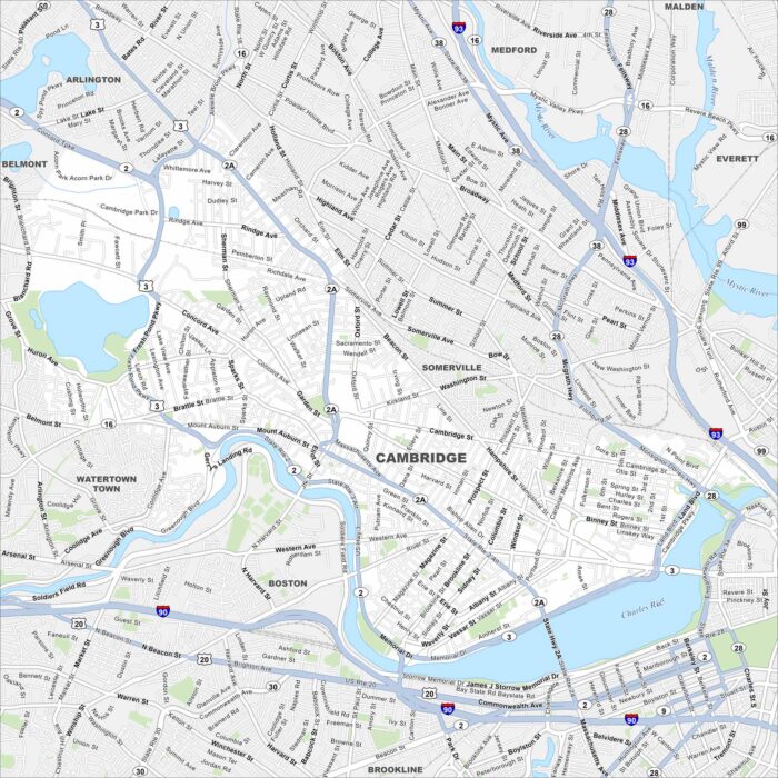
Our map of Cambridge highlights the Charles River and dense streets. It’s located near Boston with bridges across the water.
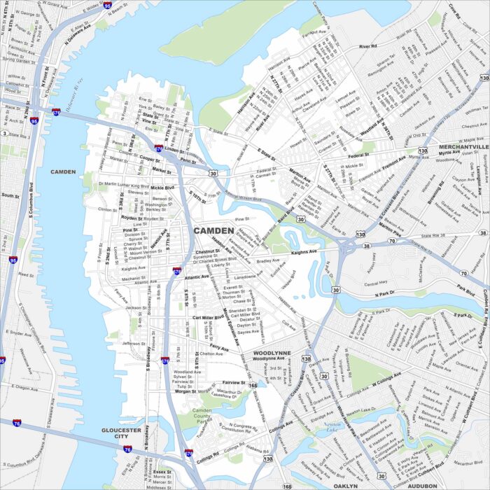
Camden is on the Delaware River across from Philadelphia. Our map shows the waterfront, roads, and major bridges.
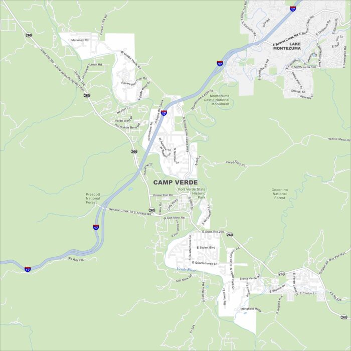
Camp Verde is tucked in central Arizona along the Verde River. Our map shows a setting of desert terrain and green valley areas.
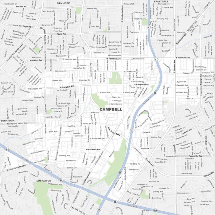
Explore Campbell with our map, a small city in Silicon Valley. It’s surrounded by San Jose but still keeps its own downtown core.
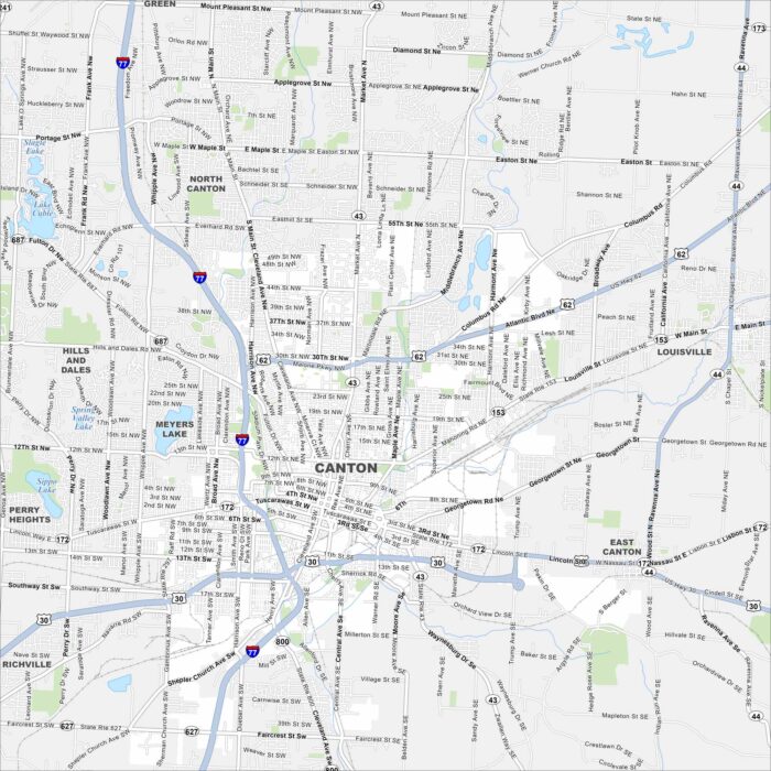
Canton is a city in northeast Ohio. Our map shows its streets, parks and lakes. It’s well known as the home of the Pro Football Hall of Fame.
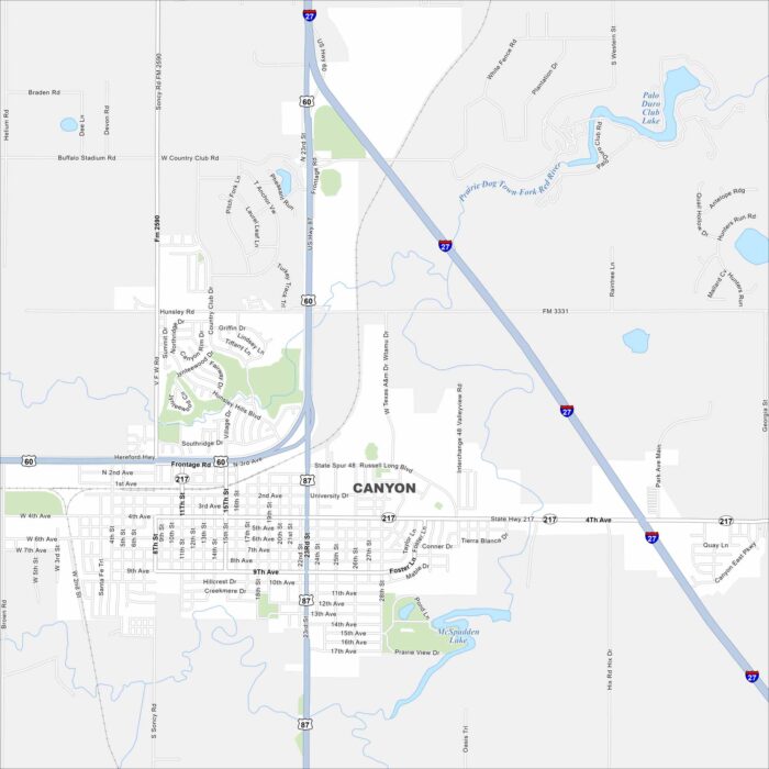
Check out Canyon, Texas on our map. It’s a Panhandle town south of Amarillo. The nearby Palo Duro Canyon is the real landmark here.
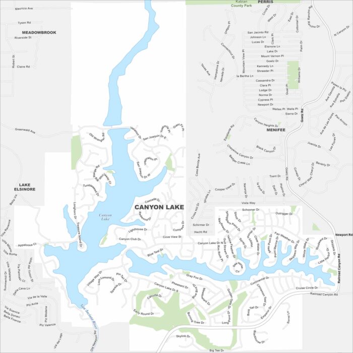
Our map of Canyon Lake highlights the gated community built around its reservoir. Roads wind around the shoreline.
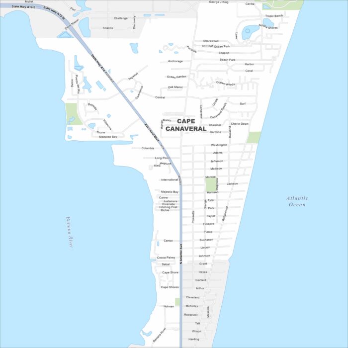
Cape Canaveral is on Florida’s Space Coast. Our map shows barrier island streets, waterways, and beach access.
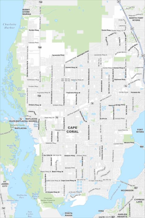
Explore Cape Coral with our map, where canals cut through nearly every neighborhood. The city is laid out on a grid but shaped by water.
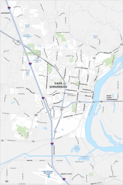
Our map of Cape Girardeau shows this city along the Mississippi River in southeast Missouri. Streets climb up from the river.
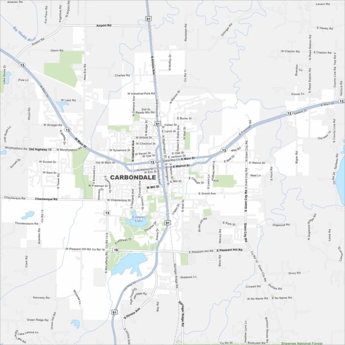
Carbondale is in southern Illinois near the Shawnee National Forest. Our map highlights neighborhoods, surrounding green hills, and lakes.
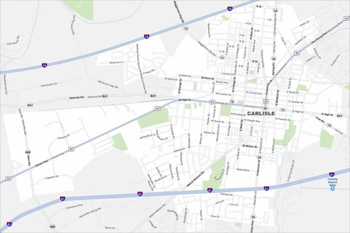
See Carlisle on our map, a small borough in south-central Pennsylvania. It’s known for its car shows because of its history with auto events.