Map of Bozeman, Montana
Our map of Bozeman shows its roads, parks and waterways. Mountains are on all sides. It’s a small city but feels busy with outdoor life.
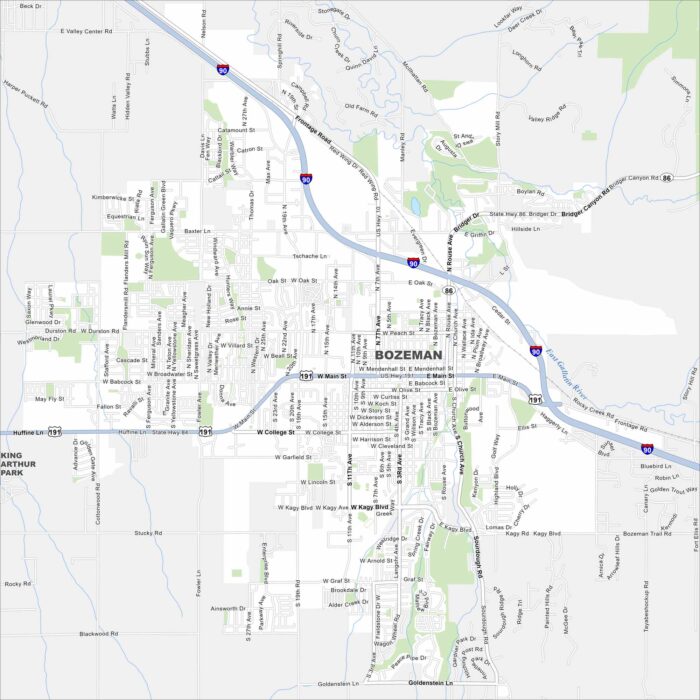
Our map of Bozeman shows its roads, parks and waterways. Mountains are on all sides. It’s a small city but feels busy with outdoor life.
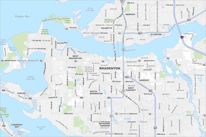
Explore Bradenton on our map where the Manatee River meets the Gulf. The waterfront is its center but beaches sit just beyond.
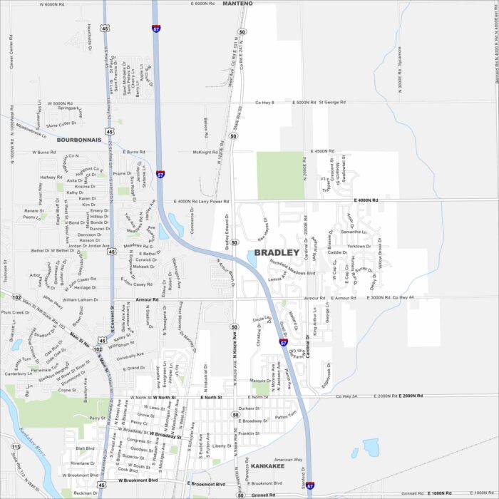
Bradley is a town near Kankakee. Check it out on our map to see its mix of roads and highways. It’s steady because of its local economy.
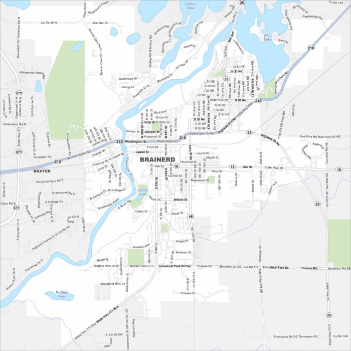
See Brainerd with our map in the heart of lake country. The Mississippi River cuts through the area. It’s a hub for fishing and summer trips.
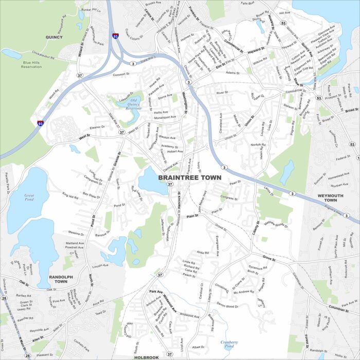
Our map of Braintree highlights its location on Boston’s South Shore. Interstate 93 cuts through the northwest corner of the area.
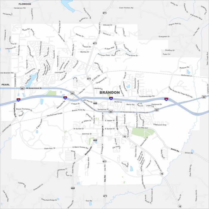
Brandon is east of Jackson with a small-town feel. Take a look at it on our map with neighborhoods spread among trees and lakes.
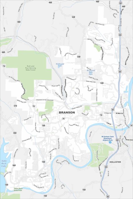
See Branson with our road map. Tourism dominates but the Ozarks give it a natural backdrop. A key feature here is Table Rock Lake.
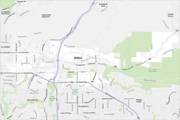
Explore Brea on our map in northern Orange County. The city is built around Chino Hills State Park with parks and trails throughout.
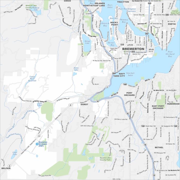
See Bremerton on our map, where the city meets Puget Sound. The naval base dominates but ferries still link it easily to Seattle.
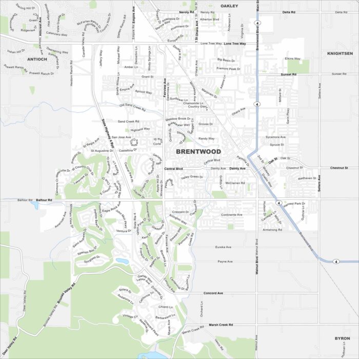
Brentwood, California is in the East Bay, surrounded by farmland. Our map shows its highways, waterways and green spaces.
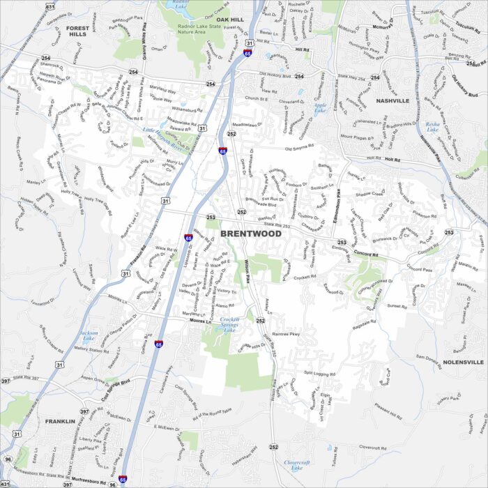
Explore Brentwood with our map. It’s known for large homes and green spaces. The city is close to Nashville but holds its own calm character.
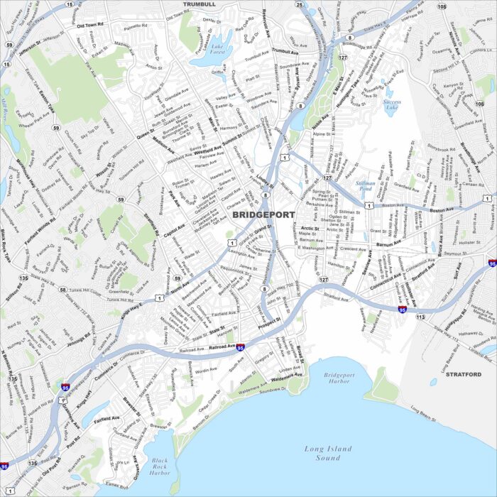
Our map of Bridgeport highlights its spot on Long Island Sound. Industry once defined the city, but waterfront access give it balance.
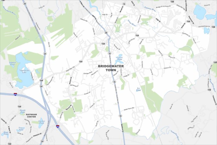
Bridgewater is a South Shore town marked by rivers and forests. Check it out on our map to see how its center spreads outward.
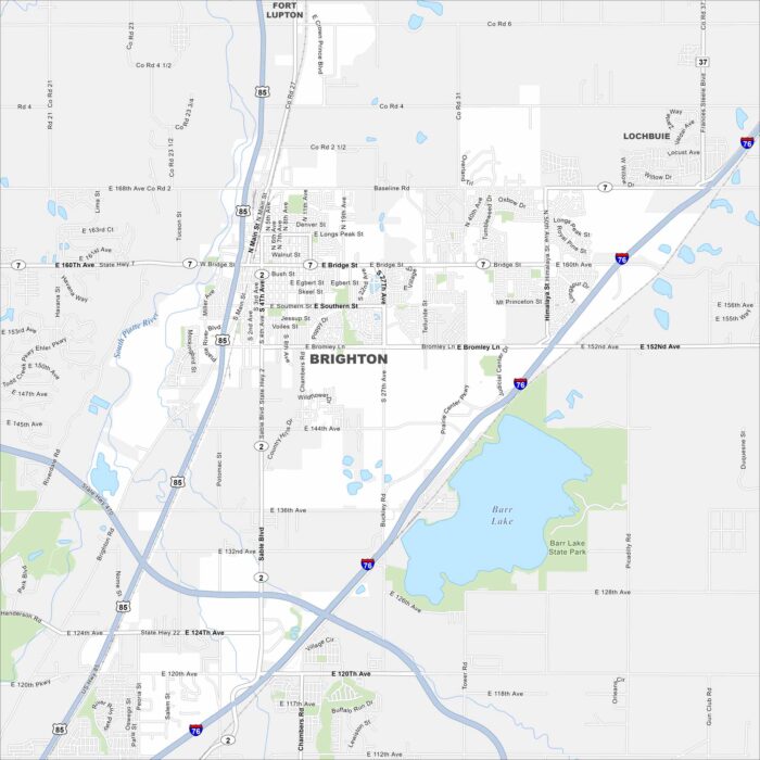
Take a look at Brighton, Colorado on our map. You can find it northeast of Denver. Barr Lake is a major waterbody here.
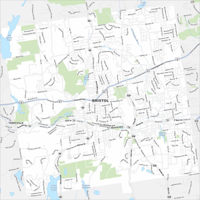
See Bristol with our road map. This area is home to quiet neighborhoods and corporate offices. Parks cut through the city.