Arizona County Map
Check out Arizona’s 15 counties stretching from desert valleys to pine forests. Maricopa County dominates the center with Phoenix and more.
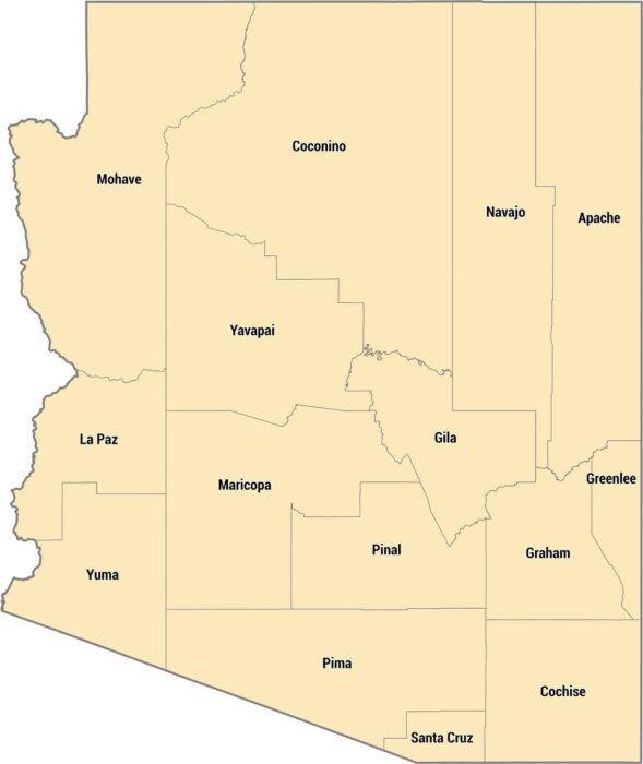
Check out Arizona’s 15 counties stretching from desert valleys to pine forests. Maricopa County dominates the center with Phoenix and more.

Alaska’s borough system is different from other states. Much of the state isn’t organized into counties at all, just massive census areas.
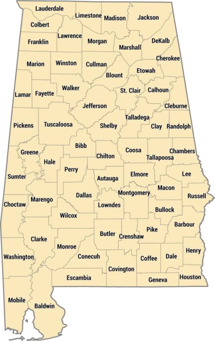
Our Alabama county map shows all 67 counties in the state. The state’s geography ranges from beaches along the Gulf Coast to mountains.
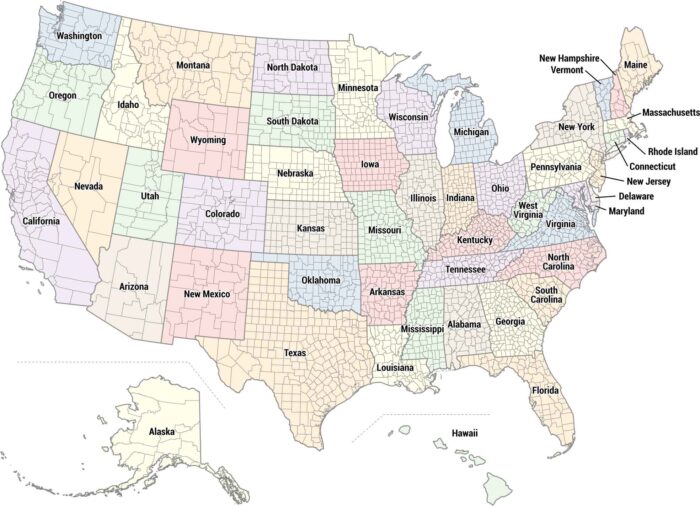
Our US county map shows all 3,000+ counties across the country. Each state is colored differently so you can easily tell them apart.
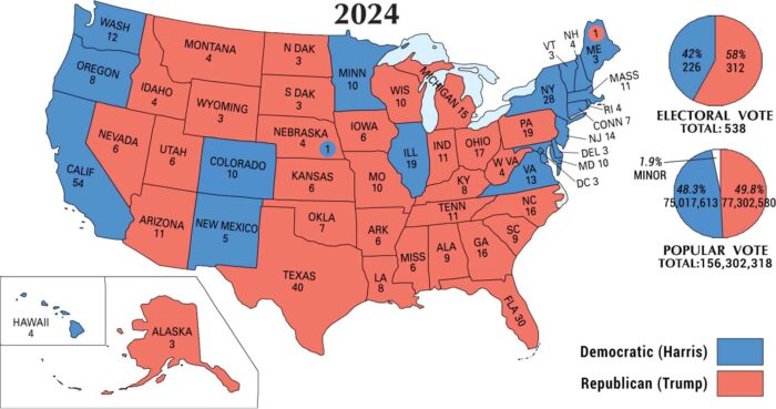
Our map from the 2024 U.S. election shows red stretching across the nation. The outcome made Donald Trump the nation’s 47th president.
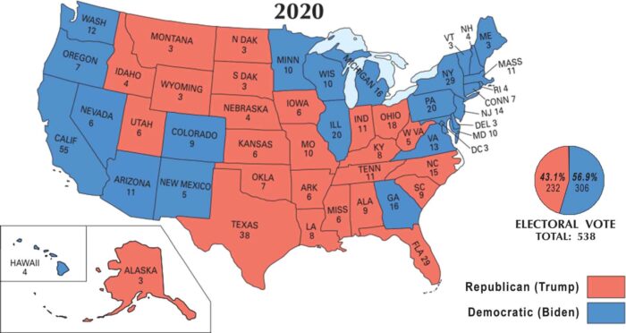
Our 2020 U.S. election map shows how the presidency flipped back to blue. Joe Biden defeated incumbent Donald Trump in a close race.
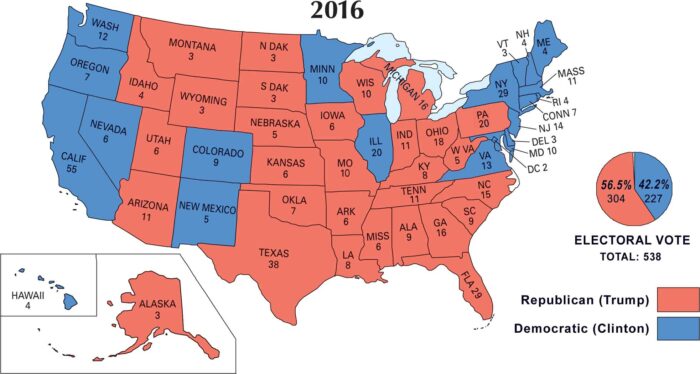
The 2016 U.S. election map flipped sharply red. Donald Trump pulled off a surprise win over Hillary Clinton, becoming the 45th president.
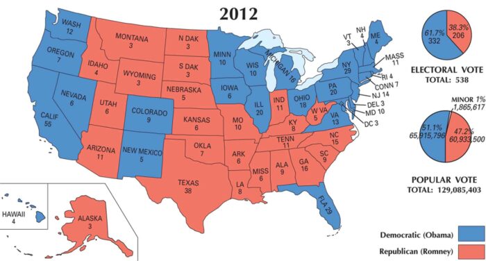
Blue holds strong on our 2012 U.S. election map. Barack Obama won re-election over Mitt Romney winning in urban and coastal America.
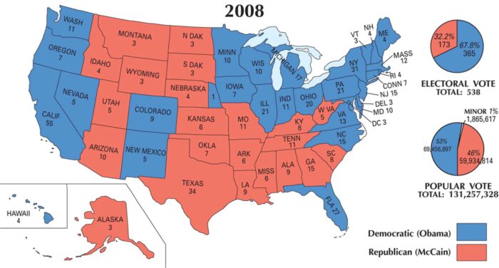
Bright blue spreads across the 2008 map as Barack Obama wins the presidency. The map marks the nation’s first Black president.
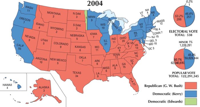
Across the U.S. 2004 election map, red stretches far and wide. George W. Bush won re-election over John Kerry in a close but clear race.
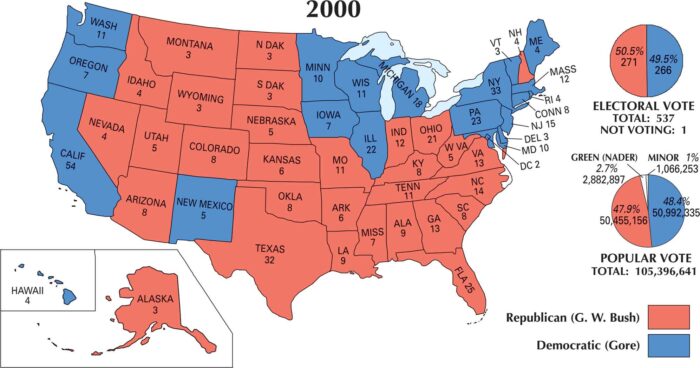
The 2000 U.S. election map is split almost perfectly in half. George W. Bush won the presidency after one of the closest races in history.
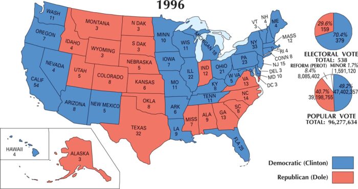
Our 1996 U.S. election map shows plenty of blue, with Bill Clinton winning a comfortable second term over Bob Dole.
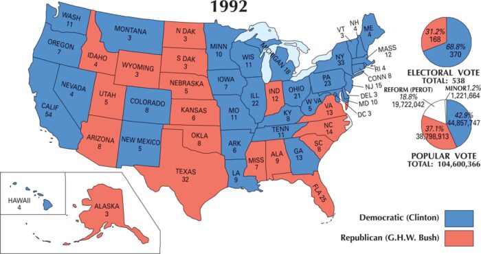
The 1992 U.S. election map looks nothing like the ones before it. Bill Clinton beat the Republicans, painting much of the country blue.

Take a glance at the 1988 U.S. election map and it’s clear. Republican red still ruled. George H. W. Bush swept most of the country.
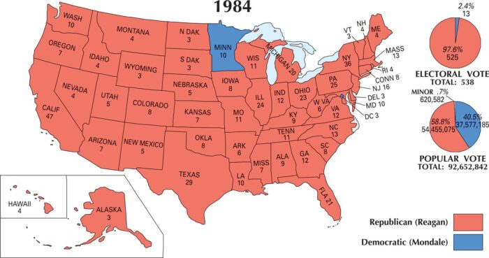
Our 1984 U.S. election map shows a Republican landslide. Ronald Reagan dominated George McGovern in a massive victory.