Map of Port Angeles, Washington
Port Angeles faces the Strait of Juan de Fuca at the edge of the Olympic Peninsula. Use our map to see its streets, parks and airport.
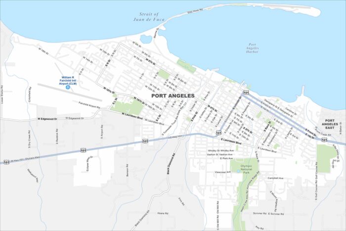
Port Angeles faces the Strait of Juan de Fuca at the edge of the Olympic Peninsula. Use our map to see its streets, parks and airport.
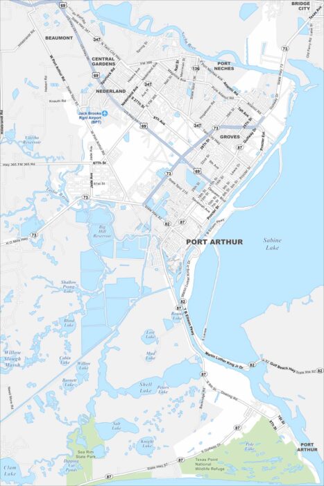
Our map of Port Arthur outlines its waterfront location on Sabine Lake. Refineries and residential areas dominate much of the landscape.
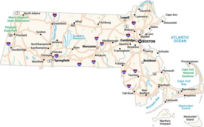
Our Massachusetts map lays it all out. It has cities, highways, rivers, and coastlines. You can trace the curve of Cape Cod or Boston.
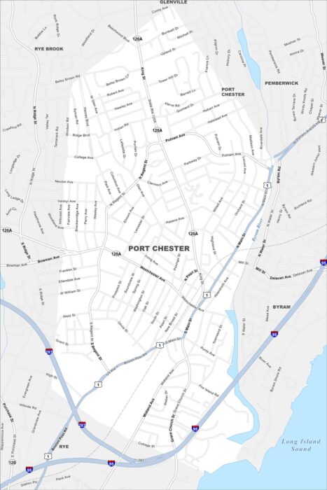
Our map of Port Chester shows its compact downtown along the Byram River. The streets lead right into the Long Island Sound.
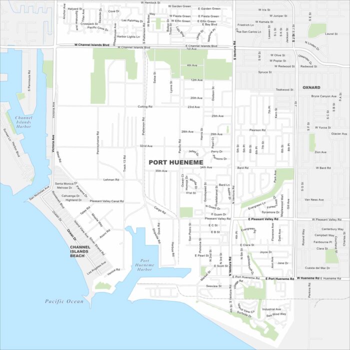
Check out Port Hueneme’s grid of streets leading straight to the Pacific coast. This map highlights its harbor and beach access.
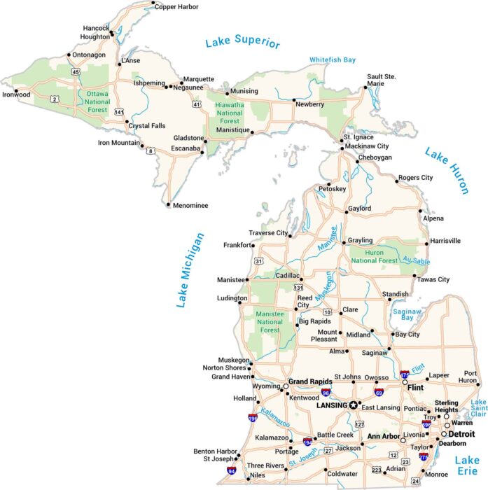
Michigan comes alive on this map. You’ll find cities like Detroit, Grand Rapids, and Marquette. The Great Lakes and rivers are here too.
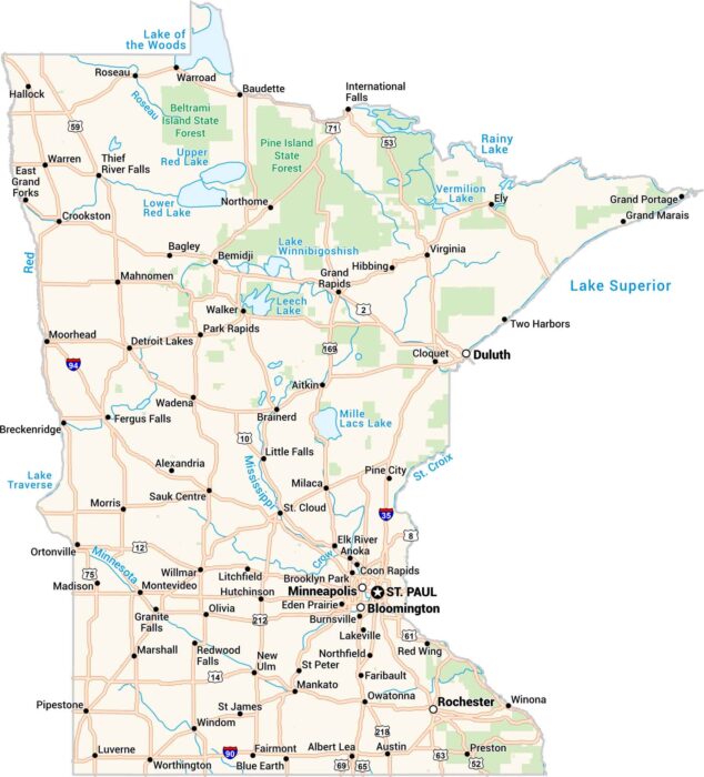
Our map of Minnesota shows the land of 10,000 lakes. From Minneapolis to Duluth, every road connects water, forest, and people.
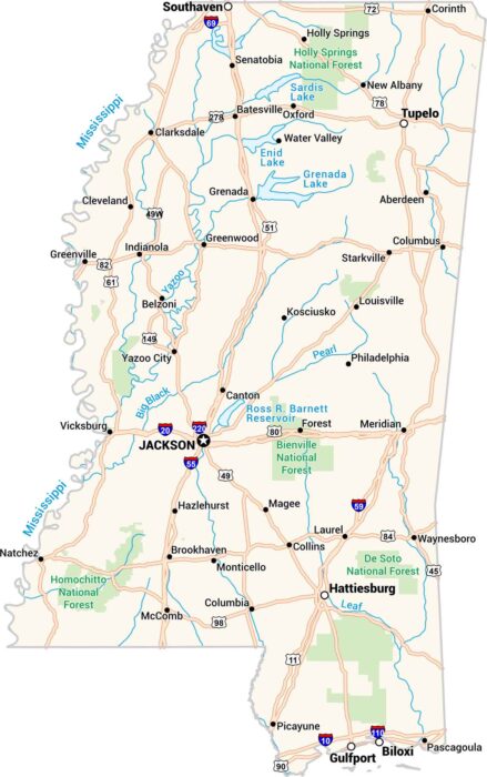
Our map of Mississippi shows every bend of the river and every small town along the way. You’ll see Jackson, Biloxi, and the Delta.
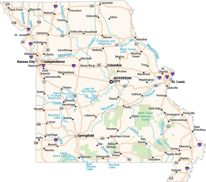
Missouri sits where the Midwest meets the South. Our map shows its rivers, highways, and growing cities like St. Louis and Kansas City.
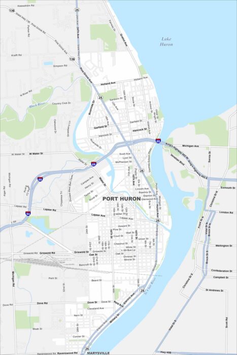
Port Huron sits at the base of Lake Huron where the St. Clair River begins. Our map shows the downtown stretch along the waterfront and more.
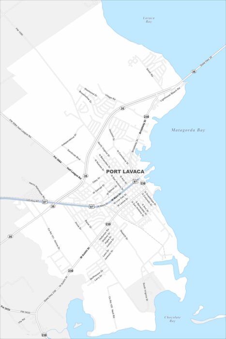
Take a look our map of Port Lavaca. This map shows connections to the Gulf Coast and local parks. Fishing and birdwatching are popular here.
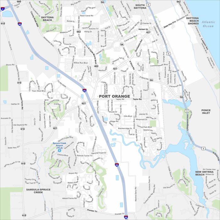
Our map of Port Orange lays out suburban neighborhoods along the Halifax River. You’ll see easy access to nearby beaches and wetlands.
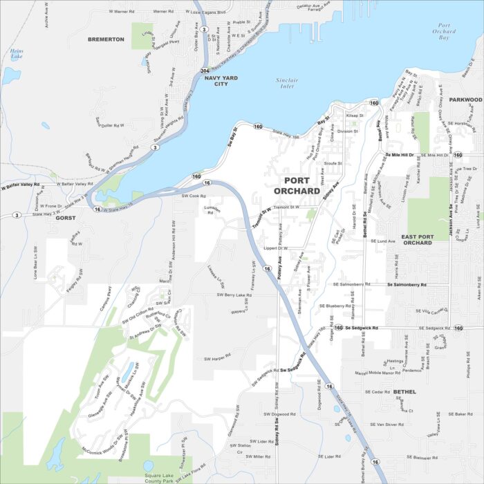
Set along Sinclair Inlet, Port Orchard faces the city of Bremerton across the water. Check out our map with streets clustered near the marina.
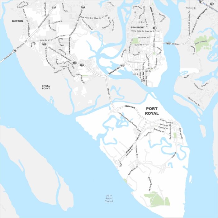
Port Royal spreads along the Beaufort River in the Lowcountry. Our map displays its streets near the waterfront and historic district.
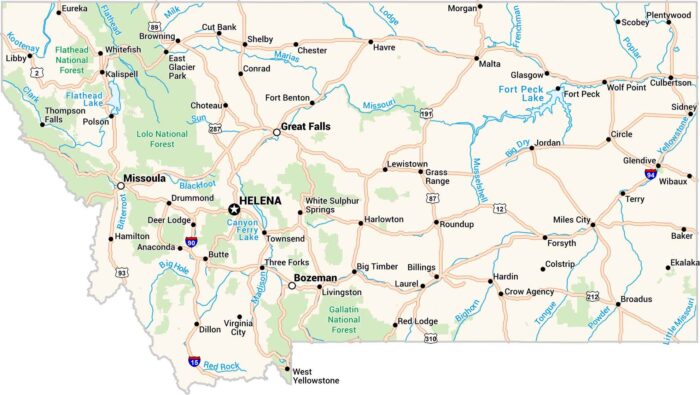
Our map of Montana stretches wide showing cities, lakes and highways. Rivers carve through the land, from the Missouri to the Yellowstone.