Map of Phenix City, Alabama
Check out Phenix City along the Chattahoochee River. The map shows how it connects directly with Columbus, Georgia across the water.
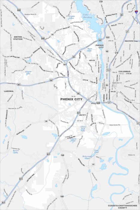
Check out Phenix City along the Chattahoochee River. The map shows how it connects directly with Columbus, Georgia across the water.
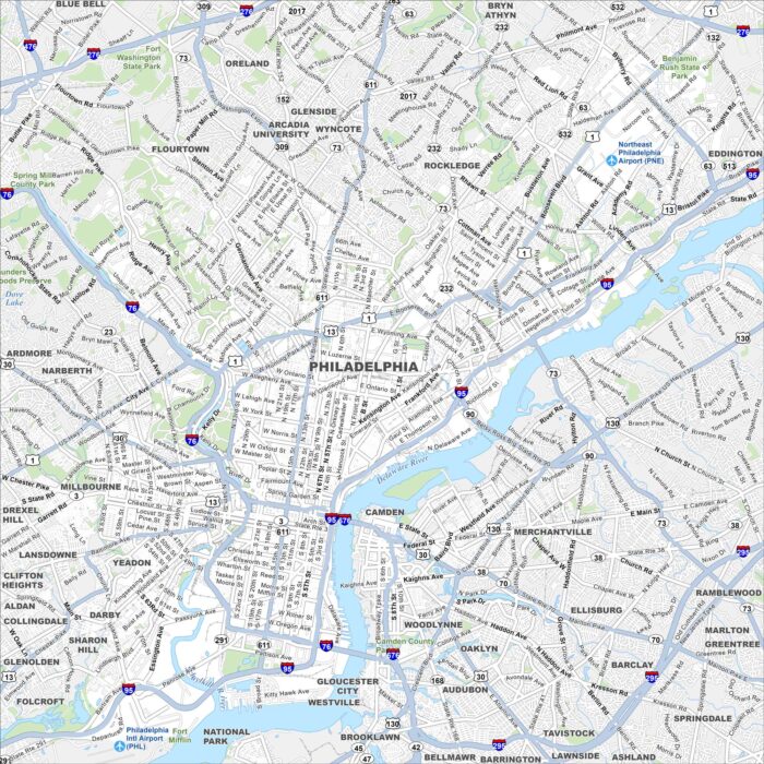
Philadelphia spreads along the Delaware River with a dense historic core. Our map of Philadelphia shows major highways and roads.
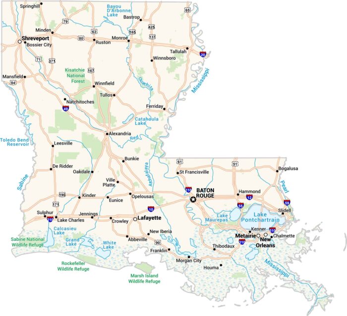
Our Louisiana map captures its bayous and big cities. You’ll spot Baton Rouge, Shreveport, and of course, New Orleans along the Mississippi.
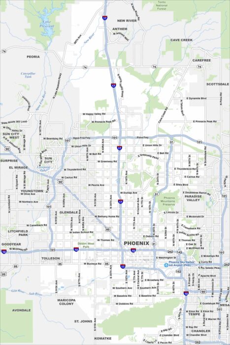
Phoenix sprawls across the Sonoran Desert, ringed by rugged mountains. Our map displays its grid system and wide highways.
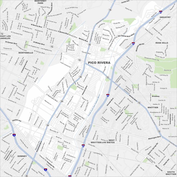
Our map of Pico Rivera lays out a suburban grid between Los Angeles and Whittier. Freeways cut across the city, linking neighborhoods.
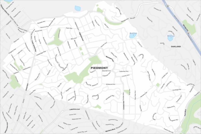
Piedmont is an enclave surrounded entirely by Oakland. Check out our map to see its residential streets in the East Bay hills.
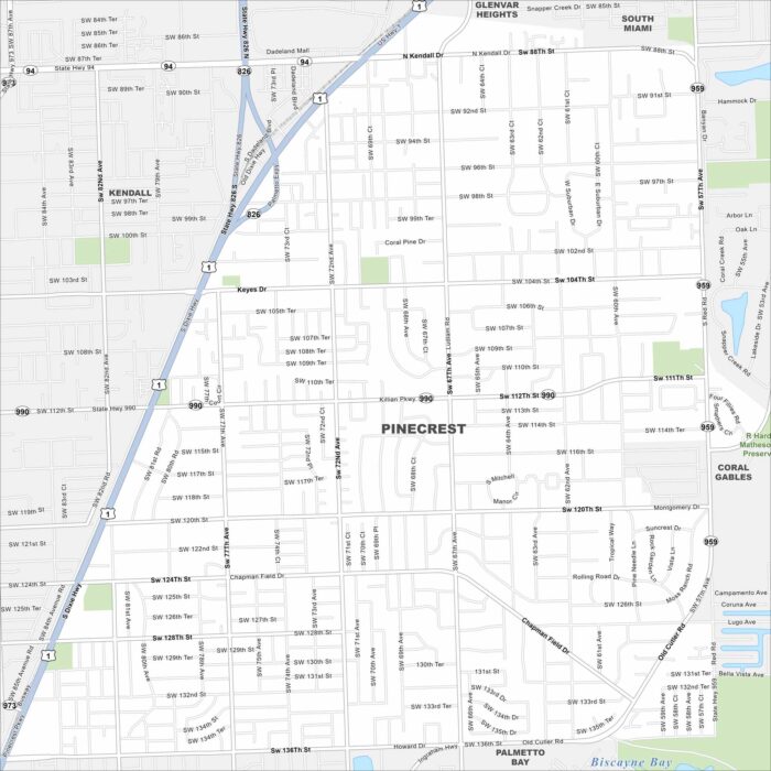
Pinecrest lies just south of Miami with leafy streets and large homes. Our map highlights its parks and easy access to major highways.
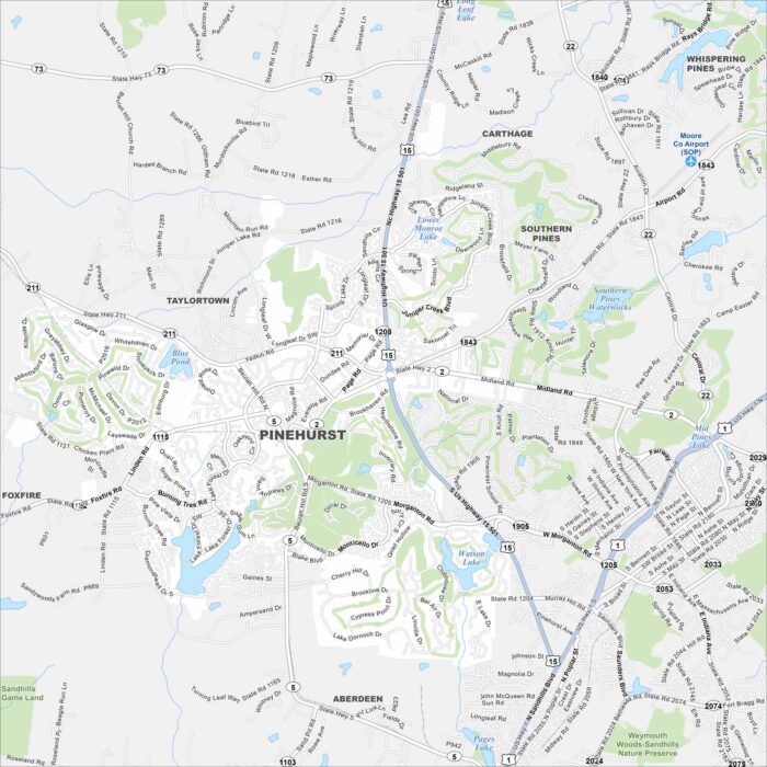
Take a look at Pinehurst, famous for its golf courses. Our map shows its winding streets around resort communities and green spaces.
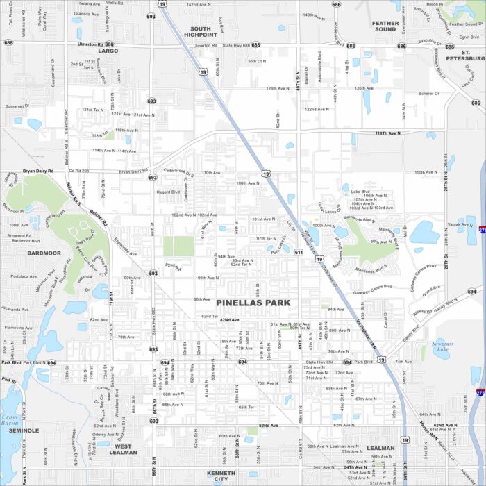
Our map of Pinellas Park shows a central location in Pinellas County. It’s a city with easy routes to Tampa Bay and the Gulf beaches.
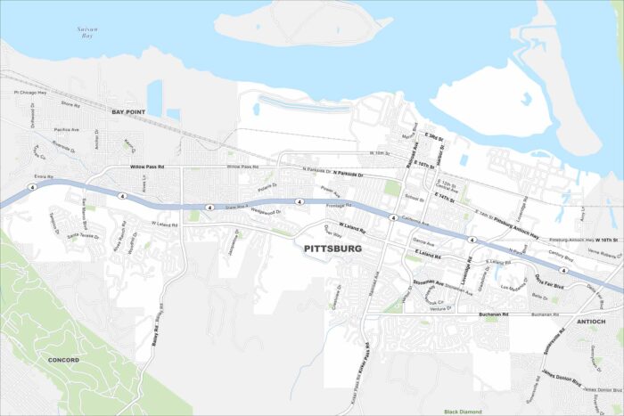
Pittsburg sits on the southern edge of Suisun Bay. Check out our map to see its waterfront, neighborhoods, and highway links.
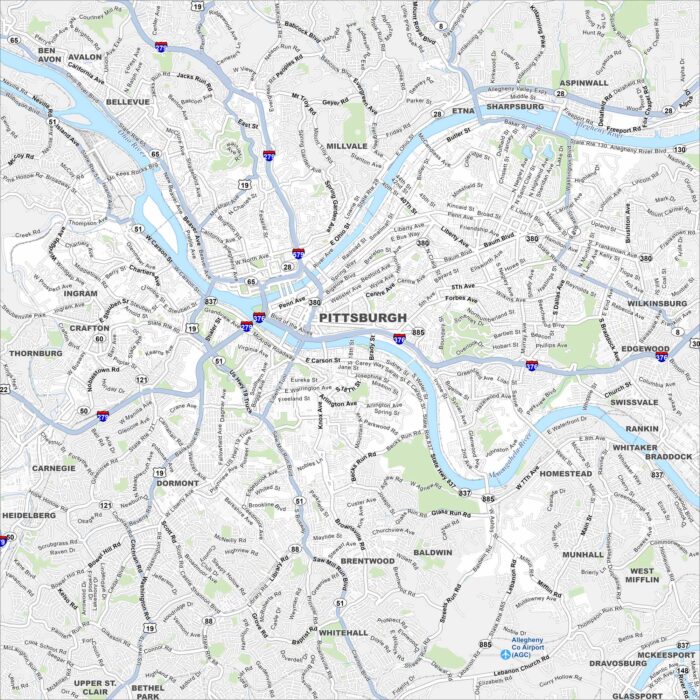
Pittsburgh sits at the confluence of three rivers, with bridges everywhere you look. Our map shows how hills and valleys shape Pittsburgh.
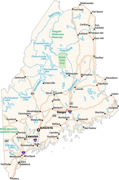
Our Maine map brings the coast and countryside together. From Portland’s harbor lights to the deep forests up north, every part stands out.
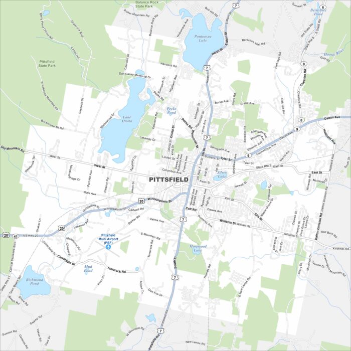
Check out Pittsfield in the heart of the Berkshires. This map highlights its compact downtown and nearby lakes. It’s a cultural hub.
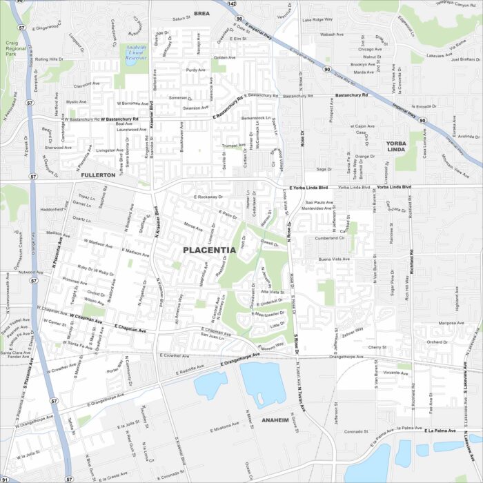
Our map of Placentia shows the suburban grid northeast of Anaheim. Residential neighborhoods dominate, with parks scattered throughout.
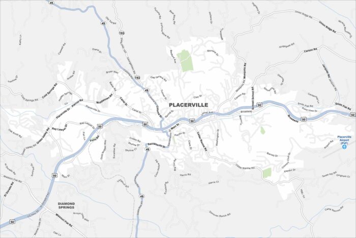
Placerville rests in the Sierra Nevada foothills, once central to the Gold Rush. Our map shows the winding streets climbing the hills.