Map of Miami, Florida
Take a look at Miami with our road map. The city spreads from Biscayne Bay inland. It’s one of the nation’s most dynamic urban centers.
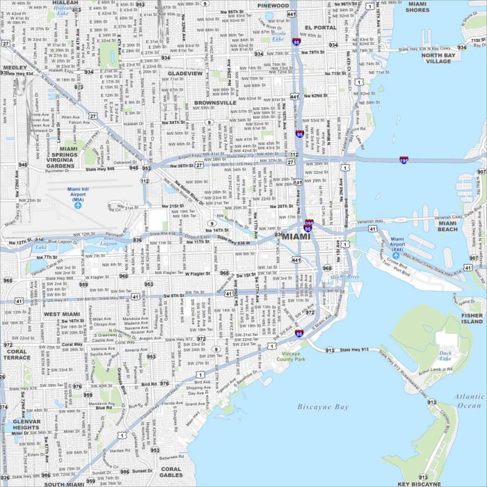
Take a look at Miami with our road map. The city spreads from Biscayne Bay inland. It’s one of the nation’s most dynamic urban centers.
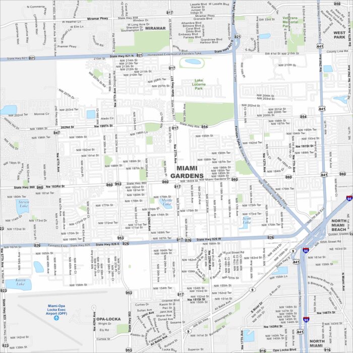
Our map of Miami Gardens highlights its residential neighborhoods and highways. The city sits north of central Miami.
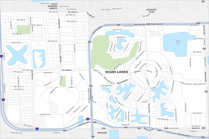
Explore the planned neighborhoods and lakes of Miami Lakes with our map. Curved streets and green spaces define its layout.
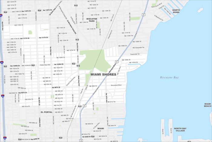
Our map of Miami Shores highlights this city that sits along Biscayne Bay. Picture tree-lined streets and quiet neighborhoods.
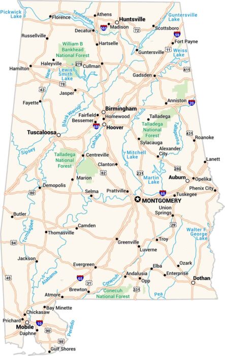
Our map of Alabama contains towns, cities, rivers, and lakes. The Tennessee flows across the top, and the Gulf occupies the bottom.
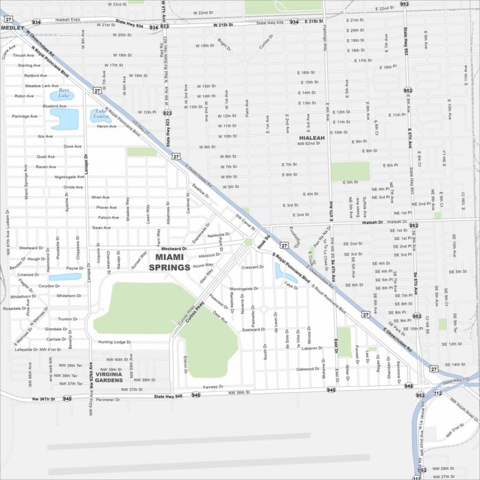
Learn about Miami Springs with our road map. The city’s circular street plan stands out immediately with the airport to the south.
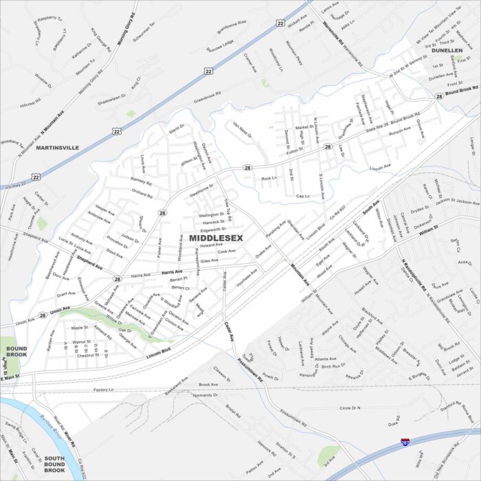
We’ve mapped Middlesex with its location along the Raritan River. Our map shows its mix of neighborhoods, parks, and highways/roads.
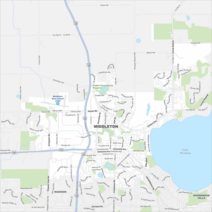
Check out Middleton, Wisconsin using our road map. The city sits just west of Madison, with Lake Mendota on the east side.
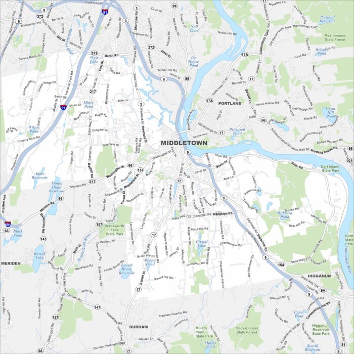
Our map of Middletown shows the city’s stretch along the Connecticut River. Wesleyan University anchors its center.
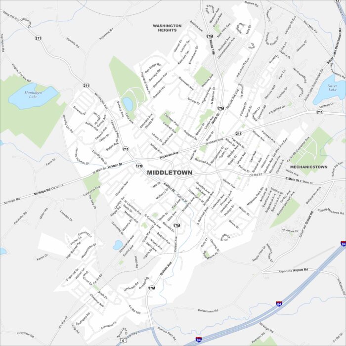
Discover Middletown with our road map. With a compact downtown, it’s surrounded by residential neighborhoods.
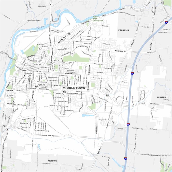
Middletown, Ohio lies between Cincinnati and Dayton. Our map shows the Great Miami River flowing through town.
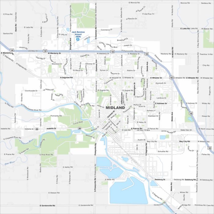
Our map of Midland highlights the Tittabawassee River running through the city. Parks and trails make up a big part of the urban layout.
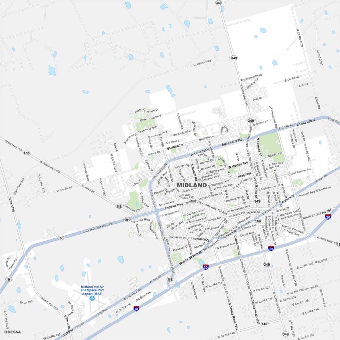
Explore our map of Midland, located in West Texas. Wide streets, oil industry landmarks, and residential areas define the city.
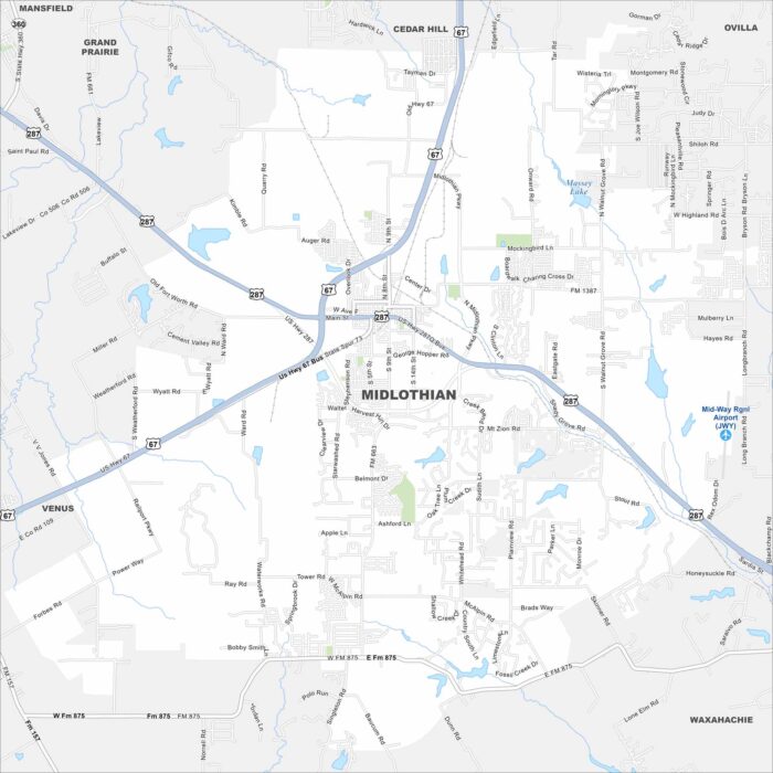
We’ve mapped out Midlothian, which is located southwest of Dallas. Highways link it closely to the Dallas-Fort Worth metroplex.
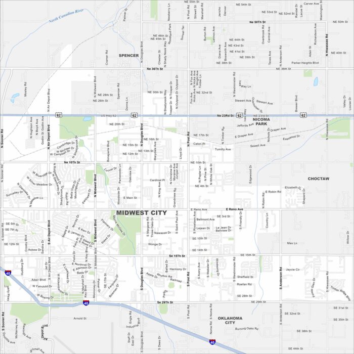
Our map of Midwest City highlights its suburban layout just east of Oklahoma City. Tinker Air Force Base is a defining feature.