Map of Jamestown, New York
Jamestown sits at the south end of Chautauqua Lake. Our map shows a compact downtown near the Chadakoin River.
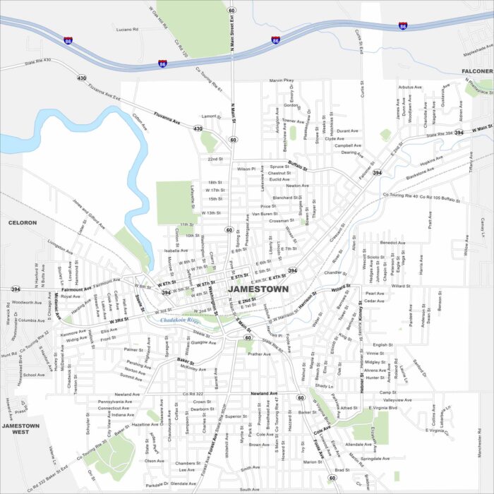
Jamestown sits at the south end of Chautauqua Lake. Our map shows a compact downtown near the Chadakoin River.
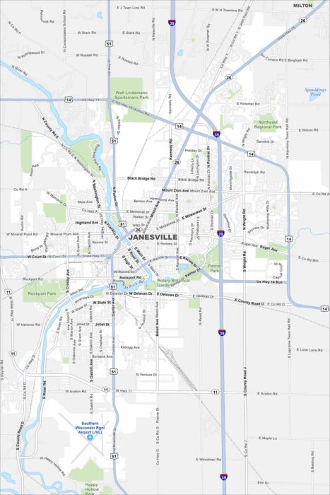
Janesville is built along the Rock River. The map shows parks and trails running beside the water. Highways connect it to Madison.
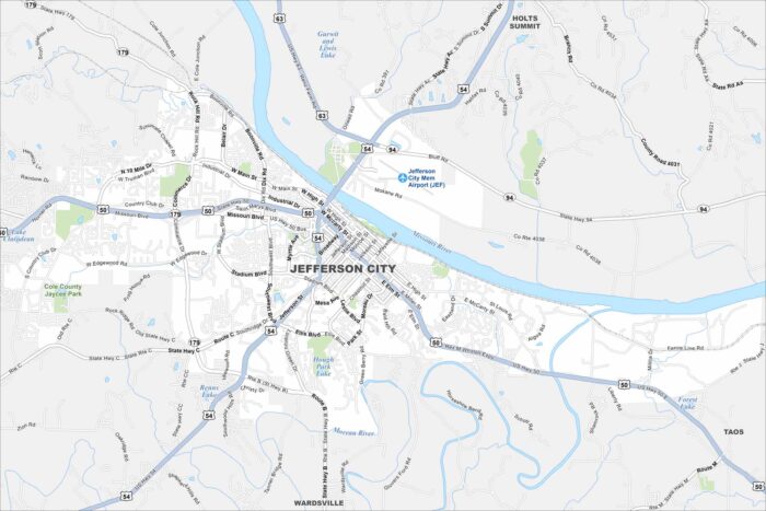
Our map of Jefferson City highlights its spot on the Missouri River. The state capitol stands out near the riverfront.
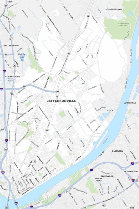
Jeffersonville sits right across the Ohio River from Louisville. Our map shows bridges linking the two cities.
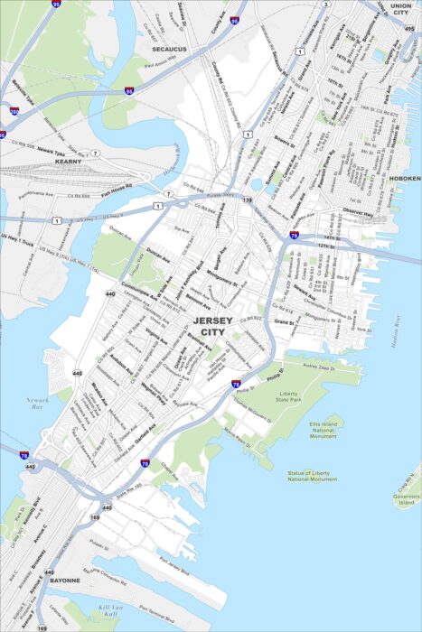
Jersey City stretches along the Hudson River across from Manhattan. Our map shows the dense waterfront skyline.
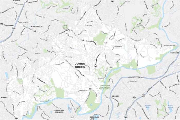
Johns Creek lies northeast of Atlanta with lots of parks and golf courses. Our map shows the Chattahoochee River, parks, highways and more.
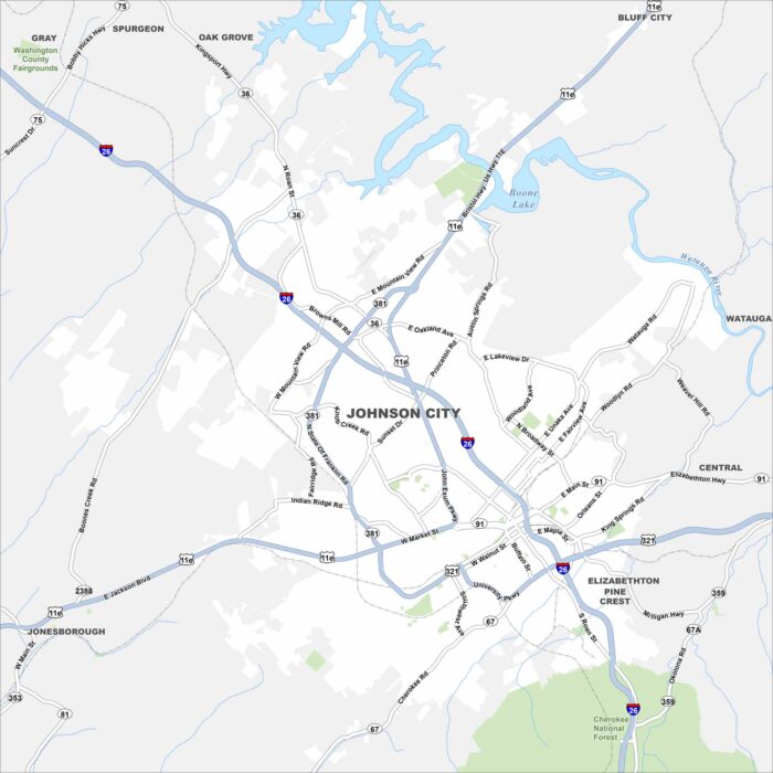
Johnson City sits in the Appalachian foothills. Our road map of Johnson City shows highways meeting near downtown.
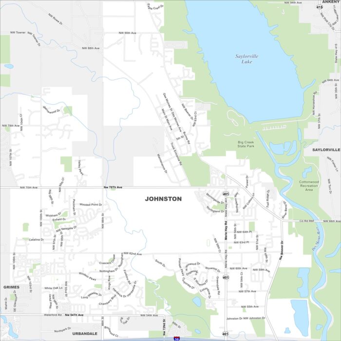
Johnston is a northern suburb of Des Moines. Our map highlights Saylorville Lake and the Des Moines River nearby.
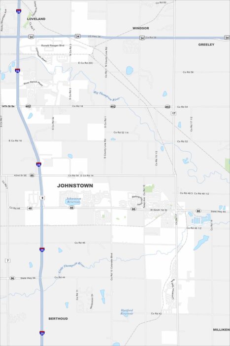
Our map of Johnstown shows a small but growing community between Loveland and Greeley. Highways I-25 and US-34 meet close by.
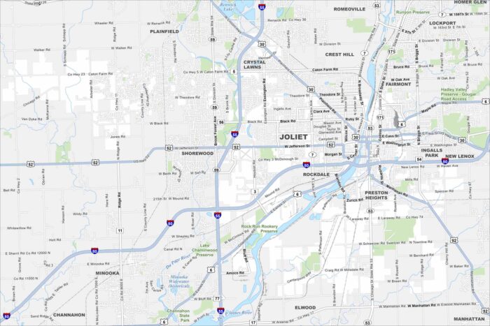
Joliet is on the Des Plaines River southwest of Chicago. This map shows rail lines, highways, and canals crossing the city.
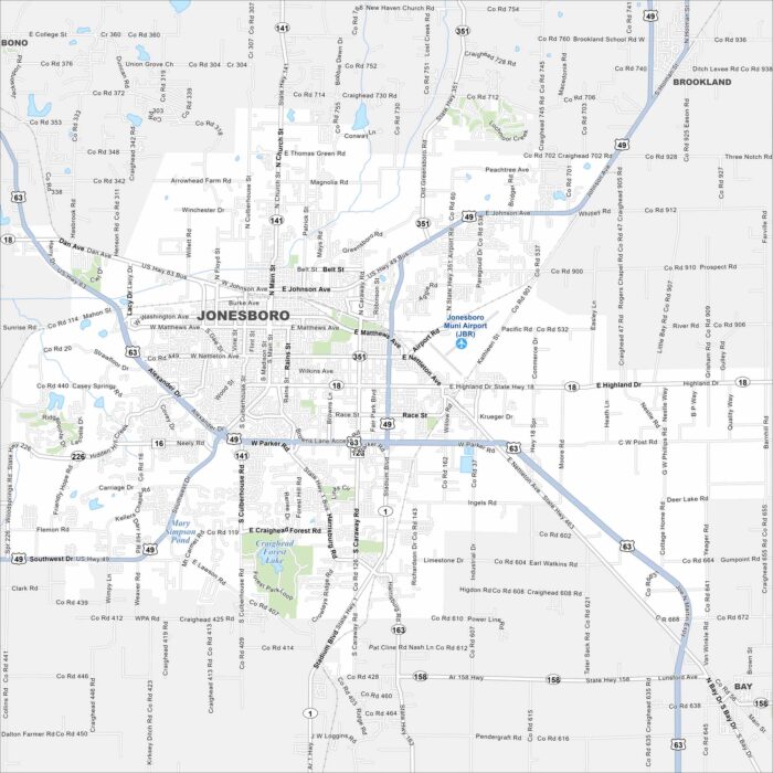
Our map of Jonesboro shows it spreading across Crowley’s Ridge. Highways extend out toward Memphis and Little Rock.
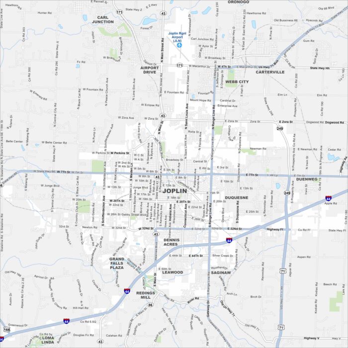
Joplin is near the meeting point of Missouri, Kansas, and Oklahoma. The map shows Interstate 44 running just south of the city.
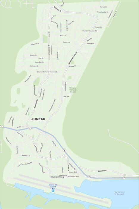
Juneau is wedged between mountains and the Gastineau Channel. Our map shows no roads leading out so travel is by air or sea.
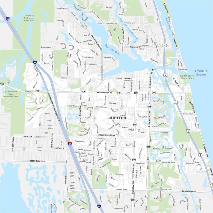
Jupiter sits on Florida’s Atlantic coast. Our map shows the Loxahatchee River meeting the ocean. Beaches, inlets, and waterways are here.
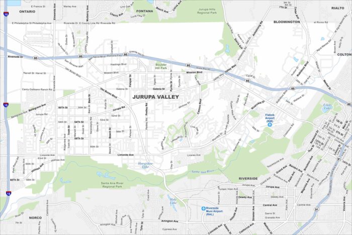
Jurupa Valley lies in the Inland Empire. Our map highlights neighborhoods spread between freeways and foothills.