Map of Maple Valley, Washington
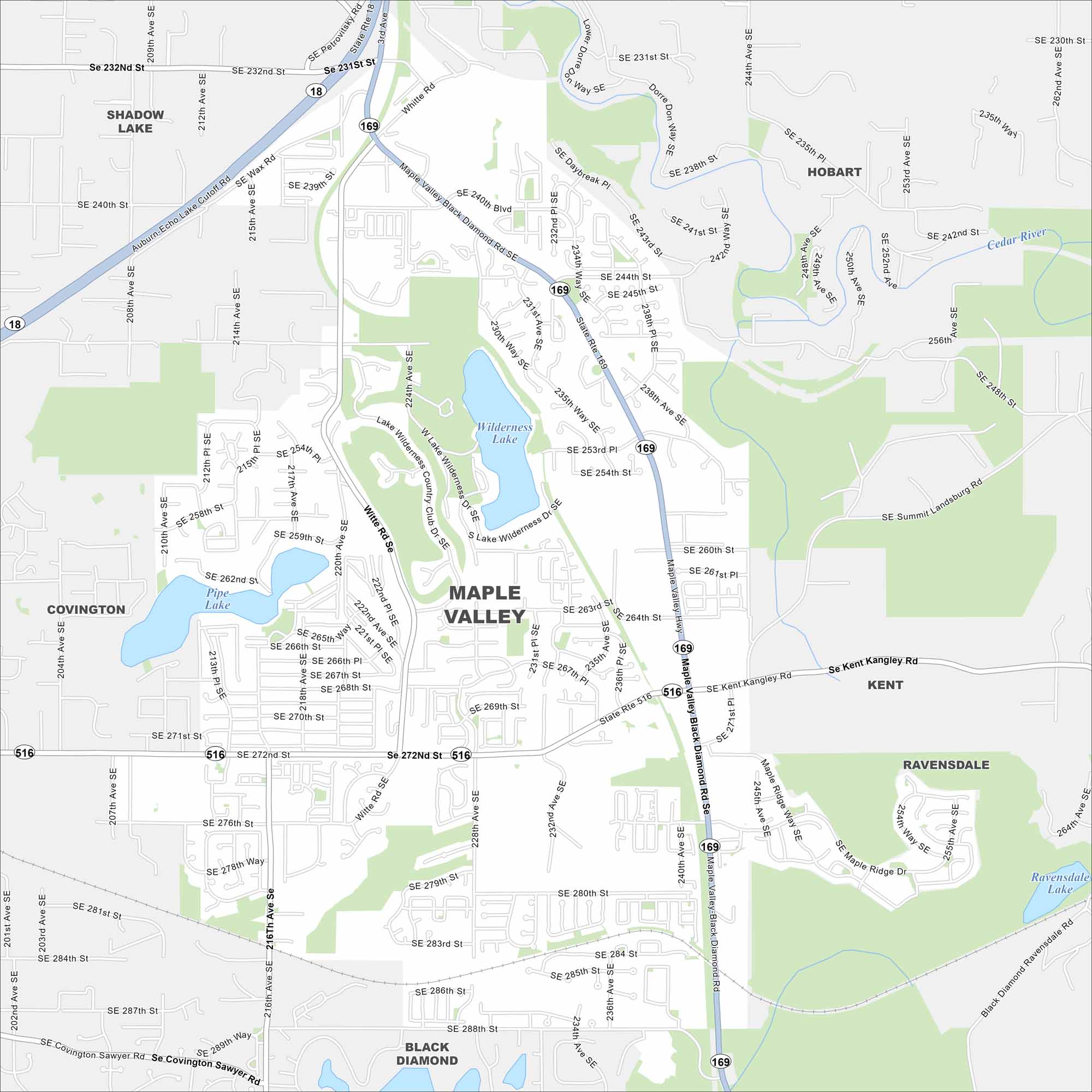
Our map of Maple Valley shows its highways winding through forests and suburban neighborhoods. The Cedar River and nearby lakes play a big role here. Maple Valley is just southeast of Seattle.
Map Information
On the Map
Interstates/Highways: State Rte 18, State Rte 169, State Rte 516 Major Roads: SE 272nd St, Maple Valley Black Diamond Rd, Kent Kangley Rd, Witte Rd, SE 240th St, SE 232nd St, SE 288th St, 216th Ave SE, 244th Ave SE, SE 264th St, SE 280th St, SE 248th St, 204th Ave SE, 240th Ave SE, SE Summit Landsburg Rd, SE Daybreak Pl, SE 260th St, SE 284th St, SE 231st St, SE 256th Lakes and Reservoirs: Wilderness Lake, Pipe Lake, Ravensdale Lake Major Rivers: Cedar River Nearby Communities: Shadow Lake, Hobart, Covington, Kent, Ravensdale, Black DiamondWashington State Maps
Move through the Evergreen State with our map collection.


City Maps of Washington
Check out our city maps of Washington


