Map of Lake Stevens, Washington
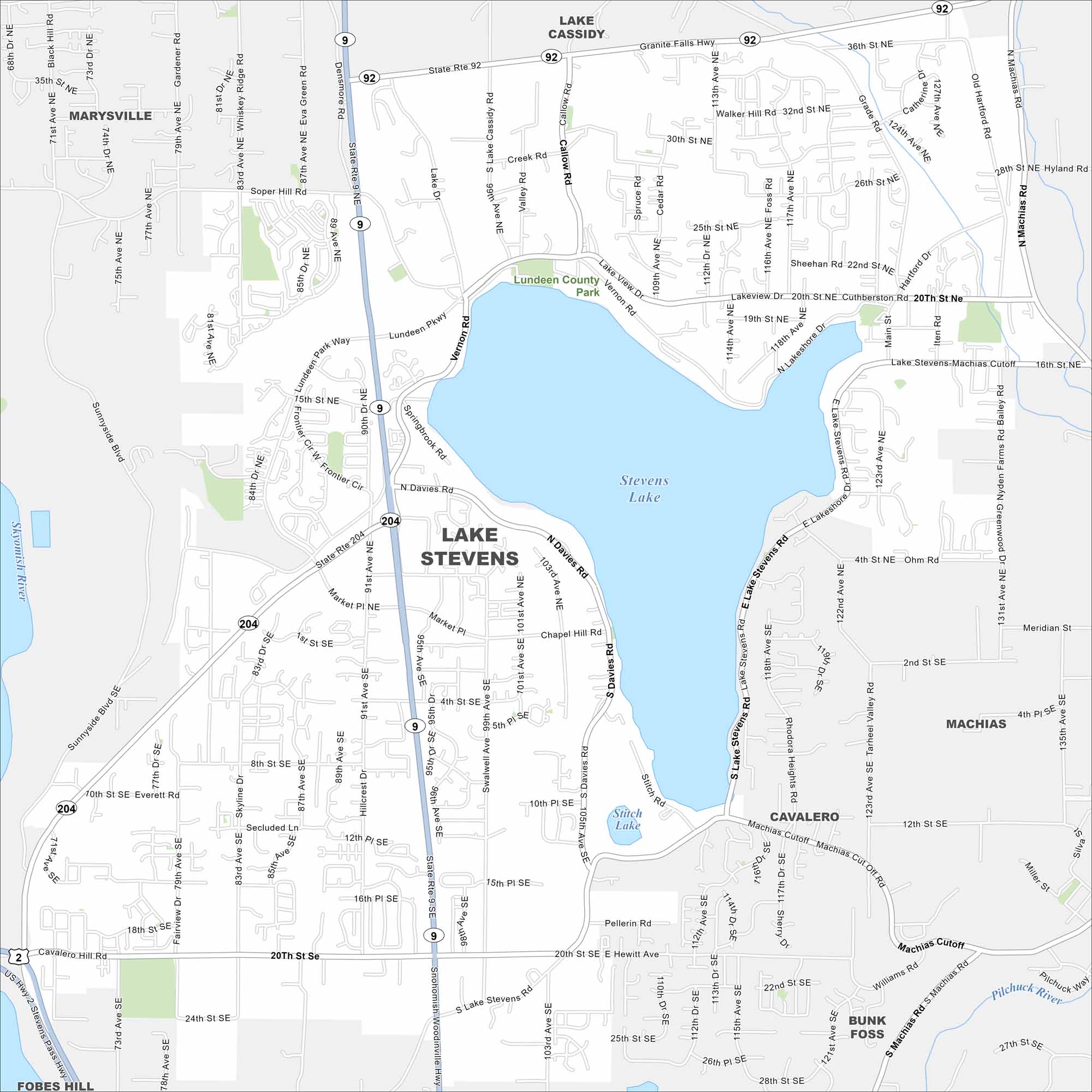
Lake Stevens dominates the center of the map. While subdivisions circle its shoreline, mountains rise in the distance to the east.
Map Information
On the Map
Interstates/Highways: State Rte 92, State Rte 9, State Rte 204 Major Roads: 20th St SE, 4th St SE, 16th St NE, 8th St SE, 24th St SE, 28th St SE, 32nd St NE, 20th St NE, Machias Cutoff, Soper Hill Rd, Lundeen Pkwy, Davies Rd, Vernon Rd, Lakeview Dr, Machias Rd, Sunnyside Blvd, Market Pl NE, Chapel Hill Rd, Pellerin Rd, Stitch Rd Lakes and Reservoirs: Stevens Lake, Stitch Lake Major Rivers: Skykomish River, Pilchuck River Parks and Preserves: Lundeen County Park Nearby Communities: Marysville, Machias, Cavalero, Bunk Foss, Fobes HillWashington State Maps
Move through the Evergreen State with our map collection.


City Maps of Washington
Check out our city maps of Washington


