Map of Lake Charles, Louisiana
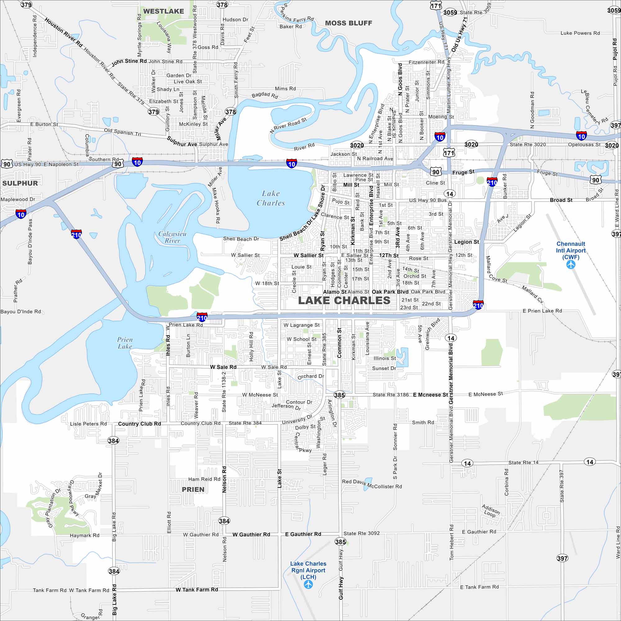
Our map of Lake Charles, Louisiana with highways, rivers and parks. Lake Charles dominates the map’s center. The Calcasieu River runs wide into the lake. Whereas highways and bridges cut across the waterfront.
Louisiana State Maps
Here are maps showcasing the state of Louisiana


Map Information
On the Map
Interstates/Highways: I-10, I-210, US Hwy 90, US Hwy 171, State Rte 378, State Rte 379, State Rte 384, State Rte 385, State Rte 3020, State Rte 3059, State Rte 3092, State Rte 3186, Gerstner Memorial Hwy, Gulf Hwy Major Roads: Broad St, Lake Shore Dr, Ryan St, Enterprise Blvd, Common St, Nelson Rd, Prien Lake Rd, Country Club Rd, Gauthier Rd, McNeese St, Sale Rd, 5th Ave, Kirkman St, Louisiana Ave, 12th St, 18th St, University Dr, Tank Farm Rd Airports: Chennault Intl Airport (CWF), Lake Charles Rgnl Airport (LCH) Lakes and Reservoirs: Lake Charles, Prien Lake Major Rivers: Calcasieu River Nearby Communities: Westlake, Moss Bluff, Sulphur, PrienCity Maps of Louisiana
Explore New Orleans and Louisiana’s urban centers with our city maps