Map of Lacey, Washington
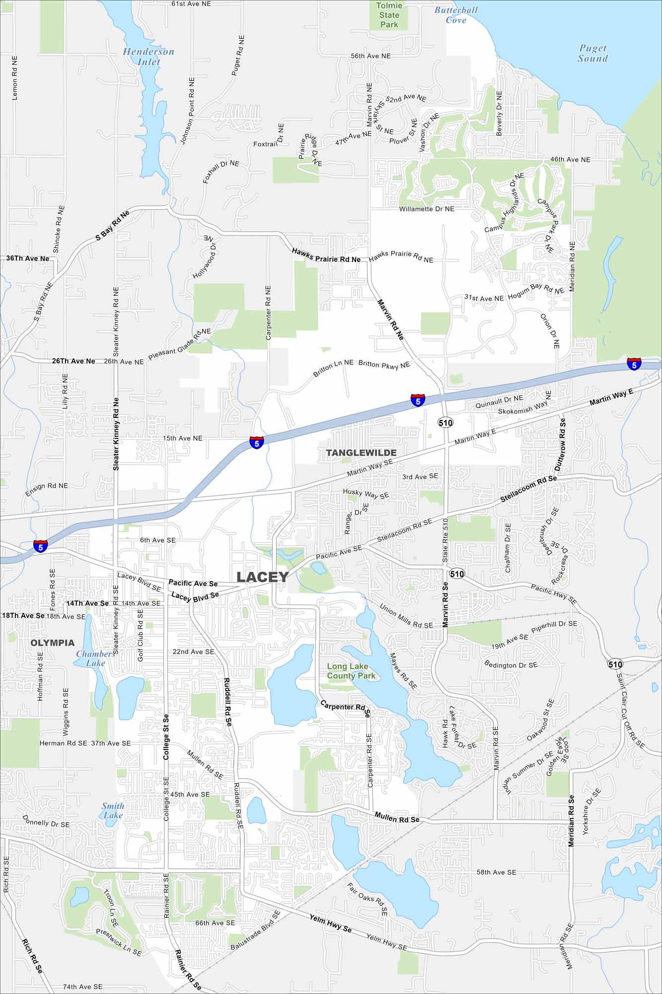
Explore Lacey, located south of Olympia. Lakes and parks are scattered through the city with I-5 cutting through along the north side. Our map displays the neighborhoods and major roads.
Map Information
On the Map
Interstates/Highways: I-5, State Rte 510 Major Roads: Marvin Rd, Sleater Kinney Rd, Pacific Ave, Martin Way, Steilacoom Rd, College St, Ruddell Rd, Mullen Rd, Yelm Hwy, Carpenter Rd, Golf Club Rd, Saint Clair Cut Off Rd, Hicks Lake Rd, 15th Ave, 26th Ave, 37th Ave, 45th Ave, 66th Ave, 58th Ave, Hawks Prairie Rd Airports: Lakes and Reservoirs: Puget Sound, Henderson Inlet, Butterball Cove, Long Lake, Pattison Lake, Smith Lake, Chambers Lake Major Rivers: Parks and Preserves: Tolmie State Park, Long Lake County Park Nearby Communities: Olympia, TanglewildeWashington State Maps
Move through the Evergreen State with our map collection.


City Maps of Washington
Check out our city maps of Washington


