Map of Klamath Falls, Oregon
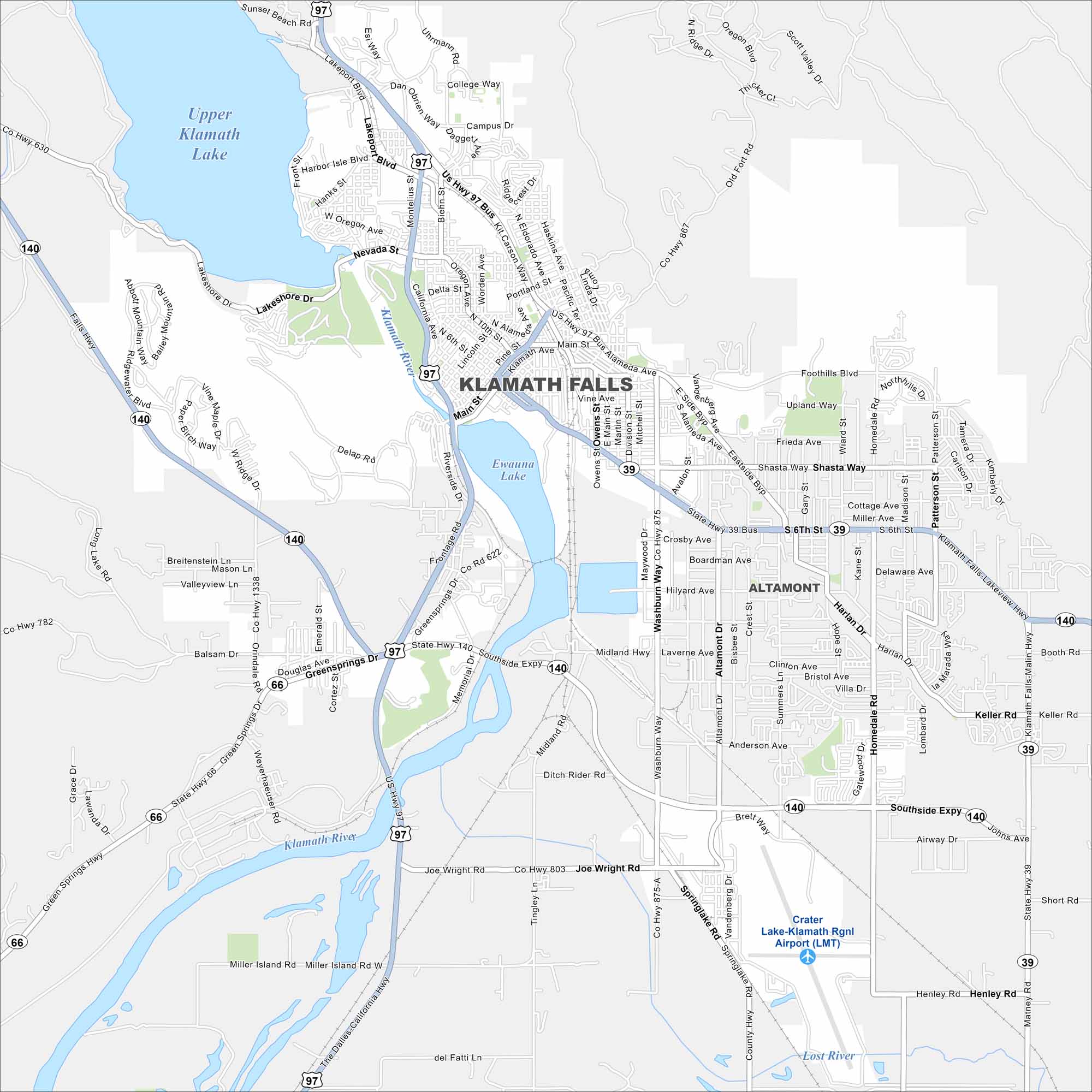
Our map shows Klamath Falls near Upper Klamath Lake. The city stretches along the Klamath River. Mountains rise to the east, framing the valley.
Map Information
On the Map
Interstates/Highways: US Hwy 97, State Hwy 39, State Hwy 66, State Hwy 140 Major Roads: Southside Expy, Main St, 6th St, 9th St, Kit Carson Way, Alameda Ave, Washburn Way, Avalon St, Shasta Way, Homedale Rd, Madison St, Patterson St, Summers Ln, Altamont Dr, Crater Lake Hwy, Greensprings Dr, Lakeshore Dr, Nevada St, Portland St, Bisbee St Airports: Crater Lake-Klamath Rgnl Airport (LMT) Lakes and Reservoirs: Upper Klamath Lake, Ewauna Lake Major Rivers: Klamath River, Lost River Nearby Communities: AltamontOregon State Maps
Here is our state map collection of Oregon.


City Maps of Oregon
Get to know Portland and Oregon’s urban areas.


