Map of Kenmore, Washington
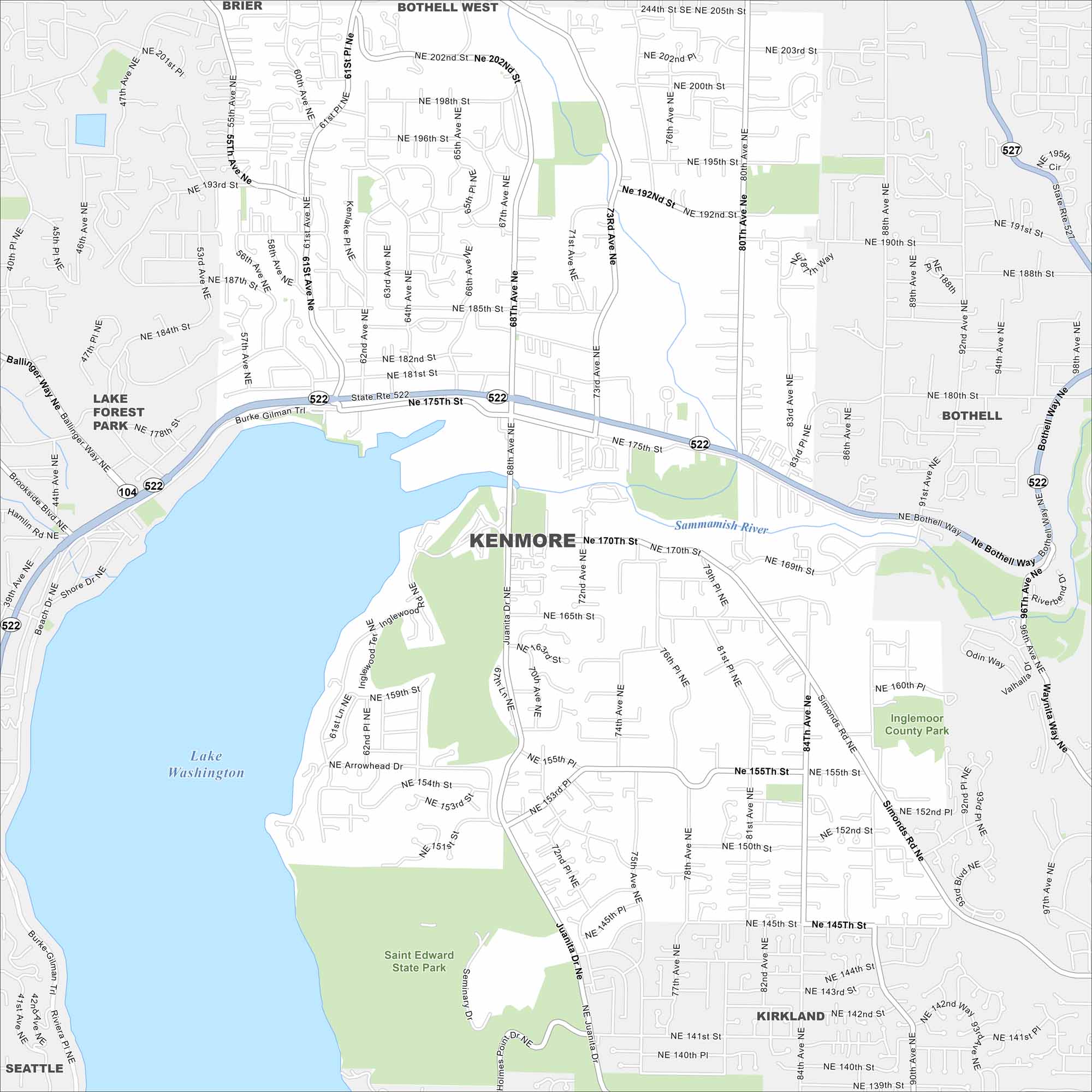
Kenmore sits at the north end of Lake Washington. Our map shows major routes, parks, and neighborhoods climbing into the hills. Seattle lies just south along the shoreline.
Map Information
On the Map
Interstates/Highways: State Rte 522, State Rte 527, State Rte 104 Major Roads: Bothell Way, Juanita Dr, Kenlake Pl, 61st Ave, 68th Ave, 73rd Ave, 80th Ave, 96th Ave, 100th Ave, Simonds Rd, Inglewood Rd, Arrowhead Dr, 170th St, 175th St, 181st St, 192nd St, 202nd St, 205th St, 145th St, 155th St Lakes and Reservoirs: Lake Washington Major Rivers: Sammamish River Parks and Preserves: Saint Edward State Park, Inglemoor County Park Nearby Communities: Brier, Bothell West, Bothell, Lake Forest Park, Kirkland, SeattleWashington State Maps
Move through the Evergreen State with our map collection.


City Maps of Washington
Check out our city maps of Washington


