Map of Issaquah, Washington
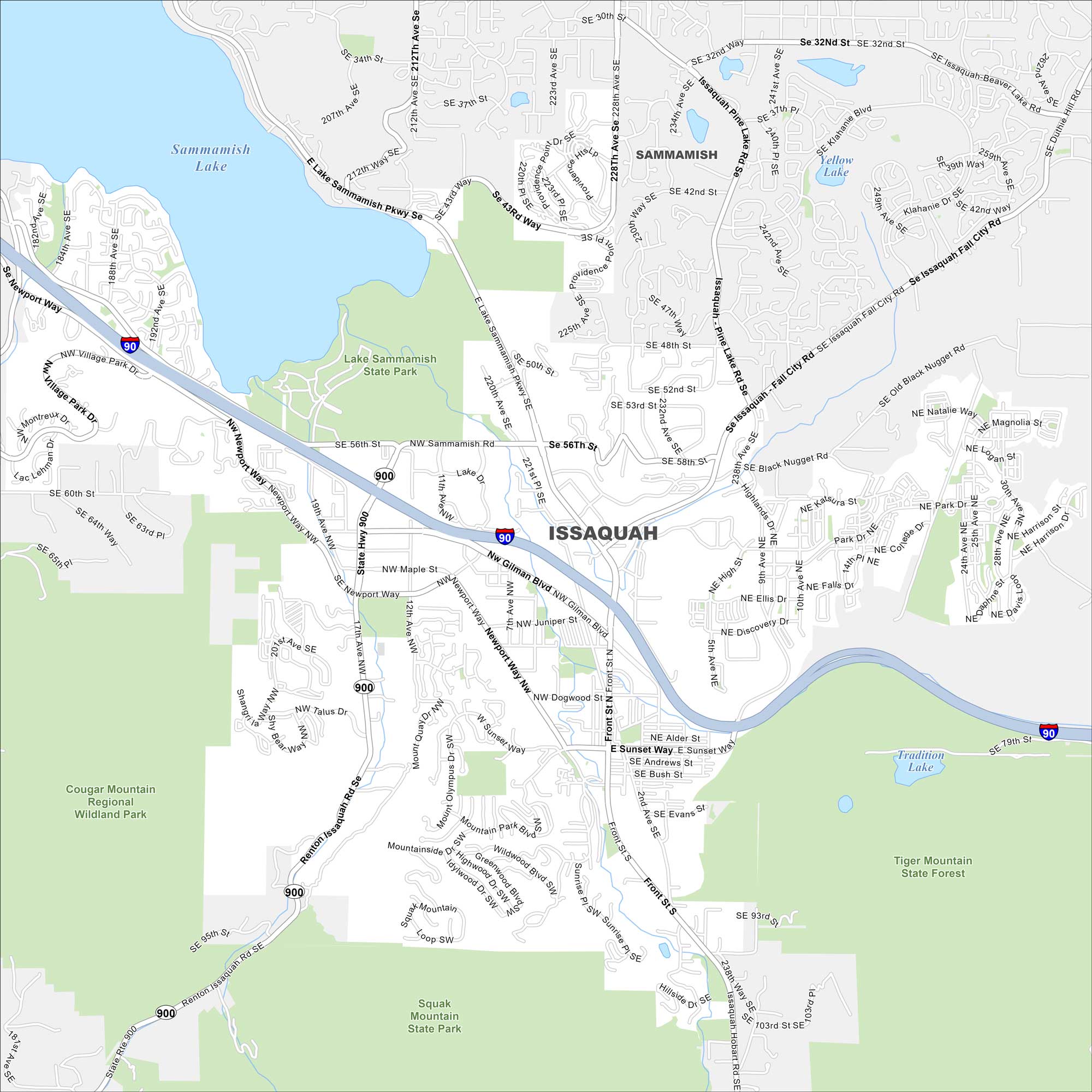
Issaquah sits at the base of the Cascade foothills with Lake Sammamish in the northwest. Our map shows I-90 cutting through the valley. Lakes and forested hills rise on both sides.
Map Information
On the Map
Interstates/Highways: I-90, State Rte 900 Major Roads: Gilman Blvd, Front St, Sunset Way, Newport Way, Renton Issaquah Rd, Issaquah Pine Lake Rd, Issaquah Fall City Rd, Black Nugget Rd, High St, 228th Ave, 212th Ave, East Lake Sammamish Pkwy, Village Park Dr, Talus Dr, Wildwood Blvd, Sunrise Pl, 10th Ave, 24th Ave, 244th Ave, 56th St Lakes and Reservoirs: Sammamish Lake, Yellow Lake, Tradition Lake Parks and Preserves: Lake Sammamish State Park, Cougar Mountain Regional Wildland Park, Squak Mountain State Park, Tiger Mountain State Forest Nearby Communities: SammamishWashington State Maps
Move through the Evergreen State with our map collection.


City Maps of Washington
Check out our city maps of Washington


