Map of Huntsville, Alabama
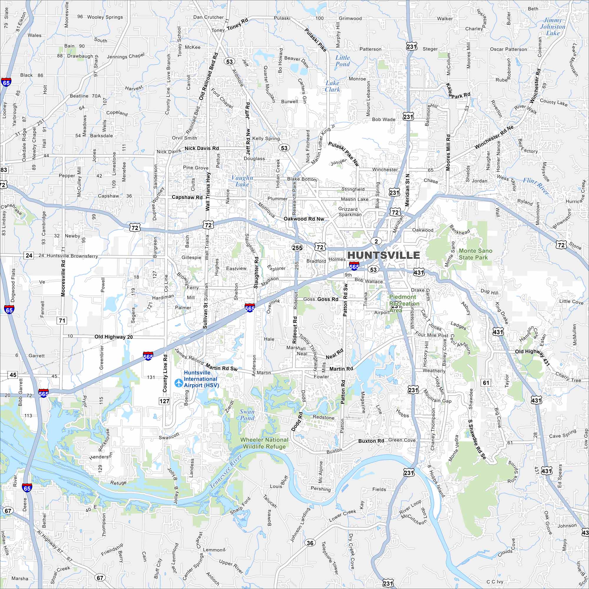
Huntsville is known for its NASA and space history. The city spreads between rolling hills and highways with the Tennessee River flowing to the south. Our map shows its rivers, lakes, parks, highways and everything else.


Map Information
On the Map
Interstates/Highways: I-65, I-565, US Hwy 72, US Hwy 231, US Hwy 431, State Rte 53, State Rte 255 Major Roads: Memorial Pkwy (US-231/431), Research Park Blvd (SR-255), Governor’s Dr, University Dr (US-72), Madison Blvd, Wall Triana Hwy, Jordan Ln, Sparkman Dr, Bob Wallace Ave, Patton Rd, Martin Rd, Drake Ave, Weatherly Rd, Hobbs Rd, Cecil Ashburn Dr, Monte Sano Blvd, Oakwood Rd, Pulaski Pike, Winchester Rd, Moores Mill Rd Airports: Huntsville International Airport (HSV) Lakes and Reservoirs: Swan Pond, Vaughn Lake, Lake Clark, Little Pond, Jimmy Johnston Lake, Winchester Road Lake Rivers and Creeks: Tennessee River, Flint River Parks/Preserves/Forests: Wheeler National Wildlife Refuge, Monte Sano State Park, Piedmont Recreation AreaAlabama City Maps
Here are our city maps of Alabama


