Map of Hoover, Alabama
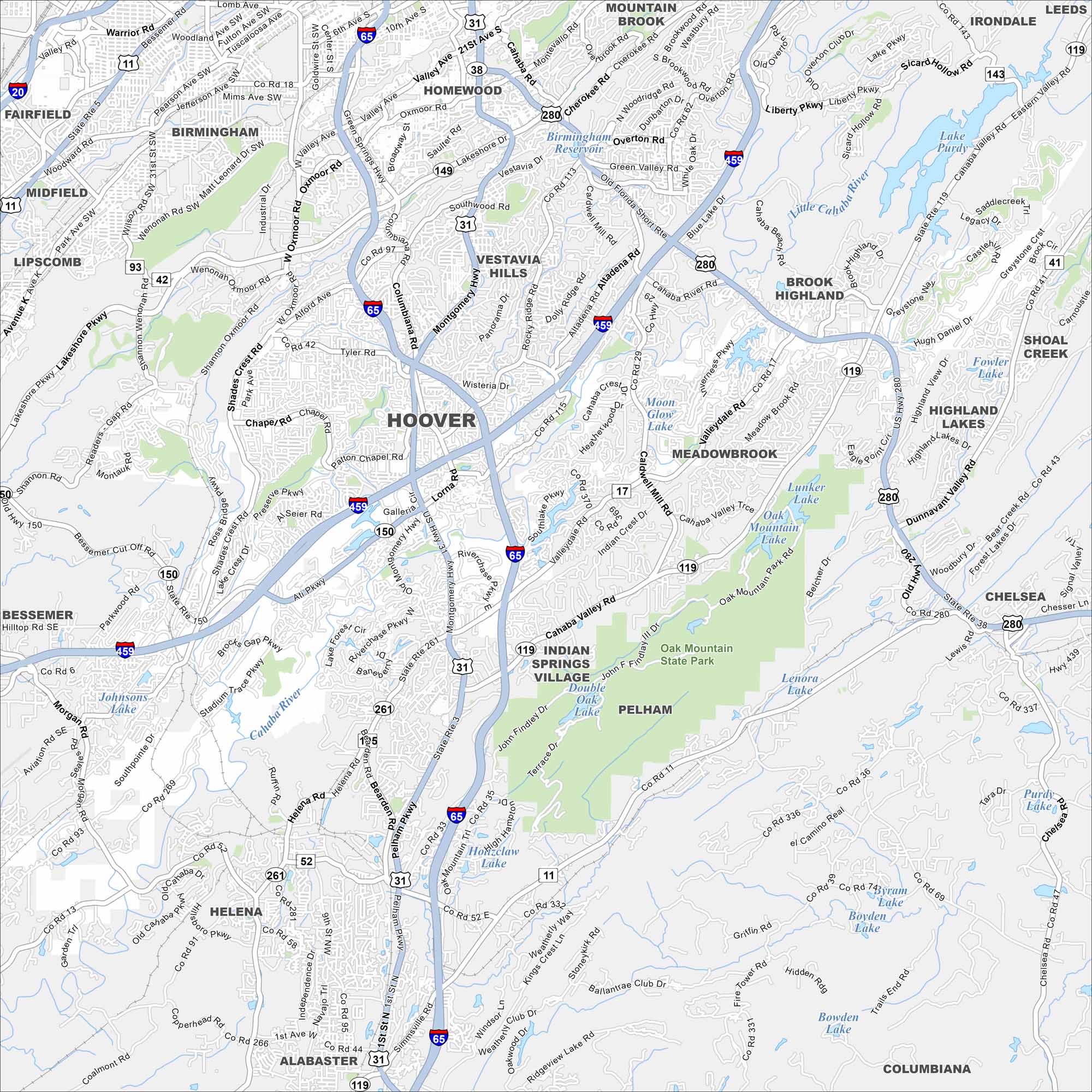
Our map of Hoover highlights its spread along I-459 and Highway 31. The Cahaba River runs through the area, adding natural scenery. It sits just south of Birmingham at the edge of the Appalachian foothills.


Map Information
On the Map
Interstates/Highways: I-65, I-459, US Hwy 31 (Montgomery Hwy), US Hwy 280, US Hwy 11, State Rte 150 Major Roads: Montgomery Hwy, Lorna Rd, Patton Chapel Rd, Galleria Blvd, Riverchase Pkwy W, Riverchase Pkwy E, Old Montgomery Hwy, Valleydale Rd, Helena Rd, John Hawkins Pkwy, Southlake Pkwy, Data Dr, Blue Lake Dr, Caldwell Mill Rd, Rocky Ridge Rd, Shades Crest Rd, Alford Ave, Braddock Dr, Tyler Rd, Wisteria Dr Lakes and Reservoirs: Birmingham Overton Rd Reservoir, Lake Purdy, Moon Glow Lake, Lunker Lake, Oak Mountain Lake, Double Oak Lake, Lenora Lake, Byram Lake, Boyden Lake, Bowden Lake, Hozcllaw Lake Rivers and Creeks: Cahaba River, Little Cahaba River, Shades Creek Parks/Preserves/Forests: Oak Mountain State Park Nearby Communities: Birmingham, Homewood, Vestavia Hills, Mountain Brook, Pelham, Helena, Bessemer, Alabaster, Chelsea, Indian Springs Village, Meadowbrook, Brook HighlandAlabama City Maps
Here are our city maps of Alabama


