Map of Homewood, Alabama
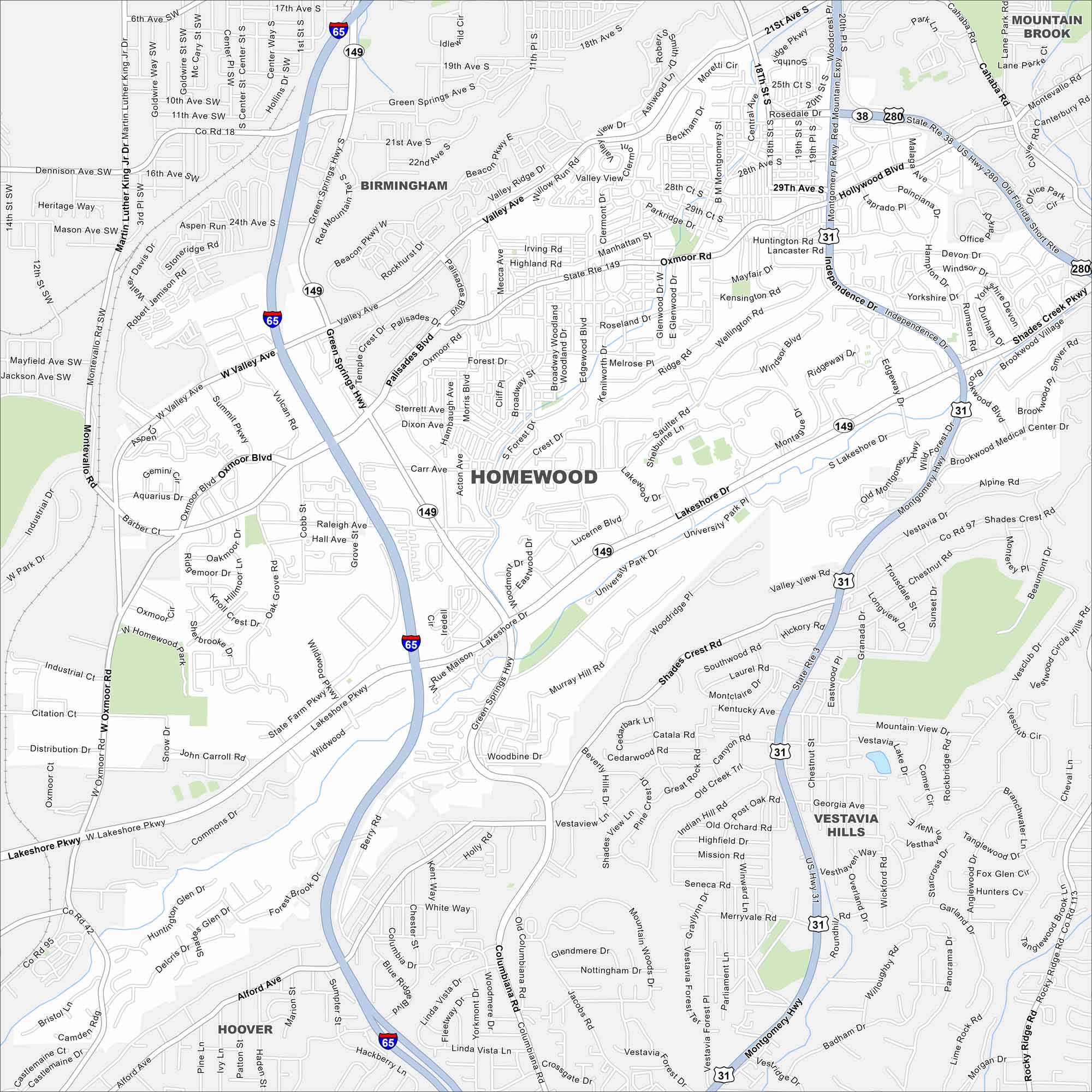
Our map of Homewood shows it tucked beside Birmingham. Neighborhoods line the ridges and valleys. Samford University is a central landmark.


Map Information
On the Map
Interstates/Highways: I-65, US Hwy 31 (Independence Dr/Montgomery Hwy), US Hwy 280, State Rte 149 (Lakeshore Dr/Green Springs Hwy), State Rte 38 Major Roads: Lakeshore Pkwy, Oxmoor Rd, Green Springs Hwy, Independence Dr, Montgomery Hwy, Valley Ave, Palisades Blvd, West Valley Ave, Broadway St, Murray Hill Rd, West Lakeshore Dr, Hollywood Blvd, Shades Creek Pkwy, Brookwood Village, Saulter Rd, Edgewood Blvd, Mayfair Dr, Raleigh Ave, Carr Ave, Alford Ave Rivers and Creeks: Shades Creek Nearby Communities: Birmingham, Mountain Brook, Vestavia Hills, HooverAlabama City Maps
Here are our city maps of Alabama


