Map of Grants Pass, Oregon
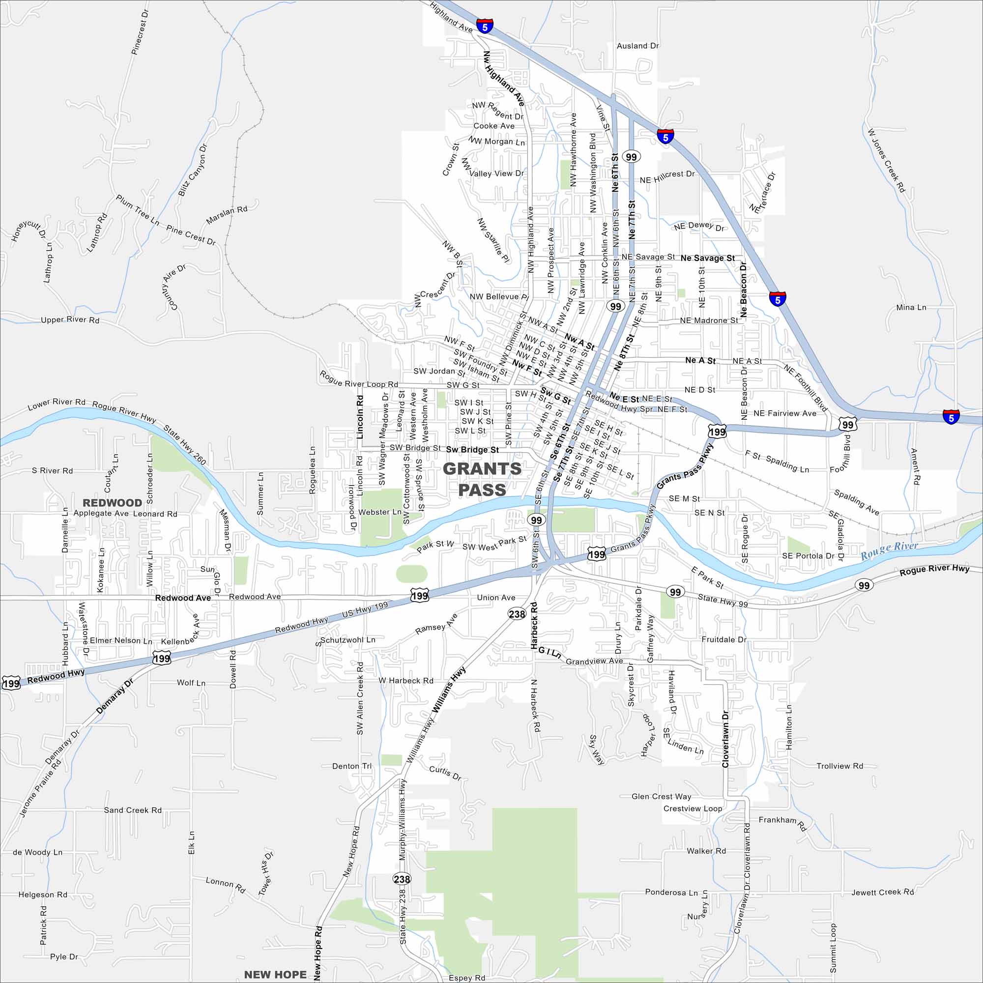
Take a look at Grants Pass, Oregon, along the Rogue River. Our map reveals interstates, roads, rivers and green spaces. The city is often called the “Gateway to the Oregon Caves”.
Map Information
On the Map
Interstates/Highways: I-5, US Hwy 199, State Hwy 238, State Hwy 260, State Hwy 99 Major Roads: Redwood Hwy, Rogue River Hwy, Williams Hwy, Grants Pass Pkwy, 6th St, 7th St, 9th St, Hillcrest Dr, Beacon Dr, Highland Ave, Madrone St, A St, D St, Bridge St, Park St, Union Ave, Harbeck Rd, Savage St, Foothill Blvd, Scoville Rd Major Rivers: Rogue River Nearby Communities: Redwood, New HopeOregon State Maps
Here is our state map collection of Oregon.


City Maps of Oregon
Get to know Portland and Oregon’s urban areas.


