Map of Fort Wayne, Indiana
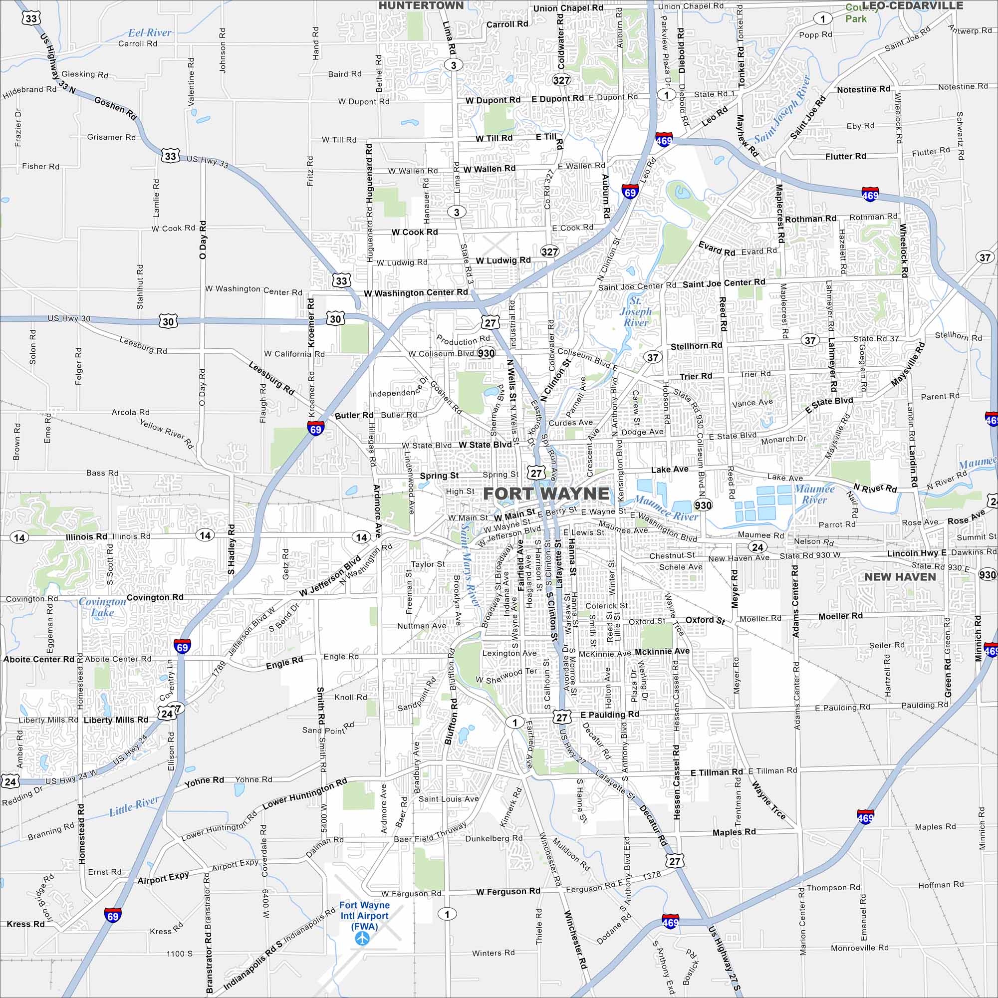
Fort Wayne sits in northeastern Indiana where the St. Marys and St. Joseph Rivers meet. Our map of the city shows I-69 running north to south. It’s known as a hub of industry and culture for the region.
Indiana State Maps
Study about Indiana with our map collection


Map Information
On the Map
Interstates/Highways: I-69, I-469, US Hwy 24, US Hwy 30, US Hwy 33, US Hwy 27, State Rte 1, State Rte 3, State Rte 37, State Rte 327, State Rte 930 Major Roads: Coliseum Blvd, Washington Center Rd, Jefferson Blvd, Lima Rd, Clinton St, Lafayette St, Anthony Blvd, Tillman Rd, Maysville Rd, Stellhorn Rd, State Blvd, Main St, Illinois Rd, Covington Rd, Ardmore Ave, Bluffton Rd, Winchester Rd, Maplecrest Rd, Lahmeyer Rd, Dupont Rd Airports: Fort Wayne Intl Airport (FWA) Lakes and Reservoirs: Covington Lake Major Rivers: Maumee River, St. Joseph River, St. Mary’s River, Eel River, Little River Nearby Communities: Huntertown, New Haven, Leo-CedarvilleIndiana City Maps
Here are our maps of Indianapolis and Indiana cities


