Map of Florence, Alabama
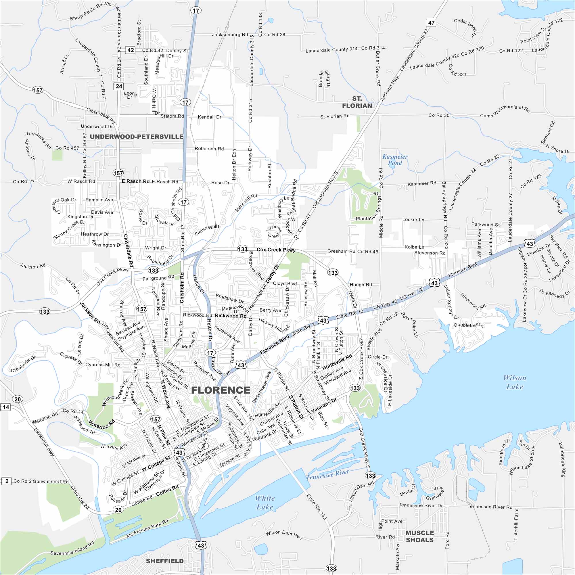
Our map of Florence shows it on the banks of the Tennessee River. Bridges connect the city across the wide waterway. The river gives the town its defining shape.


Map Information
On the Map
Interstates/Highways: US Hwy 43, US Hwy 72, US Hwy 72 Alt, State Rte 2, State Rte 13, State Rte 14, State Rte 17, State Rte 20, State Rte 24, State Rte 42, State Rte 43, State Rte 47, State Rte 133, State Rte 157 Major Roads: Cox Creek Pkwy, Florence Blvd, Veterans Dr, Huntsville Rd, Chisholm Rd, Cloverdale Rd, Waterloo Rd, Savannah Hwy, Mars Hill Rd, Rickwood Rd, Helton Dr, N Wood Ave, Cypress Mill Rd, Jackson Rd, Old Jackson Hwy, Broadway St, Patton St, Royal Ave, Pine St, Court St Lakes and Reservoirs: Wilson Lake, White Lake, Kasmeier Pond Rivers and Creeks: Tennessee River Nearby Communities: Muscle Shoals, Sheffield, St. Florian, Underwood-Petersville, TuscumbiaAlabama City Maps
Here are our city maps of Alabama


