Map of Fishers, Indiana
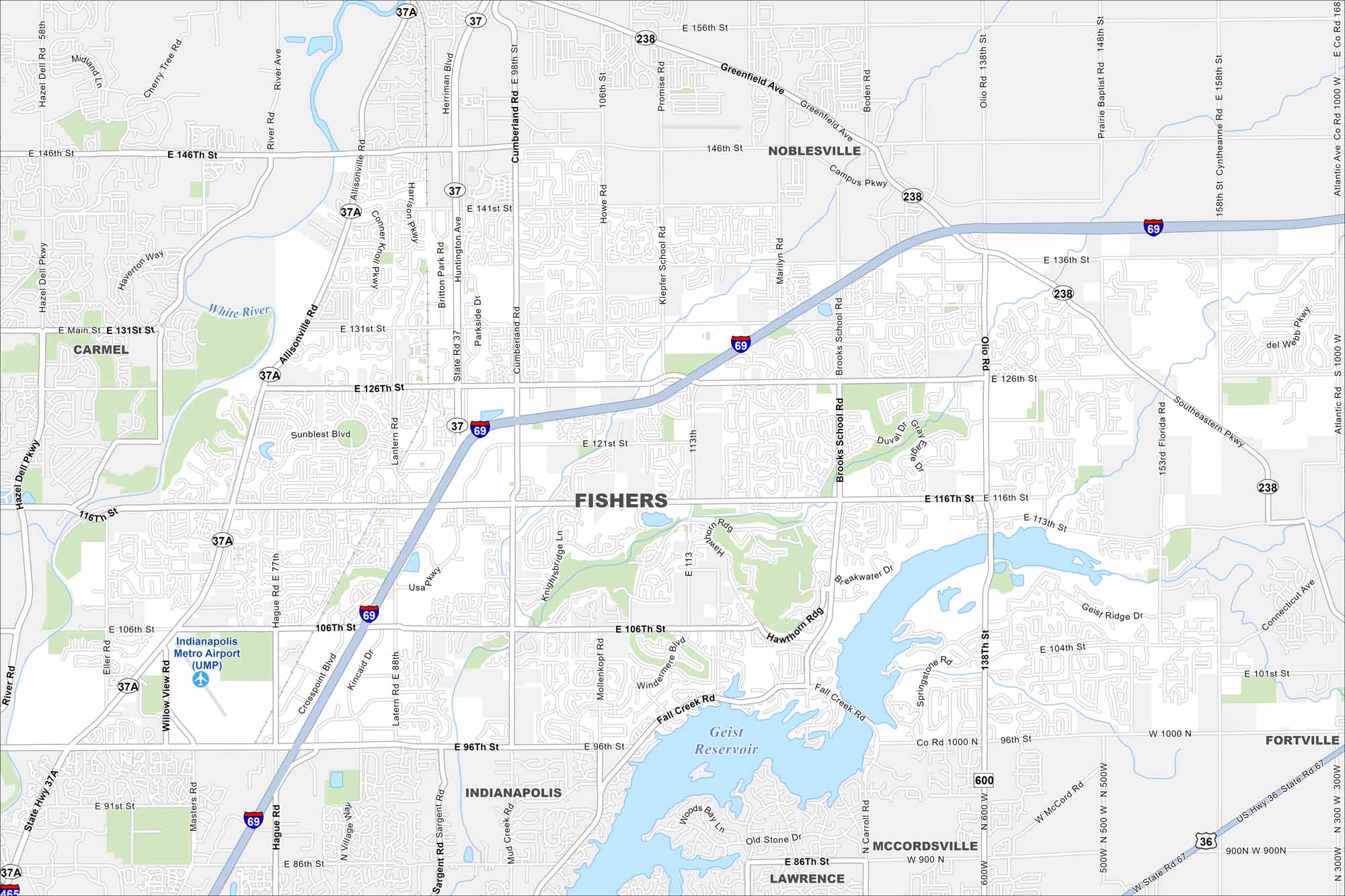
Our map of Fishers shows it northeast of Indianapolis. While the White River winds nearby, the Geist Reservoir was constructed by damming Fall Creek. You’ll notice several green corridors and I-69 here too.
Indiana State Maps
Study about Indiana with our map collection


Map Information
On the Map
Interstates/Highways: I-69, State Rte 37, State Rte 37A, State Rte 238 Major Roads: 116th St, 146th St, 96th St, Olio Rd, Allisonville Rd, Cumberland Rd, Brooks School Rd, Promise Rd, Greenfield Ave, Campus Pkwy, Lantern Rd, Hague Rd, Sargent Rd, 106th St, 126th St, 131st St, 141st St, 156th St, Boden Rd, Florida Rd Airports: Indianapolis Metro Airport (UMP) Lakes and Reservoirs: Geist Reservoir Major Rivers: White River Nearby Communities: Noblesville, Carmel, Indianapolis, Lawrence, McCordsville, FortvilleIndiana City Maps
Here are our maps of Indianapolis and Indiana cities


