Map of Eugene, Oregon
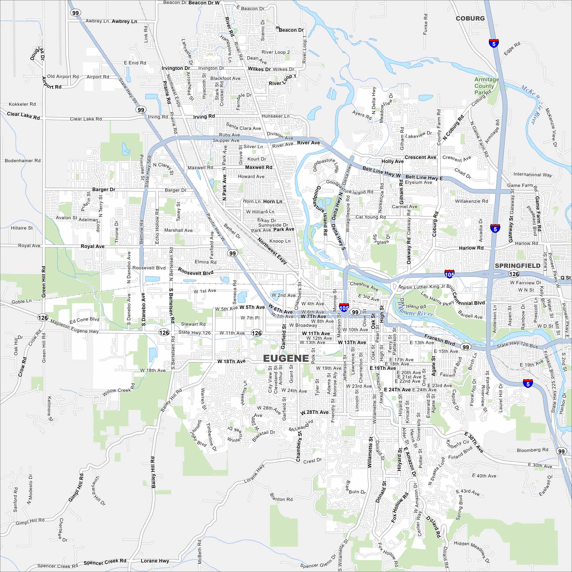
Our map of Eugene shows the city along the Willamette River. The foothills are on nearly every side with I-5 and I-105 as the main highways.
Map Information
On the Map
Interstates/Highways: I-5, I-105, US Hwy 99, State Hwy 126, State Hwy 569 Major Roads: Belt Line Hwy, 18th Ave, 11th Ave, 7th Ave, 6th Ave, Willamette St, Chambers St, River Rd, Coburg Rd, Franklin Blvd, Amazon Pkwy, West 11th Ave, Jefferson St, Washington St, Hilyard St, Patterson St, Agate St, University St, 30th Ave, Delta Hwy Major Rivers: Willamette River, McKenzie River Parks and Preserves: Armitage County Park Nearby Communities: Springfield, CoburgOregon State Maps
Here is our state map collection of Oregon.


City Maps of Oregon
Get to know Portland and Oregon’s urban areas.


