Map of Elkhart, Indiana
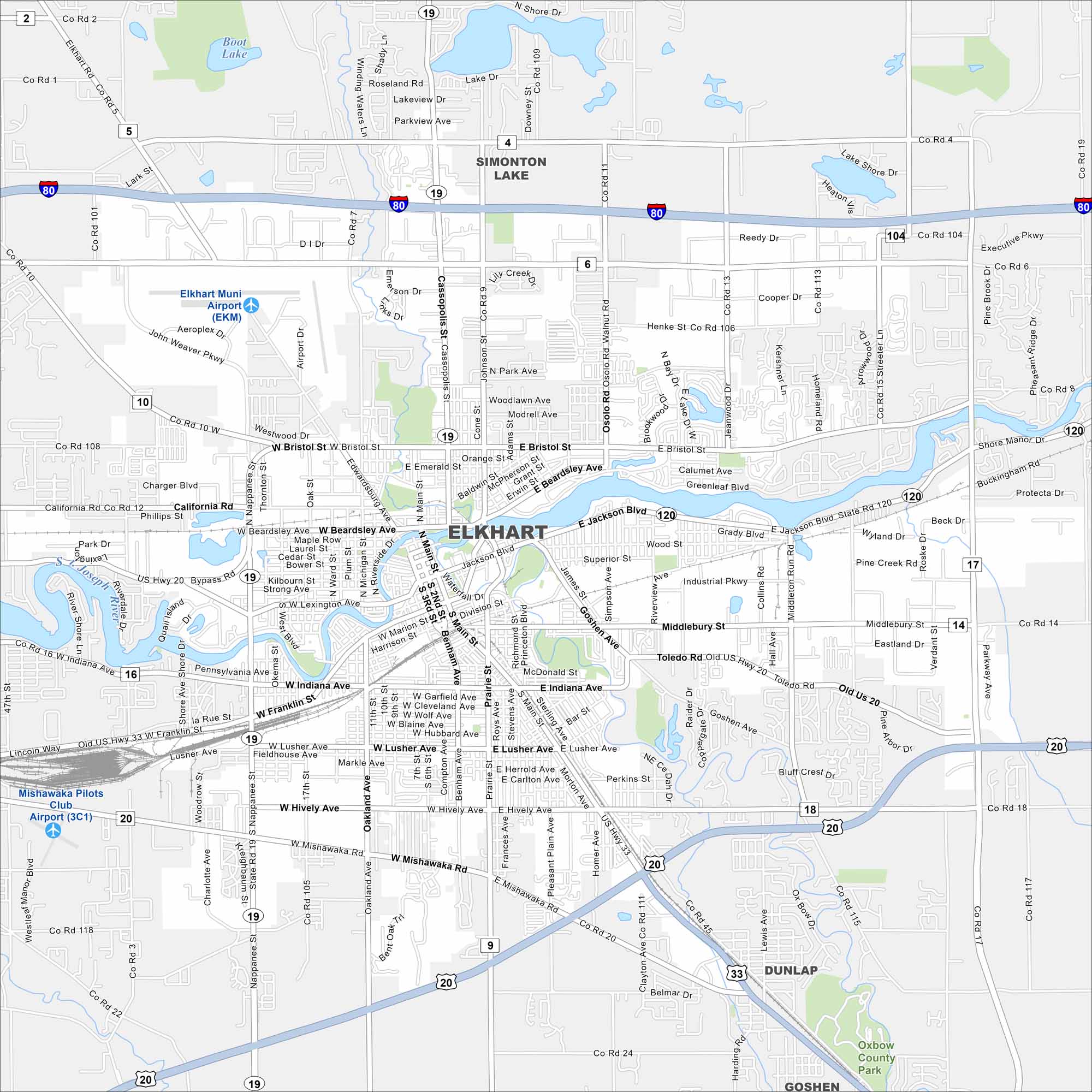
Our map of Elkhart shows the St. Joseph River flowing through the city. Major routes like the I-80 and U.S. 20 pass nearby. Elkhart sits in northern Indiana and is known for its RV industry.
Indiana State Maps
Study about Indiana with our map collection


Map Information
On the Map
Interstates/Highways: I-80, US Hwy 20, US Hwy 33, State Rte 19, State Rte 120, State Rte 112 Major Roads: Main St, Bristol St, Cassopolis St, Beardsley Ave, Jackson Blvd, Indiana Ave, Franklin St, Lusher Ave, Hively Ave, Mishawaka Rd, Nappanee St, Oakland Ave, Prairie St, Middleton Run Rd, Johnson St, Osolo Rd, Greenleaf Blvd, Middlebury St, Toledo Rd, County Rd 6 Airports: Elkhart Muni Airport (EKM), Mishawaka Pilots Club Airport (3C1) Lakes and Reservoirs: Boot Lake, Simonton Lake Major Rivers: St. Joseph River, Elkhart River Parks and Preserves: Oxbow County Park Nearby Communities: Dunlap, Goshen, Simonton LakeIndiana City Maps
Here are our maps of Indianapolis and Indiana cities


