Map of Edmonds, Washington
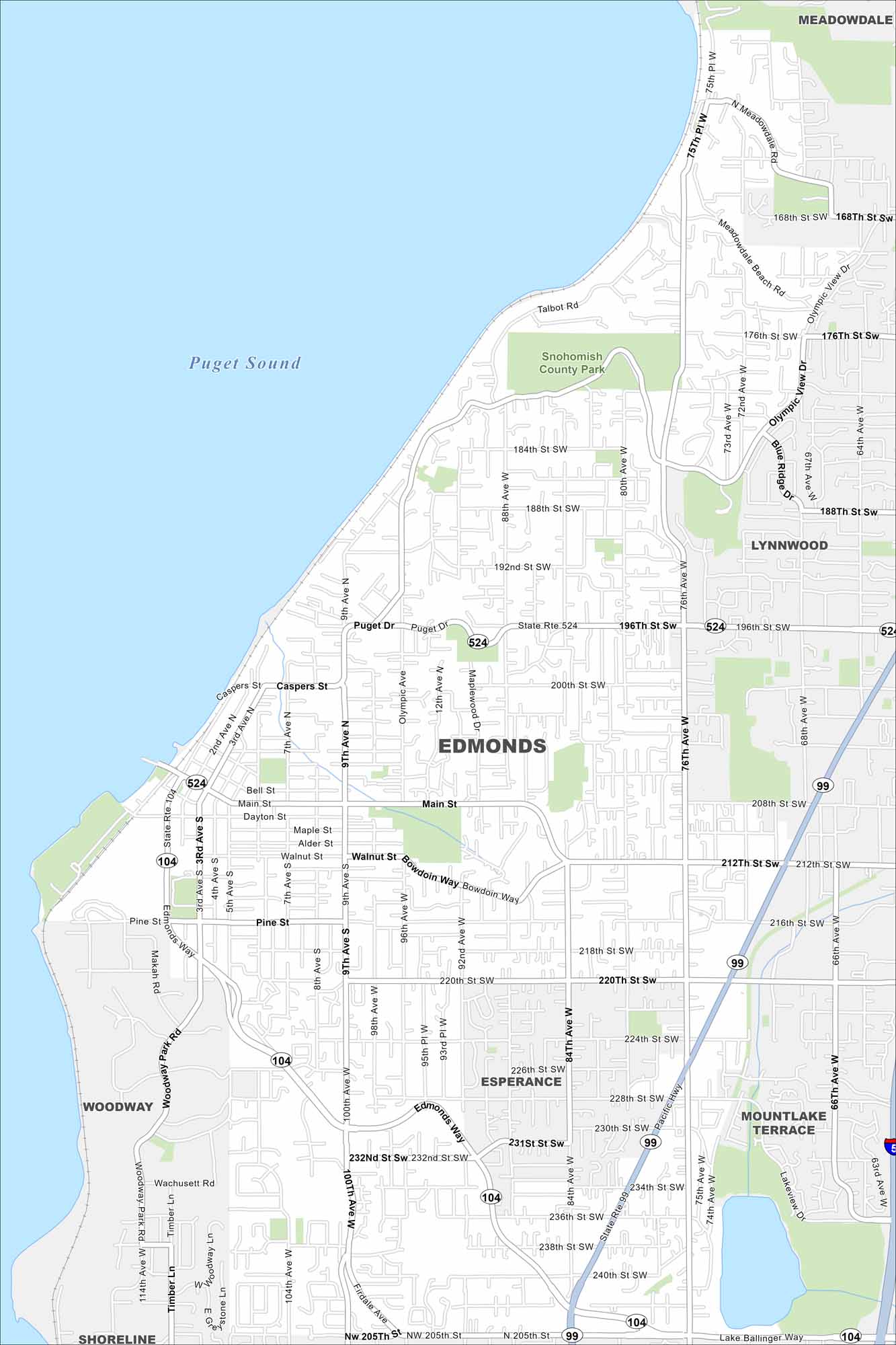
Edmonds rests on Puget Sound with ferry routes stretching across the water. The map shows a bluffside downtown leading straight to the shoreline. It’s known for its waterfront views of the Olympic Mountains.
Map Information
On the Map
Interstates/Highways: State Rte 104, State Rte 524, State Rte 99 Major Roads: Edmonds Way, Main St, Pine St, 9th Ave, 76th Ave, 84th Ave, 100th Ave, 212th St, 220th St, 226th St, 238th St, 244th St, Bowdoin Way, Olympic View Dr, Puget Dr, Caspers St, Walnut St, Dayton St, Firdale Ave, Timber Ln Lakes and Reservoirs: Puget Sound Parks and Preserves: Snohomish County Park Nearby Communities: Meadowdale, Lynnwood, Esperance, Mountlake Terrace, Woodway, ShorelineWashington State Maps
Move through the Evergreen State with our map collection.


City Maps of Washington
Check out our city maps of Washington


